
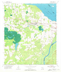
1954 Map of Sneads
USGS Topo · Published 1955About this map
The town of Sneads serves as a focal point in Jackson County during the mid-1950s, situated just west of the Apalachicola River and the developing Jim Woodruff Reservoir along the Georgia-Florida border. The landscape is defined by a dense network of water features, from the large expanse of Ocheesee Pond to smaller named basins like Brickyard Pond and Sugar Mill Pond. Transportation through the region is anchored by the Louisville and Nashville rail line and a specialized Industrial Railroad serving the eastern riverfront near a Pumping Station and Power Plant.
Find a feature on this map
49 named features on this map. Tap any name to fly to it.
Don’t see what you’re looking for? This feature index may not catch every label — zoom into the map to look around manually.
Map Details
Editions of this 1954 Sneads Map
2 editions found
Other maps of this area

1952 · Cypress
USGS Topo · 1:24,000

1952 · Dellwood
USGS Topo · 1:24,000

1952 · Altha East
USGS Topo · 1:24,000

1954 · Tallahassee
USGS Topo · 1:250,000

1955 · Fairchild
USGS Topo · 1:24,000

1955 · Reynoldsville
USGS Topo · 1:24,000

1955 · Rock Bluff
USGS Topo · 1:24,000

1955 · Sycamore
USGS Topo · 1:24,000

1955 · Chattahoochee
USGS Topo · 1:24,000

1959 · Tallahassee
USGS Topo · 1:250,000