
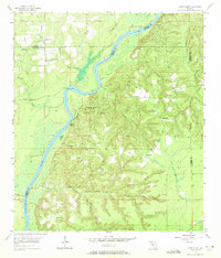
1955 Map of Rock Bluff
USGS Topo · Published 1956About this map
Apalachicola River meanders through the heart of this mid-1950s survey, marking a complex boundary between Jackson, Gadsden, Calhoun, and Liberty counties. The landscape is defined by the high bluffs and deep ravines of Torreya State Park, where the elevation rises sharply from the riverbank toward Hickory Hill. Small rural communities and church-centered settlements like Rock Bluff and Sweetwater are connected by unimproved roads and light-duty paths. The map reveals the ecclesiastical center of the local area, featuring St Stephens Ch near the banks of Sweetwater Creek and Rock of Will Ch perched on the ridges to the east. Several river access points, including Ocheesee Landing and Rock Bluff Landing, indicate the continuing importance of the waterway to this North Florida region even as the road network expanded.
Find a feature on this map
32 named features on this map. Tap any name to fly to it.
Don’t see what you’re looking for? This feature index may not catch every label — zoom into the map to look around manually.
Map Details
Editions of this 1955 Rock Bluff Map
2 editions found
Other maps of this area

1945 · Blountstown
USGS Topo · 1:31,680

1945 · Hosford
USGS Topo · 1:31,680

1945 · Bristol
USGS Topo · 1:31,680

1952 · Cypress
USGS Topo · 1:24,000

1952 · Altha East
USGS Topo · 1:24,000

1954 · Sneads
USGS Topo · 1:24,000

1954 · Tallahassee
USGS Topo · 1:250,000

1955 · Sycamore
USGS Topo · 1:24,000

1955 · Chattahoochee
USGS Topo · 1:24,000

1959 · Tallahassee
USGS Topo · 1:250,000