Loading...
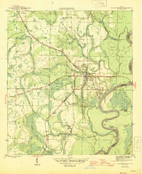
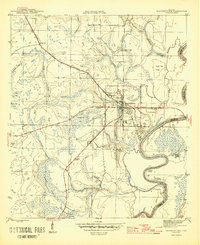
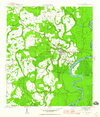
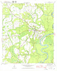
Loading map...1945 Map of Blountstown
USGS Topo · Published 1945About this map
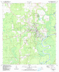
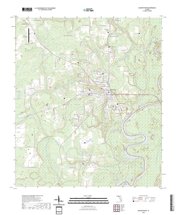
Blountstown serves as the focal point for this mid-1940s survey of the Florida Panhandle, situated along the western banks of the Apalachicola River. The town is a crossroads of river navigation and rail transport, anchored by the Marianna and Blountstown railroad line. Local industry and land use are evident through features like Flowers Still and Browns Mill Pond, while the Airport north of the town center reflects the era's infrastructure development.
Find a feature on this map
32 named features on this map. Tap any name to fly to it.
Don’t see what you’re looking for? This feature index may not catch every label — zoom into the map to look around manually.
Map Details
Date Portrayed1945
Date Published1945
PublisherU.S. Geological Survey
Map TypeTopographic
Scale1:31,680
Physical Dimensions17 x 20.8 inches
Editions of this 1945 Blountstown Map
4 editions found
Historical Maps of Blountstown Through Time
7 maps found
Featured Locations
Source Details
SourceU.S. Geological Survey
CopyrightPublic Domain