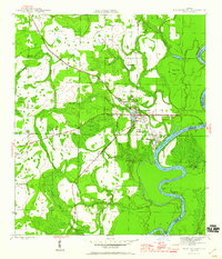
1945 Map of Blountstown
USGS Topo · Published 1960About this map
Blountstown serves as the focal point of this mid-1940s landscape, positioned where the Marianna and Blountstown railroad meets the winding course of the Apalachicola River. This era shows a community deeply integrated with its hydrology and timber resources, evidenced by the presence of Flowers Still and numerous family-named landmarks like Browns Mill Pond and Sutton Creek. The topographic detail reveals a intricate network of swampy lowlands and ridges, such as Peach Tree Ridge and Bullhead Bay, which dictated early settlement patterns. Beyond the main town, smaller clusters and transit points like Durham, Leonards, and McNeal provide essential data for local historians. Cultural sites including Nettle Ridge Cem and Boggs Cem further ground the map in the lived history of Calhoun and Liberty Counties during the late stages of World War II.
Find a feature on this map
38 named features on this map. Tap any name to fly to it.
Don’t see what you’re looking for? This feature index may not catch every label — zoom into the map to look around manually.
Map Details
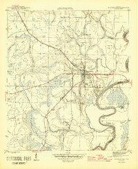
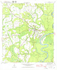
Editions of this 1945 Blountstown Map
4 editions found
Other maps of this area

1944 · Clarksville
USGS Topo · 1:31,680

1945 · Blountstown
USGS Topo · 1:31,680

1945 · Clarksville
USGS Topo · 1:31,680

1945 · Estiffanulga
USGS Topo · 1:31,680

1945 · Bristol
USGS Topo · 1:31,680

1945 · Frink
USGS Topo · 1:31,680

1945 · Woods
USGS Topo · 1:31,680

1952 · Altha West
USGS Topo · 1:24,000

1952 · Altha East
USGS Topo · 1:24,000

1954 · Tallahassee
USGS Topo · 1:250,000