
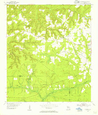
1955 Map of Sycamore
USGS Topo · Published 1956About this map
Sycamore and the surrounding rural landscape of Gadsden County are documented in this mid-century survey, revealing a network of small communities and family-named landmarks. The area is defined by its numerous rural congregations and resting places, such as St James Ch, Greensboro Ch, and the Smith Cem. To the east, the City Boundary of Greensboro marks a transition from open country to a more concentrated township.
Find a feature on this map
35 named features on this map. Tap any name to fly to it.
Don’t see what you’re looking for? This feature index may not catch every label — zoom into the map to look around manually.
Map Details
Editions of this 1955 Sycamore Map
2 editions found
Other maps of this area

1943 · Lake Talquin
USGS Topo · 1:62,500

1945 · Hosford
USGS Topo · 1:31,680

1945 · Bristol
USGS Topo · 1:31,680

1954 · Sneads
USGS Topo · 1:24,000

1954 · Tallahassee
USGS Topo · 1:250,000

1955 · Rock Bluff
USGS Topo · 1:24,000

1955 · Chattahoochee
USGS Topo · 1:24,000

1955 · Mt Pleasant
USGS Topo · 1:24,000

1959 · Tallahassee
USGS Topo · 1:250,000

1959 · Gretna
USGS Topo · 1:24,000