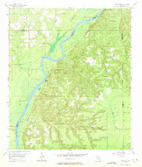
1955 Map of Rock Bluff
USGS Topo · Published 1972About this map
The Apalachicola River carves a winding path through the borderlands of Liberty, Gadsden, Calhoun, and Jackson counties, defining a landscape of steep bluffs and deep creek ravines. Centered on the settlement of Rock Bluff, this 1955 survey captures the rural character of the Panhandle before significant modern development. Along the river's eastern banks, Torreya State Park preserves the unique topography where numerous landings, such as Aspalaga Landing and Ocheesee Landing, once served as vital connection points for river traffic.
Find a feature on this map
33 named features on this map. Tap any name to fly to it.
Don’t see what you’re looking for? This feature index may not catch every label — zoom into the map to look around manually.
Map Details
Editions of this 1955 Rock Bluff Map
2 editions found
Other maps of this area

1945 · Blountstown
USGS Topo · 1:31,680

1945 · Hosford
USGS Topo · 1:31,680

1945 · Bristol
USGS Topo · 1:31,680

1952 · Cypress
USGS Topo · 1:24,000

1952 · Altha East
USGS Topo · 1:24,000

1954 · Sneads
USGS Topo · 1:24,000

1954 · Tallahassee
USGS Topo · 1:250,000

1955 · Rock Bluff
USGS Topo · 1:24,000

1955 · Sycamore
USGS Topo · 1:24,000

1955 · Chattahoochee
USGS Topo · 1:24,000