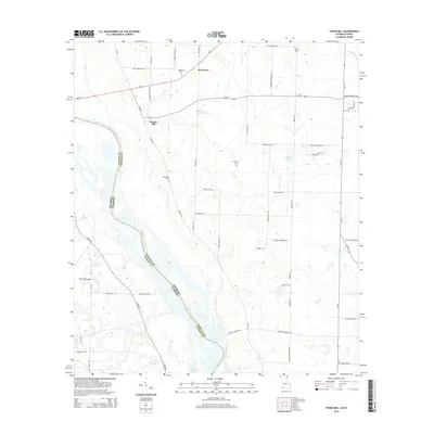
2014 Map of Steam Mill
USGS Topo · Published 2014About this map
The Chattahoochee River defines the border between Georgia and Florida in this riverine landscape south of Riverturn. The settlement at Steam Mill serves as a central point in a network of rural roads such as Ga-285 and Ga-91, reflecting the area's agricultural and industrial heritage. The terrain transitions from the low-lying wetlands of The Flatwoods in the southwest to the managed waters of Lake Seminole at the southern edge of the quadrangle. Genealogists will find significant value in the distribution of family-named burial sites across the landscape, including Williams Cem, Brunson Cem, Dickenson Cem, and Danley Cem. Notable water features like Hammock Springs and Lewis Pond punctuate the inland areas, while Fishpond Drain flows through the northeastern corner, highlighting the intricate drainage patterns of the Seminole County region.
Find a feature on this map
56 named features on this map. Tap any name to fly to it.
Don’t see what you’re looking for? This feature index may not catch every label — zoom into the map to look around manually.
Map Details
Editions of this 2014 Steam Mill Map
This is the sole edition of this map. No revisions or reprints were ever made.
Other maps of this area

1952 · Dellwood
USGS Topo · 1:24,000

1952 · Bascom
USGS Topo · 1:24,000

1953 · Dothan
USGS Topo · 1:250,000

1954 · Dothan
USGS Topo · 1:250,000

1954 · Steam Mill
USGS Topo · 1:24,000

1954 · Desser
USGS Topo · 1:24,000

1954 · Tallahassee
USGS Topo · 1:250,000

1955 · Dothan
USGS Topo · 1:250,000

1955 · Fairchild
USGS Topo · 1:24,000

1955 · Reynoldsville
USGS Topo · 1:24,000