1900s (20th Century) Maps of Avalon, Georgia
Explore 6 historic maps of Avalon from the 1900s (20th Century). These maps offer a rare glimpse into what life looked like during the 1900s — showing old roads, neighborhoods, homes, and landmarks that have changed or disappeared over time.
Whether you're researching your family's past, planning a metal detecting trip, or studying how Avalon's landscape evolved across the 1900s, these high-resolution maps are a powerful tool for exploring the history of this region.
- Focus on a specific era: All maps on this page are from the 1900s, giving you a focused view of this time period.
- See what’s changed: Compare century-old streets, trails, and buildings to today's modern landscape using overlays and satellite layers.
- Research with precision: Use these maps for genealogy, historical research, land use analysis, or educational projects.
- View, download, or print: Maps are fully viewable online in high resolution, and can be downloaded or printed for your own records.
Start exploring Avalon's history through authentic maps from the 1900s. This is your window into the past.
Avalon, GA maps
(6)- 1954 Map of Greenville, 1965 Print
 1954 Greenville1965 Print · USGSThe Upstate and Northeast Georgia are captured here during a decade of massive transformation as new reservoirs reshaped the Piedmont. Genealogists and hikers can trace the Appalachian Trail over Brasstown Bald or locate old community centers like Demorest, Westminster, and Royston.3 unique versions available
 - 1958 Map of Greenville
 1958 Greenville1958 Print · USGSThe Piedmont and Blue Ridge foothills come alive in this mid-century survey of the Upstate and Northeast Georgia. Trace the regional rail-and-river economy through the Southern Railway corridors and early reservoir developments like Lake Sidney Lanier.
 - 1960 Map of Martin, 1962 Print
 1960 Martin1962 Print · USGSThe Georgia Piedmont in the early sixties remains a landscape of rail-side towns and rural churches connected by the Southern railroad. Genealogists can trace family footprints near Line Academy, the Carnesville Trade Sch, and Zion Hill Cem Ch.3 unique versions available
 - 1963 Map of Avalon, 1964 Print
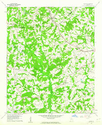
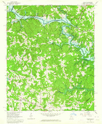 1963 Avalon1964 Print · USGSThe Tugaloo River valley meets the rising waters of the Hartwell Reservoir in the early sixties. Genealogists and historians can trace the rural communities of Avalon and Old Madison, alongside local landmarks like Tugaloo Ch and Museum Cem.3 unique versions available
 - 1979 Map of Commerce, 1980 Print
 1979 Commerce1980 Print · USGSThe Georgia and South Carolina Piedmont reached a period of significant regional growth in the late seventies. Genealogists and historians can trace family roots through locations like Blackberry Church, Old Pioneer Cem, and the Gillsville Sch.2 unique versions available
 - 1981 Map of Toccoa, 1982 Print
 1981 Toccoa1982 Print · USGSThe tri-state mountain region where Georgia meets the Carolinas is shown here in the early eighties. Genealogists and historians can trace family-named locations and settlements from Dahlonega to Tallulah Falls, along with the Southern rail corridor.2 unique versions available
End of results
Showing maps 1-6 of 6
Top cities near Avalon
- Toccoa historical maps
- Seneca historical maps
- Westminster historical maps
- Royston historical maps
- Lavonia historical maps
- Franklin Springs historical maps
See more
Frequently asked questions
- What are the different types of historical maps available for Avalon?
- What is the oldest map of Avalon?
- Where can I purchase historical maps of Avalon for my home or office?
- Where can I download high-res historical maps of Avalon?
- Are there historical topographic maps available for Avalon?
- Is there historical aerial imagery available for Avalon?
- Where are historical maps of Avalon sourced from?