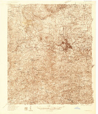
Old Maps of Talbot County, Georgia for Metal Detecting
Plan your next treasure hunt with 93 historic maps of Talbot County. Find old homesites, ghost towns, trails, and gathering spots that may be lost to time — perfect for identifying promising metal detecting locations.
- Locate forgotten sites: Uncover places like long-lost settlements, abandoned rail lines, or gathering spots.
- Plan better hunts: Use map overlays combined with LiDAR or satellite views to narrow in on historically rich areas.
- Made for detectorists: Thousands of hobbyists use these maps to discover relics, coins, and hidden history.
Use these historic maps to boost your research and find new opportunities beneath the surface of Talbot County.
Talbot County, GA maps
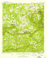
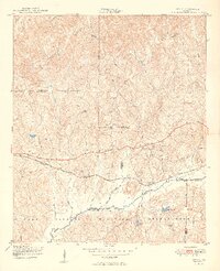
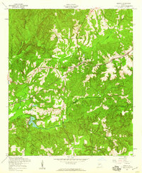
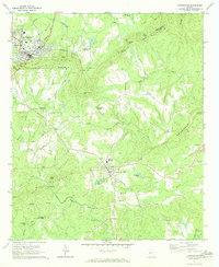
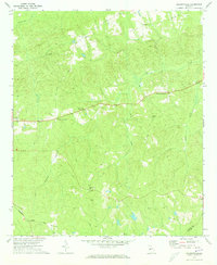
(93)- 1907 Map of Talbotton
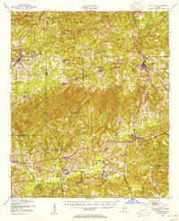
 1907 Talbotton1907 Print · USGSWest-central Georgia at the turn of the century is a landscape of ridges and rail-lines, dominated by the thermal waters of Warm Springs. Local historians can trace the foundations of Talbotton and rural life at Turntime Crossroads, Cataula Camp Ground, and Greens Mill.3 unique versions available
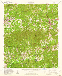
 - 1934 Map of Warm Springs, 1958 Print
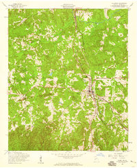
 1934 Warm Springs1958 Print · USGSWest-central Georgia at the height of the New Deal era reveals a landscape of therapeutic springs, mountain gaps, and busy rail junctions. Genealogists and historians can locate family landmarks like Williams Chapel, the Warm Springs Foundation, and Chalybeate Springs along the rugged Pine Mountain ridge.7 unique versions available
 - 1935 Map of Thomaston
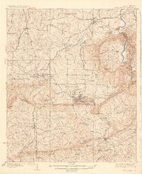
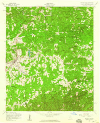
 1935 Thomaston1935 Print · USGSIn the mid-1930s, the industrial corridor around THOMASTON and Silvertown anchored this Georgia landscape. Genealogists and historians can trace the river's influence through several decommissioned crossings like Du Bignon Ferry and family hubs like McCrary Settlement.
 - 1936 Map of Warm Springs
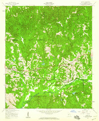
 1936 Warm Springs1936 Print · USGSWest-central Georgia at the height of the New Deal era centers on the therapeutic and institutional development of Warm Springs. Researchers can trace the rail-and-road network connecting Manchester and Woodbury or locate landmarks like the Warm Springs Foundation and Ebenezer Cem.4 unique versions available
 - 1939 Map of Thomaston
 1939 Thomaston1939 Print · USGSUpson County and the industrial town of Thomaston are captured here in the late 1930s, showing a landscape of textile mills and family settlements. Researchers can trace rural life through dozens of local landmarks like Silvertown, Paynes Mill, and the McCrary Settlement.3 unique versions available
 - 1949 Map of Upatoi
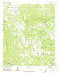
 1949 Upatoi1949 Print · USGSThe Fort Benning boundary and the Central of Georgia railroad define this corner of Georgia in the late forties. Researchers can trace family landmarks like Mt Carmel Church and the rural settlements at Upatoi and Box Springs.2 unique versions available
 - 1950 Map of Talbotton, 1953 Print
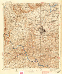
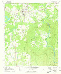
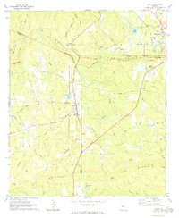
 1950 Talbotton1953 Print · USGSTalbotton and its surrounding countryside are captured here just after the war, showing a landscape defined by traditional rail travel and rural community. Genealogists can trace family roots near Upatoie Ch or locate the old Powell Sch and the settlement of Beall.2 unique versions available
 - 1950 Map of Geneva, 1953 Print
 1950 Geneva1953 Print · USGSMid-century Talbot County is captured here at a time when rural life centered on the railroad and local congregations. Trace the routes through Geneva and Juniper Station to find local landmarks like Oak Grove Ch and Welcome Sch.
 - 1950 Map of Waverly Hall, 1953 Print
 1950 Waverly Hall1953 Print · USGSMid-century Harris County comes into focus as the railroad era meets the expanding post-war road network. Researchers can trace family sites near Waverly Hall Cem, the Mt McCatherine Sch, and the rail station at Cleola.
 - 1950 Map of Talbotton, 1955 Print
 1950 Talbotton1955 Print · USGSWestern Georgia at the start of the fifties reveals a landscape of rural railroad towns and numerous country churches. Genealogists can trace family connections at Waverly Hall Cem or locate old community centers like Box Springs, Geneva, and Matthews Chapel.
 - 1955 Map of Talbotton, 1959 Print
 1955 Talbotton1959 Print · USGSTalbot County centered on the town of Talbotton in the mid-1950s, showing the intersection of local roads and rail transit. Genealogists can trace family connections at landmarks like Neel Cem, Powell Ch, and the Atlantic Coast Line corridor.2 unique versions available
 - 1955 Map of Waverly Hall, 1959 Print
 1955 Waverly Hall1959 Print · USGSWestern Georgia's rural landscape is captured here in the mid-fifties as the railroad and small-town congregations defined community life. Genealogists and local historians can trace the exact locations of Matthews Chapel, Bangsville, and the St Johns Cem.3 unique versions available
 - 1955 Map of Upatoi, 1959 Print
 1955 Upatoi1959 Print · USGSThe rural borderlands of Talbot and Muscogee counties are captured here in the mid-1950s, split between timbered creeks and federal land. Genealogists can locate family landmarks like Phillips Cem, Mt Paron Ch, and the Crossroads Sch along the Central of Georgia line.3 unique versions available
 - 1955 Map of Geneva, 1959 Print
 1955 Geneva1959 Print · USGSGeneva and the surrounding Georgia countryside are shown in the mid-1950s as the railroad and creek networks dictated local life. Genealogists can trace family roots through Oak Grove Ch, Welcome Ch, and the rural Juniper Sta rail stop.2 unique versions available
 - 1955 Map of Talbotton, 1961 Print
 1955 Talbotton1961 Print · USGSTalbot County and its neighboring parishes are captured here in the mid-fifties, showing the transition between traditional rail-town life and the expanding military presence to the south. Genealogists can trace family roots through numerous rural landmarks like Olive Branch Ch, the Geneva Sch, and Box Springs.2 unique versions available
 - 1955 Map of Phenix City, 1964 Print
 1955 Phenix City1964 Print · USGSPost-war Alabama and Georgia meet along the Chattahoochee River as industry and military installations expand. Trace the rail lines of the Central of Georgia through towns like Opelika, Tuskegee, and Alexander City.3 unique versions available
 - 1957 Map of Phenix City
 1957 Phenix City1957 Print · USGSThe Alabama-Georgia borderlands are captured here in the mid-fifties, centered on the bustling river crossing at Phenix City and Columbus. Researchers can trace the mid-century footprint of the Fort Benning Military Reservation or locate smaller textile and railroad towns like Langdale and Camp Hill.
 - 1958 Map of Phenix City
 1958 Phenix City1958 Print · USGSThe Alabama-Georgia borderlands thrive during the late fifties, anchored by the river-driven industry of Columbus and Phenix City. Researchers can trace the mid-century footprints of Fort Benning, Auburn, and the textile towns of Fairfax and Lanett.
 - 1971 Map of Sunset Village, 1973 Print
 1971 Sunset Village1973 Print · USGSUpson County at the start of the seventies reveals a landscape of family settlements and emerging rural industries. Genealogists can trace family footprints at McCrary Settlement or Jones Settlement, while discovering local landmarks like Lawrences Mill and Thurston Sch.2 unique versions available
 - 1971 Map of Woodbury, 1973 Print
 1971 Woodbury1973 Print · USGSThe railroad junction at Woodbury and the heights of Pine Mountain define this Georgia landscape in the early seventies. Genealogists can trace family names and rural communities through landmarks like Sees Old Mill, Concord Cem, and Loftin.2 unique versions available
 - 1971 Map of Roland, 1973 Print
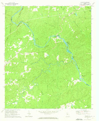 1971 Roland1973 Print · USGSTalbot County at the start of the 1970s is defined by its relationship to the Flint River and its complex network of islands. Local researchers can trace family landmarks and rural congregations at Flint River Ch, Pleasant Hill, and Smith Cem.2 unique versions available
 - 1971 Map of Manchester, 1973 Print
 1971 Manchester1973 Print · USGSThe Georgia Piedmont at the start of the 1970s was defined by the ridges of PINE MOUNTAIN and the tracks of the Seaboard Coast Line. Genealogists and historians can trace the rural communities of Chalybeate Springs and Belleview, and locate local landmarks like Greens Mill and Valley Grove Ch.2 unique versions available
 - 1971 Map of Shiloh, 1973 Print
 1971 Shiloh1973 Print · USGSShiloh and the surrounding ridgelines are captured here in the early seventies as the railroad and rural life defined this part of Georgia. Researchers can trace family history at Tramell Cem or locate the site of St Pauls Ch and Bulloch Crossroads.2 unique versions available
 - 1971 Map of Prattsburg, 1973 Print
 1971 Prattsburg1973 Print · USGSTaylor County, Georgia, is documented here in the early seventies as a rural landscape of creek-fed valleys and small crossroads communities. Genealogists and local historians can trace the locations of Antioch Ch, the Prattsburg Airport, and the small settlement of Wesley.2 unique versions available
 - 1971 Map of Baldwinville, 1973 Print
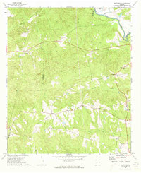
 1971 Baldwinville1973 Print · USGSTalbot County in the early seventies remained a landscape of quiet crossroads and rural parishes. Researchers can trace family sites near Po Biddy Crossroads, locate the Jumpin Airfield, or find records of congregations at Philadelphia Ch and New Salem Ch.2 unique versions available
Showing maps 1-25 of 93
Top cities of Talbot County
- Talbotton historical maps
- Woodland historical maps
- Junction City historical maps
- Geneva historical maps
Frequently asked questions
- What are the different types of historical maps available for Talbot County?
- What is the oldest map of Talbot County?
- Where can I purchase historical maps of Talbot County for my home or office?
- Where can I download high-res historical maps of Talbot County?
- Are there historical topographic maps available for Talbot County?
- Is there historical aerial imagery available for Talbot County?
- Where are historical maps of Talbot County sourced from?