Old Maps of Thomas County, Georgia for Genealogy
Trace your family roots with 120 historic maps of Thomas County. These high-res maps reveal old neighborhoods, homesites, landmarks, and streets — helping you uncover where your ancestors lived and how the area evolved over time.
- Explore historic neighborhoods: Identify where your relatives may have lived in the 1800s or 1900s.
- Compare maps over time: Trace the changes in streets, buildings, and landmarks for multi-generational research.
- Perfect for genealogy & ancestry research: Used by family historians and researchers to map out lineage and migration.
These maps are an incredible resource for exploring your personal connection to Thomas County's past.
Thomas County, GA maps
(120)- 1953 Map of Dothan, 1966 Print
 1953 Dothan1966 Print · USGSSoutheast Alabama and Southwest Georgia are captured during a period of massive hydraulic and military expansion in the mid-fifties. Genealogists and historians can trace rural landmarks like Antioch Church and School, the Andrew Jackson Monument, and the early footprint of Fort Rucker Military Reservation.3 unique versions available
 - 1953 Map of Waycross, 1967 Print
 1953 Waycross1967 Print · USGSSouth Georgia's agricultural and rail heartland is captured here in the mid-1950s, showing a vast network of timber and farming towns. Researchers can trace the rail lines connecting Waycross and Tifton or locate landmarks like Jefferson Davis State Park and Lake Blackshear.2 unique versions available
 - 1954 Map of Dothan
 1954 Dothan1954 Print · USGSSoutheast Alabama and Southwest Georgia are seen here in the mid-fifties, during a decade of military expansion and rural transition. Genealogists can trace the location of country schools like Little Zion School or the grounds of Kolomoki Mounds State Park.
 - 1954 Map of Valdosta, 1967 Print
 1954 Valdosta1967 Print · USGSThe South Georgia and North Florida borderlands are captured here in the mid-fifties, showing the deep timber and wetland networks of the coastal plain. Researchers can trace the path of the Atlantic Coast Line through Valdosta or explore the interior of the Okefenokee Swamp.2 unique versions available
 - 1954 Map of Tallahassee, 1967 Print
 1954 Tallahassee1967 Print · USGSThe Florida Panhandle and South Georgia are captured here during a period of mid-century growth and military expansion. Researchers can trace the development of Panama City, the footprint of Tyndall Air Force Base, and the rail lines of the Atlantic Coast Line.4 unique versions available
 - 1955 Map of Dothan
 1955 Dothan1955 Print · USGSSoutheast Alabama and Southwest Georgia are captured here in the mid-fifties, showing a landscape of river-port history and growing military bases. Researchers can trace rural life via the Andrew Jackson Monument, Bauxite mines, and the Central of Georgia RR.
 - 1956 Map of Grooverville, 1957 Print
 1956 Grooverville1957 Print · USGSThe Georgia-Florida borderlands in the mid-fifties reveal a quiet rural landscape of family cemeteries and timbered bays. Researchers can pinpoint the locations of local schools like Grooverville Sch and the grounds of Simmons Hill Ch Cem.2 unique versions available
 - 1956 Map of Monticello NE, 1957 Print
 1956 Monticello NE1957 Print · USGSThe Georgia-Florida borderlands come to life in the mid-fifties, showing a rural landscape defined by the Watson Line and timbered creek bottoms. Genealogists can trace family roots through numerous local landmarks like Mallette Cem, Little Flock Cem, and Olive Ch.3 unique versions available
 - 1956 Map of Cairo, 1957 Print
 1956 Cairo1957 Print · USGSMid-century Grady and Thomas Counties are defined here by a network of rural churches and the busy rail corridor of the Atlantic Coast Line. Researchers can locate family landmarks like Pierce Chapel, the Silica Strip Mines, and the vanished Midway Sch campus.2 unique versions available
 - 1956 Map of Metcalf, 1957 Print
 1956 Metcalf1957 Print · USGSCrossing the state line in the mid-fifties, this survey traces the rural settlements and rail siding towns of South Georgia and North Florida. Genealogists can locate family-named landmarks like Hicks Cemetery and the Galilee School.3 unique versions available
 - 1957 Map of Miccosukee NE, 1958 Print
 1957 Miccosukee NE1958 Print · USGSThe Georgia-Florida borderlands come to life in the late fifties, showing a rural landscape defined by family cemeteries and country churches. Genealogists can trace roots at Copeland Cem or locate historic meeting places like Trinity Ch and New Hope Ch.2 unique versions available
 - 1957 Map of Thomasville, 1959 Print
 1957 Thomasville1959 Print · USGSThomas County during the late fifties shows a landscape of growing towns and established rail corridors. Genealogists and historians can trace numerous rural communities and landmarks like Merrillville, the Confederate Bridge, and Bethlehem Cem.
 - 1958 Map of Valdosta
 1958 Valdosta1958 Print · USGSSouth Georgia and North Florida are captured here in the mid-fifties, showing the vast Okefenokee Swamp and the vital timber and rail corridors connecting the two states. Researchers can locate the footprint of Moody Air Force Base, trace the Live Oak Perry and Gulf railroad, or find early community sites like Bakers Mill and Paradise Church.
 - 1958 Map of Waycross
 1958 Waycross1958 Print · USGSSoutheast Georgia in the late fifties remains a landscape of deep river basins and vital rail junctions. Genealogists and historians can trace family-named landmarks and rural hubs like Union Church, South Georgia College, and the sprawling Okefenokee Swamp.2 unique versions available
 - 1959 Map of Tallahassee
 1959 Tallahassee1959 Print · USGSFlorida's Panhandle and the Big Bend region appear here in the mid-fifties, showing a landscape defined by its great river systems and developing coast. Trace the early layout of Panama City, the expansive Apalachicola National Forest, and the coastal St Marks Lighthouse.
 - 1959 Map of Valdosta
 1959 Valdosta1959 Print · USGSThe Georgia-Florida borderlands in the mid-fifties reveal a landscape of massive blackwater swamps and emerging military aviation hubs. Genealogists and historians can trace rail-stop towns like Fargo and Stockton or explore the interior reaches of the Okefenokee Swamp and Billys Island.
 - 1960 Map of Tallahassee
 1960 Tallahassee1960 Print · USGSThe Florida Panhandle and southern Georgia are captured here in the mid-twentieth century, showing a region defined by its rivers and military installations. Genealogists and historians can trace the growth of Tallahassee or locate coastal landmarks like the St Marks Lighthouse and Tyndall Air Force Base.
 - 1961 Map of Quitman, 1964 Print
 1961 Quitman1964 Print · USGSBrooks and Thomas counties are shown in the early sixties as a thriving rail-centered landscape. Genealogists can trace family names and local landmarks through sites like Robinson Cem, Simmon Hill Ch, and the mills at Bowen Millpond.
 - 1971 Map of Meigs, 1972 Print
 1971 Meigs1972 Print · USGSMeigs and the surrounding Georgia countryside are mapped here in the early seventies, capturing the intersection of four counties. Genealogists can trace family landmarks like Sunset Cem, Ravenwood Sch, and the quiet community of Quality along the Seaboard Coast Line.
 - 1974 Map of Pine Park, 1976 Print
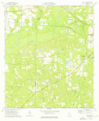 1974 Pine Park1976 Print · USGSSouth Georgia during the mid-seventies reveals a landscape of river-fed bottomlands and rural rail stops. You can trace family roots through numerous country churches like Ireland Ch and Upchurch Ch or locate family plots at Sunkola Cem and Pierce Chapel Cem.
 - 1974 Map of Ochlocknee, 1976 Print
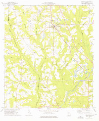 1974 Ochlocknee1976 Print · USGSIn the mid-1970s, the rural corridor between Grady and Thomas County centered on the rail-aligned community of Ochlocknee. Researchers can trace the placement of local landmarks like the Childrens Center Sch, Dawes Chapel, and family-named sites such as Hendry Cem.
 - 1975 Map of Thomasville, 1977 Print
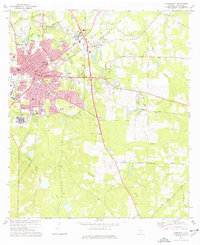 1975 Thomasville1977 Print · USGSThomasville in the mid-seventies is a hub of industry and regional healthcare, crisscrossed by the Seaboard Coast Line. Genealogists and researchers can trace family roots through numerous sites like Laurel Hill Cem, Beulah Cem, and Archbold Memorial Hospital.2 unique versions available
 - 1975 Map of Merrillville, 1986 Print
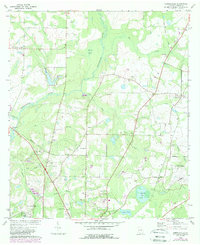 1975 Merrillville1986 Print · USGSNortheast of Thomasville in the 1970s, this Thomas County landscape is defined by the winding Ochlocknee River and its rural outposts. Genealogists can trace family connections through numerous landmarks like Spring Hill Ch, Wilson Cem, and the settlement of Merrillville.
 - 1977 Map of Chastain
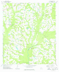 1977 Chastain1977 Print · USGSThe borderlands of Colquitt and Thomas County come into focus during the 1970s, showcasing a landscape of river-bottom farms and rural crossroads. Genealogists and local historians can trace family-named landmarks like White Cem and country steeples including New Bethel Ch and Zion Grove Ch.
 - 1977 Map of Patten
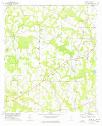 1977 Patten1977 Print · USGSThomas County in the late seventies is a landscape of established rural communities and scattered family homesteads. Researchers can trace local heritage through numerous landmarks like Patten, Mt Calvary Ch Cem, and the Aucilla River.
Showing maps 1-25 of 120
Top cities of Thomas County
- Thomasville historical maps
- Boston historical maps
- Meigs historical maps
- Ochlocknee historical maps
- Coolidge historical maps
Frequently asked questions
- What are the different types of historical maps available for Thomas County?
- What is the oldest map of Thomas County?
- Where can I purchase historical maps of Thomas County for my home or office?
- Where can I download high-res historical maps of Thomas County?
- Are there historical topographic maps available for Thomas County?
- Is there historical aerial imagery available for Thomas County?
- Where are historical maps of Thomas County sourced from?