Old Maps of Turner County, Georgia for Genealogy
Trace your family roots with 77 historic maps of Turner County. These high-res maps reveal old neighborhoods, homesites, landmarks, and streets — helping you uncover where your ancestors lived and how the area evolved over time.
- Explore historic neighborhoods: Identify where your relatives may have lived in the 1800s or 1900s.
- Compare maps over time: Trace the changes in streets, buildings, and landmarks for multi-generational research.
- Perfect for genealogy & ancestry research: Used by family historians and researchers to map out lineage and migration.
These maps are an incredible resource for exploring your personal connection to Turner County's past.
Turner County, GA maps
(77)- 1953 Map of Waycross, 1967 Print
 1953 Waycross1967 Print · USGSSouth Georgia's agricultural and rail heartland is captured here in the mid-1950s, showing a vast network of timber and farming towns. Researchers can trace the rail lines connecting Waycross and Tifton or locate landmarks like Jefferson Davis State Park and Lake Blackshear.2 unique versions available
 - 1956 Map of Sylvester, 1958 Print
 1956 Sylvester1958 Print · USGSWorth County at the height of the mid-fifties is centered on the busy rail-and-road corridor between Sylvester and Poulan. Genealogists and historians can locate dozens of rural landmarks, from the County Prison Farm to community hubs like Porters Corner Sch and Morning Star Ch.2 unique versions available
 - 1958 Map of Waycross
 1958 Waycross1958 Print · USGSSoutheast Georgia in the late fifties remains a landscape of deep river basins and vital rail junctions. Genealogists and historians can trace family-named landmarks and rural hubs like Union Church, South Georgia College, and the sprawling Okefenokee Swamp.2 unique versions available
 - 1972 Map of Cuffietown, 1975 Print
 1972 Cuffietown1975 Print · USGSWorth and Turner counties are captured in the early seventies, showing a rural landscape defined by creek branches and country churches. Genealogists can locate family landmarks such as Davis Ch, Five Points, and Harmony Ch along the local drainage ways.2 unique versions available
 - 1973 Map of Sumner, 1975 Print
 1973 Sumner1975 Print · USGSWorth County’s agricultural and rail-linked landscape comes into focus in the early seventies, centered on the community of Sumner. Genealogists and historians can trace numerous rural congregations and landmarks like Old Sumner Cem, Millers Chapel, and the Parker Sch.2 unique versions available
 - 1973 Map of Waterloo, 1975 Print
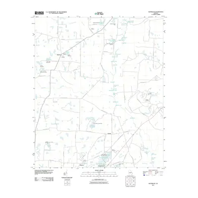
 1973 Waterloo1975 Print · USGSThe rural borderlands of Irwin, Turner, and Tift counties come into focus in the early 1970s, centered on the swampy reaches of the Alapaha River. Genealogists and local historians can trace the foundations of Waterloo and Harding, alongside rural landmarks like Eureka Ch and St Pauls Ch.2 unique versions available
 - 1973 Map of Irwinville, 1975 Print
 1973 Irwinville1975 Print · USGSThe rural landscape of Irwin County comes into focus in the early 1970s, featuring the site of Jefferson Davis Memorial State Park. Researchers can trace the river-centered geography of Irwinville and locate historical community sites like Ebenezer Cem and Big Creek Ch.2 unique versions available
 - 1973 Map of Sylvester, 1975 Print
 1973 Sylvester1975 Print · USGSWorth County's rail-and-road network comes into focus in the early seventies as the region expanded around its historic county seat. Genealogists can trace family roots through several local landmarks like Isabella Cem, Worth Academy, and Macedonia Ch.
 - 1973 Map of Ashburn, 1976 Print
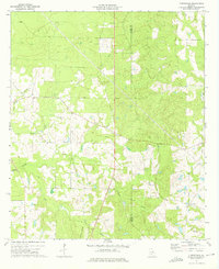
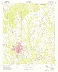
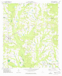
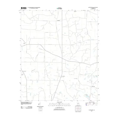
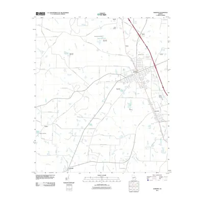
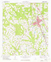 1973 Ashburn1976 Print · USGSMid-1970s Turner County comes to life as the Georgia Southern and Florida railroad connects the bustling hubs of Ashburn and Sycamore. Genealogists can locate family landmarks such as Hobby Cem, Oak Grove Ch, and the small settlement of Coverdale.
 - 1973 Map of Chula, 1976 Print
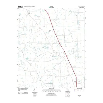
 1973 Chula1976 Print · USGSTift County in the early seventies shows an evolving agricultural landscape defined by its rail and research history. Researchers can trace rural lineages at Mt Zion Ch, locate old water features like Whiddons Millpond, and explore the rail corridor of the Georgia Southern and Florida.2 unique versions available
 - 1973 Map of Bethel, 1976 Print
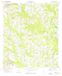
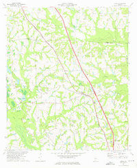
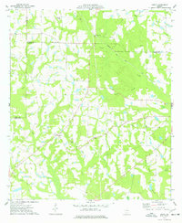
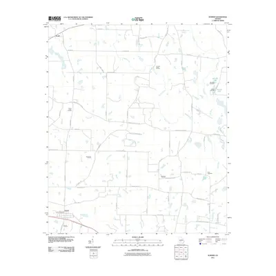
 1973 Bethel1976 Print · USGSTurner County's rural landscape is captured here in the early seventies, showing a community defined by its creeks and country crossroads. Researchers can trace family roots through several local congregations like New Hope Ch and Prospect Ch or locate the Georgia Southern and Florida rail line.2 unique versions available
 - 1974 Map of Rebecca, 1977 Print
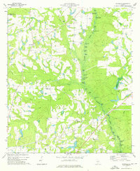
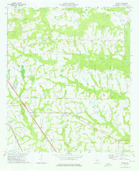
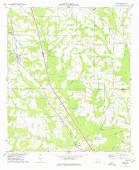
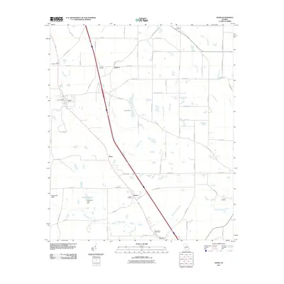
 1974 Rebecca1977 Print · USGSThe rural landscape of Turner County comes to life in the mid-1970s, showcasing the intersection of the Seaboard Coast Line and the Alapaha River. Genealogists can trace local roots at New Providence Ch, Paulk Cem, and the small settlement of Arp.
 - 1974 Map of Amboy, 1977 Print
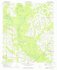
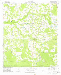
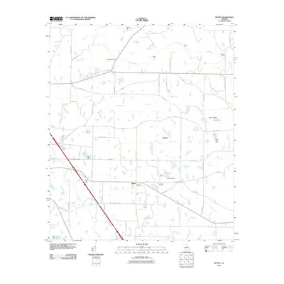
 1974 Amboy1977 Print · USGSThe Turner County countryside in the mid-1970s reveals a landscape shaped by changing rail lines and quiet rural communities. Genealogists and historians can trace family locations near Amboy, Pate Cem, and St Lukes Ch along the Seaboard Coast Line.
 - 1977 Map of Arabi
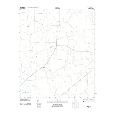
 1977 Arabi1977 Print · USGSThe rural landscapes of Crisp and Turner counties are captured here in the late seventies, centered on the town of Arabi. Genealogists and local historians can trace family sites like the Arabi-Antioch Cem, Dakota, and New Hope Ch.
 - 1977 Map of Pateville
 1977 Pateville1977 Print · USGSThe South Georgia plains near the Crisp and Worth county lines come alive in the late 1970s through this detailed survey. Researchers can trace family ties at the Story-Odum Cem, locate the old New Hope Sch, or follow the waters of Swift Creek through Pateville.
 - 1981 Map of Cordele, 1982 Print
 1981 Cordele1982 Print · USGSSouth Georgia’s agricultural heartland is documented here in the early eighties, showing the convergence of the Seaboard Coast Line Railroad and the Georgia Southern and Florida lines. Genealogists and researchers can trace local landmarks like Bowens Mill Pond, the University of Georgia Research Center, and the shores of Lake Blackshear.
 - 1988 Map of Waycross
 1988 Waycross1988 Print · USGSSouth Georgia's wiregrass and timber country is documented here in the late eighties, centered on the vital rail junction of Waycross. Genealogists and historians can trace the rural landscape from Okefenokee up to the Ocmulgee, finding sites like Lumber City and Jefferson Davis Memorial State Park.
 - 2011 Map of Cuffietown, 2011 Print
 2011 Cuffietown2011 Print · USGSCovers Turner County, including Five Points, Cuffietown, and other nearby areas
 - 2011 Map of Chula, 2011 Print
 2011 Chula2011 Print · USGSCovers Turner County, including Chula, Inaha, and other nearby areas
 - 2011 Map of Ashburn, 2011 Print
 2011 Ashburn2011 Print · USGSCovers Turner County, including Ashburn, Sycamore, and other nearby areas
 - 2011 Map of Waterloo, 2011 Print
 2011 Waterloo2011 Print · USGSCovers Turner County, including Brighton, Waterloo, and other nearby areas
 - 2011 Map of Sumner, 2011 Print
 2011 Sumner2011 Print · USGSCovers Turner County, including Sumner, Terrell, and other nearby areas
 - 2011 Map of Arabi, 2011 Print
 2011 Arabi2011 Print · USGSCovers Turner County, including Arabi, Sibley, and other nearby areas
 - 2011 Map of Bethel, 2011 Print
 2011 Bethel2011 Print · USGSCovers Turner County, including Sycamore, Bethel, and other nearby areas
 - 2011 Map of Amboy, 2011 Print
 2011 Amboy2011 Print · USGSCovers Turner County, including Amboy, Crisp County, and other nearby areas
Showing maps 1-25 of 77
Top cities of Turner County
Frequently asked questions
- What are the different types of historical maps available for Turner County?
- What is the oldest map of Turner County?
- Where can I purchase historical maps of Turner County for my home or office?
- Where can I download high-res historical maps of Turner County?
- Are there historical topographic maps available for Turner County?
- Is there historical aerial imagery available for Turner County?
- Where are historical maps of Turner County sourced from?