Old Maps of Twiggs County, Georgia
Explore 26 old maps of Twiggs County, spanning from 1956 to today. These high-resolution historic maps reveal how streets, neighborhoods, landmarks, and natural features evolved over time — perfect for genealogy, metal detecting, research, and local history exploration.
What you can do with these maps:
- See how Twiggs County changed over time: Compare historical maps to modern-day views to trace roads, homesites, rail lines & more.
- View detailed metadata: Each map includes creators, publishers, year, scale, and archive source.
- Overlay maps with satellite & LiDAR: Visualize the past alongside modern tools to explore terrain & human change.
- Trusted historical sources: Maps sourced from the USGS, Library of Congress, and other archives.
- Access maps your way: View online, download high-res files, or order prints for personal or research use.
Start exploring old maps of Twiggs County to uncover forgotten places, hidden landmarks, and the deep history beneath your feet.
Twiggs County, GA maps
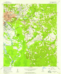
(26)- 1956 Map of Cochran, 1957 Print
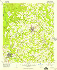 1956 Cochran1957 Print · USGSCovers Twiggs County, including Cochran, Hawkinsville, and other nearby areas2 unique versions available
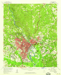
 - 1956 Map of Perry, 1957 Print
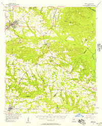 1956 Perry1957 Print · USGSCovers Twiggs County, including Perry, Hawkinsville, and other nearby areas2 unique versions available
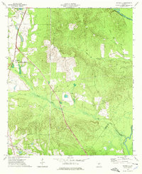
 - 1956 Map of Gordon, 1957 Print
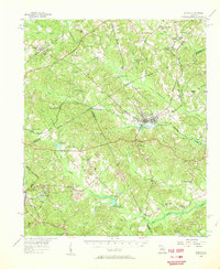 1956 Gordon1957 Print · USGSCovers Twiggs County, including Macon, Gordon, and other nearby areas
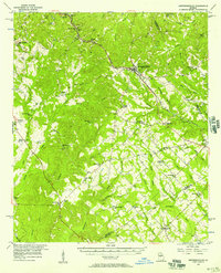
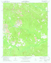
 - 1956 Map of Warner Robins, 1957 Print
 1956 Warner Robins1957 Print · USGSCovers Twiggs County, including Macon, Warner Robins, and other nearby areas2 unique versions available
 - 1956 Map of Jeffersonville, 1957 Print
 1956 Jeffersonville1957 Print · USGSCovers Twiggs County, including Jeffersonville, Danville, and other nearby areas2 unique versions available
 - 1956 Map of Macon East, 1958 Print
 1956 Macon East1958 Print · USGSCovers Twiggs County, including Macon, Sunnydale Acres, and other nearby areas4 unique versions available
 - 1956 Map of Macon, 1959 Print
 1956 Macon1959 Print · USGSCovers Twiggs County, including Macon, Gray, and other nearby areas3 unique versions available
 - 1957 Map of Macon
 1957 Macon1957 Print · USGSCovers Twiggs County, including Macon, Warner Robins, and other nearby areas
 - 1958 Map of Macon
 1958 Macon1958 Print · USGSCovers Twiggs County, including Macon, Warner Robins, and other nearby areas
 - 1964 Map of Macon
 1964 Macon1964 Print · USGSCovers Twiggs County, including Macon, Warner Robins, and other nearby areas2 unique versions available
 - 1973 Map of Hayneville, 1976 Print
 1973 Hayneville1976 Print · USGSCovers Twiggs County, including Perry, Hayneville, and other nearby areas2 unique versions available
 - 1973 Map of Massey Hill, 1977 Print
 1973 Massey Hill1977 Print · USGSCovers Twiggs County, including Gordon, Massey Hill, and other nearby areas
 - 1973 Map of Warner Robins NE, 1977 Print
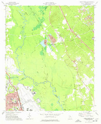 1973 Warner Robins NE1977 Print · USGSCovers Twiggs County, including Macon, Warner Robins, and other nearby areas2 unique versions available
 - 1973 Map of Tarversville, 1977 Print
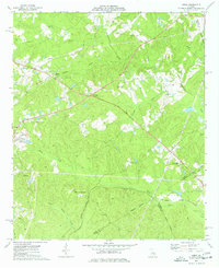
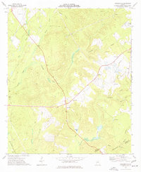 1973 Tarversville1977 Print · USGSCovers Twiggs County, including Mount Calvary, District Path, and other nearby areas
 - 1973 Map of Marion, 1977 Print
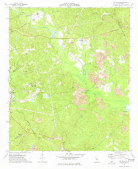
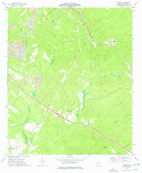 1973 Marion1977 Print · USGSCovers Twiggs County, including Fitzpatrick, Marion, and other nearby areas2 unique versions available
 - 1973 Map of Warner Robins SE, 1977 Print
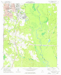 1973 Warner Robins SE1977 Print · USGSCovers Twiggs County, including Warner Robins, Perry, and other nearby areas2 unique versions available
 - 1973 Map of James, 1977 Print
 1973 James1977 Print · USGSCovers Twiggs County, including Lewiston, James, and other nearby areas2 unique versions available
 - 1973 Map of Dry Branch, 1977 Print
 1973 Dry Branch1977 Print · USGSCovers Twiggs County, including Macon, Dry Branch, and other nearby areas2 unique versions available
 - 1974 Map of Danville East, 1976 Print
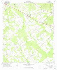
 1974 Danville East1976 Print · USGSCovers Twiggs County, including Danville, Montrose, and other nearby areas
 - 1974 Map of Danville West, 1977 Print
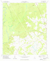
 1974 Danville West1977 Print · USGSCovers Twiggs County, including Danville, Allentown, and other nearby areas
 - 1974 Map of Westlake, 1977 Print
 1974 Westlake1977 Print · USGSCovers Twiggs County, including Coley, Westlake, and other nearby areas
 - 1974 Map of Jeffersonville, 1977 Print
 1974 Jeffersonville1977 Print · USGSCovers Twiggs County, including Jeffersonville, Wilkinson County, and other nearby areas2 unique versions available
 - 1977 Map of Hawkinsville
 1977 Hawkinsville1977 Print · USGSCovers Twiggs County, including Perry, Eastman, and other nearby areas
 - 1978 Map of Hawkinsville, 1979 Print
 1978 Hawkinsville1979 Print · USGSCovers Twiggs County, including Perry, Eastman, and other nearby areas
 - 1978 Map of Macon, 1980 Print
 1978 Macon1980 Print · USGSCovers Twiggs County, including Macon, Warner Robins, and other nearby areas2 unique versions available
Showing maps 1-25 of 26
Top cities of Twiggs County
Frequently asked questions
- What are the different types of historical maps available for Twiggs County?
- What is the oldest map of Twiggs County?
- Where can I purchase historical maps of Twiggs County for my home or office?
- Where can I download high-res historical maps of Twiggs County?
- Are there historical topographic maps available for Twiggs County?
- Is there historical aerial imagery available for Twiggs County?
- Where are historical maps of Twiggs County sourced from?