Old Maps of Twiggs County, Georgia for Genealogy
Trace your family roots with 91 historic maps of Twiggs County. These high-res maps reveal old neighborhoods, homesites, landmarks, and streets — helping you uncover where your ancestors lived and how the area evolved over time.
- Explore historic neighborhoods: Identify where your relatives may have lived in the 1800s or 1900s.
- Compare maps over time: Trace the changes in streets, buildings, and landmarks for multi-generational research.
- Perfect for genealogy & ancestry research: Used by family historians and researchers to map out lineage and migration.
These maps are an incredible resource for exploring your personal connection to Twiggs County's past.
Twiggs County, GA maps
(91)- 1956 Map of Cochran, 1957 Print
 1956 Cochran1957 Print · USGSBleckley and Pulaski counties are captured in the mid-fifties, centered on the railroad corridor and the Middle Georgia College campus. Genealogists can trace family landmarks like Lizzie Bloomer Ch, St Paul Sch, and the riverside community of Hartford.2 unique versions available
 - 1956 Map of Perry, 1957 Print
 1956 Perry1957 Print · USGSCentral Georgia in the mid-fifties is captured here as a thriving agricultural and rail corridor between the Ocmulgee and the Flint. Researchers can trace the layout of legacy communities like Perry and Unadilla, as well as numerous rural landmarks like Kings Chapel Sch and Macedonia Ch.2 unique versions available
 - 1956 Map of Gordon, 1957 Print
 1956 Gordon1957 Print · USGSWilkinson County and its neighbors are shown in the mid-fifties during a peak era of clay mining and rail transport. Researchers can trace family roots through numerous rural sites like Myricks Mill, Stevens Pottery, and Tarrance Chapel Sch.
 - 1956 Map of Warner Robins, 1957 Print
 1956 Warner Robins1957 Print · USGSWarner Robins and the Ocmulgee River valley are captured in the mid-fifties during a period of significant military and urban expansion. Researchers can trace the development of Robins Air Force Base and find local landmarks like Feagin Mill or Tharpe Memorial Ch.2 unique versions available
 - 1956 Map of Jeffersonville, 1957 Print
 1956 Jeffersonville1957 Print · USGSMiddle Georgia's rural heartland is captured here in the mid-fifties, centered on the railroad hub of Jeffersonville. Genealogists can trace family connections to numerous landmarks like New Richland Ch, White Springs Sch, and the riverfront at Cary.2 unique versions available
 - 1956 Map of Macon East, 1958 Print
 1956 Macon East1958 Print · USGSThe outskirts of Macon in the late fifties reveal a landscape of ancient mounds, growing suburbs, and industrial strip mines. Genealogists and historians can locate family landmarks like Ft Hawkins Cem, old schools such as Hall Sch, and the grounds of the Ocmulgee National Monument.4 unique versions available
 - 1956 Map of Macon, 1959 Print
 1956 Macon1959 Print · USGSMacon and the Ocmulgee river valley are shown in detail during the mid-fifties as the city expanded its industrial and academic footprint. Genealogists can locate family landmarks from Lundies Chapel to the Georgia Industrial Home and the earthworks at Ocmulgee National Monument.3 unique versions available
 - 1957 Map of Macon
 1957 Macon1957 Print · USGSMid-century Georgia comes into focus as the river-and-rail economy shifts toward a new era of aviation and highway travel. Trace family roots and vanished landmarks across the Ocmulgee River valley from Macon to the onion fields of Vidalia.
 - 1958 Map of Macon
 1958 Macon1958 Print · USGSMiddle Georgia during the late fifties shows the post-war expansion of Warner Robins alongside the deep-rooted rail hubs of the Central of Georgia line. Researchers can trace the river-bound boundaries of numerous counties and find local landmarks like Veterans Memorial Hospital and Robins AFB.
 - 1964 Map of Macon
 1964 Macon1964 Print · USGSCentral Georgia in the mid-sixties is defined by its major river valleys and a booming military presence. Genealogists and historians can trace the growth of Warner Robins near Robins AFB or locate smaller rural junctions like Allentown and Jeffersonville along the historic Southern railroad lines.2 unique versions available
 - 1973 Map of Hayneville, 1976 Print
 1973 Hayneville1976 Print · USGSHouston County and the Ocmulgee River bottomlands are captured here in the mid-1970s, showcasing a rural landscape tied to the rails and river. Genealogists and local historians can locate the Kathleen Ch, Spring Chapel, and family-named routes like Wimberly Road.2 unique versions available
 - 1973 Map of Massey Hill, 1977 Print
 1973 Massey Hill1977 Print · USGSWilkinson and Twiggs counties appear here in the early 1970s, showcasing a landscape shaped by the kaolin industry and rural community life. Genealogists and historians can locate numerous landmarks like Spring Hill Ch Cem, Asbury Ch, and the Old Grade Railroad.
 - 1973 Map of Warner Robins NE, 1977 Print
 1973 Warner Robins NE1977 Print · USGSWarner Robins and the Ocmulgee River basin are captured here in the early seventies during a period of significant military and industrial activity. Researchers can trace family sites like Bond Cem and Bethlehem Ch or locate industrial landmarks like the Huber Tailings Pond.2 unique versions available
 - 1973 Map of Tarversville, 1977 Print
 1973 Tarversville1977 Print · USGSTwiggs and Bleckley counties are captured in the early seventies, centered on the railroad crossing at Tarversville. Genealogists can trace family names and rural landmarks like the Shiloh Ch Cem, Twiggs County South Sch, and the Southern railroad tracks.
 - 1973 Map of Marion, 1977 Print
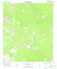 1973 Marion1977 Print · USGSTwiggs County in the early seventies was a landscape of clay mining and quiet rural junctions along the Seaboard Coast Line. Genealogists and local historians can trace family-named sites like Wall Cem, Pearce Cem, and Beech Spring Ch.2 unique versions available
 - 1973 Map of Warner Robins SE, 1977 Print
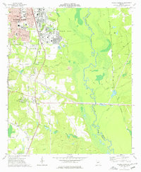 1973 Warner Robins SE1977 Print · USGSHouston County at the start of the 1970s shows the expansion of Warner Robins alongside the vast installation of Robins Air Force Base. Researchers can locate several schools and churches like Sacred Heart Sch, or trace the rural landscape around Bonaire and the Ocmulgee River.2 unique versions available
 - 1973 Map of James, 1977 Print
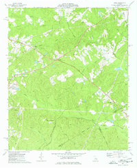 1973 James1977 Print · USGSJones and Wilkinson counties come into focus in the 1970s as rural communities thrive along the Central of Georgia railroad. Researchers can trace ancestral roots through small settlements like Lewiston, find local landmarks such as Mountain Springs, and locate several rural churches including New Salem Ch.2 unique versions available
 - 1973 Map of Dry Branch, 1977 Print
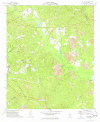 1973 Dry Branch1977 Print · USGSTwiggs County's kaolin mining landscape and rural crossroads are captured here in the early 1970s. Trace local family roots at Nelson Cem or explore industrial history through the sprawling Clay Pits and the historic site of Myricks Mill.2 unique versions available
 - 1974 Map of Danville East, 1976 Print
 1974 Danville East1976 Print · USGSThe railroad towns of Danville, Allentown, and Montrose anchor this mid-1970s Georgia landscape where four counties meet. Genealogists can locate rural landmarks like the Twiggs-Wilkinson Sch, Laurens Hill Ch, and the old Claypit mines.
 - 1974 Map of Danville West, 1977 Print
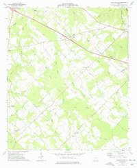 1974 Danville West1977 Print · USGSTwiggs and Bleckley Counties are captured in the mid-seventies, showing a rural landscape defined by family cemeteries and rail-side settlements. Genealogists can locate specific landmarks like the Lizzy Harold Ch and Cem, Lucy Chapel, and the community of Cary.
 - 1974 Map of Westlake, 1977 Print
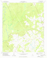 1974 Westlake1977 Print · USGSCentral Georgia’s riverfront and rail corridors are captured in the mid-1970s as they wind through the swampy lowlands of the Ocmulgee River. Researchers can trace old family footprints at Walker Cem, community hubs like Antioch Ch, and the rail stops of Westlake or Magnolia.
 - 1974 Map of Jeffersonville, 1977 Print
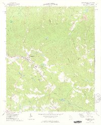 1974 Jeffersonville1977 Print · USGSThe rural landscape of Twiggs County is captured here in the mid-1970s, showing a community centered on rail and agriculture. Researchers can locate family landmarks like the Hardy-Durham Cem and several rural pulpits such as Pauls Chapel and Prospect Ch.2 unique versions available
 - 1977 Map of Hawkinsville
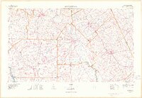 1977 Hawkinsville1977 Print · USGSSouth Georgia’s agricultural and rail heartland is meticulously documented during the late seventies. Researchers can trace family ties and transit routes through old depots and towns like Unadilla, Pineview, and Hawkinsville along the Ocmulgee River.
 - 1978 Map of Hawkinsville, 1979 Print
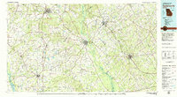 1978 Hawkinsville1979 Print · USGSMiddle Georgia's agricultural and rail heartland is captured here in the late seventies, showing the vital connections between the Ocmulgee River and the rural plains. Genealogists and historians can trace family locations near Vienna, Hawkinsville, or along the tracks of the Southern railroad.
 - 1978 Map of Macon, 1980 Print
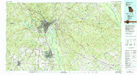 1978 Macon1980 Print · USGSCentral Georgia during the late seventies reveals a landscape shaped by military expansion and clay mining. Genealogists and local historians can trace the development of Warner Robins, the grounds of Wesleyan College, and the rural surroundings of Griswoldville.2 unique versions available
Showing maps 1-25 of 91
Top cities of Twiggs County
Frequently asked questions
- What are the different types of historical maps available for Twiggs County?
- What is the oldest map of Twiggs County?
- Where can I purchase historical maps of Twiggs County for my home or office?
- Where can I download high-res historical maps of Twiggs County?
- Are there historical topographic maps available for Twiggs County?
- Is there historical aerial imagery available for Twiggs County?
- Where are historical maps of Twiggs County sourced from?