Old Maps of Warren County, Georgia for Metal Detecting
Plan your next treasure hunt with 70 historic maps of Warren County. Find old homesites, ghost towns, trails, and gathering spots that may be lost to time — perfect for identifying promising metal detecting locations.
- Locate forgotten sites: Uncover places like long-lost settlements, abandoned rail lines, or gathering spots.
- Plan better hunts: Use map overlays combined with LiDAR or satellite views to narrow in on historically rich areas.
- Made for detectorists: Thousands of hobbyists use these maps to discover relics, coins, and hidden history.
Use these historic maps to boost your research and find new opportunities beneath the surface of Warren County.
Warren County, GA maps
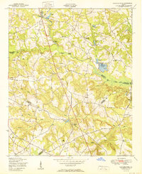
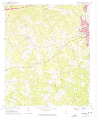
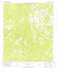
(70)- 1906 Map of Crawfordville
 1906 Crawfordville1906 Print · USGSUpper Georgia and the South Carolina border come alive in this early century survey, showing a landscape defined by river ferries and mining sites. Genealogists can trace family roots through old post offices like Triplett P.O. or find historic crossings like Fishdam Ferry and the Columbia Mines.3 unique versions available
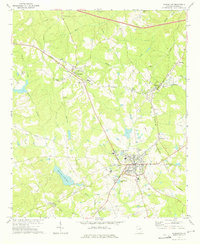
 - 1922 Map of Harlem
 1922 Harlem1922 Print · USGSEastern Georgia's rural landscape is captured here in the years following the Great War, showing a territory tied together by the Georgia Railroad. Genealogists can locate family-named landmarks such as Lundie Grove School, Arrington Mill, and Old Union Church.3 unique versions available
 - 1948 Map of Harlem
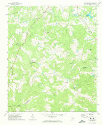
 1948 Harlem1948 Print · USGSEastern Georgia in the late forties shows the expansion of the Camp Gordon Military Reservation into a landscape of rural hamlets. Researchers can trace old family sites like Bynum Cemetery and vanished landmarks like Central School (Abandoned).2 unique versions available
 - 1950 Map of Bowdens Pond
 1950 Bowdens Pond1950 Print · USGSMid-century rural Georgia comes to life where four counties meet, showing a landscape of small family farms and timberland. Genealogists can trace family names and local landmarks through Phillips Cemetery, the Purvis School, and Mt Aldrich Church.2 unique versions available
 - 1953 Map of Athens, 1966 Print
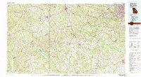
 1953 Athens1966 Print · USGSGeorgia's Piedmont and Savannah River borderlands come alive in this mid-century survey of the region surrounding Athens and Augusta. Trace the rail-and-river economy through the Georgia RR and landmarks like the Fort Gordon Military Reservation.3 unique versions available
 - 1958 Map of Athens
 1958 Athens1958 Print · USGSNorth-central Georgia and the Savannah River valley are captured in the late fifties, showing the region as the new reservoirs were filling. Researchers can trace historic rail lines like the Georgia RR and locate rural landmarks such as Social Circle, Graves Mountain, and the Fort Gordon Military Reservation.
 - 1959 Map of Athens
 1959 Athens1959 Print · USGSNortheast Georgia and the South Carolina borderlands appear here in the mid-fifties, during a decade of infrastructure growth. Genealogists and historians can trace the rail-and-river geography of towns like Social Circle, the sprawl of Fort Gordon Military Reservation, and the newly formed Clark Hill Reservoir.
 - 1963 Map of Athens
 1963 Athens1963 Print · USGSGeorgia's Piedmont and the Savannah River valley are captured in the early sixties as major reservoirs and military installations reshaped the landscape. Researchers can trace the development of Clark Hill Reservoir, locate the Fort Gordon Military Reservation, and find historic towns like Social Circle and Eatonton.
 - 1971 Map of Beall Springs, 1974 Print
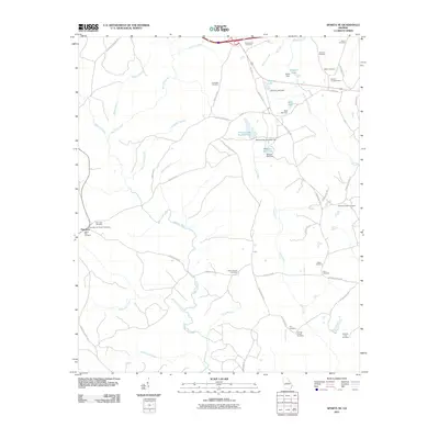
 1971 Beall Springs1974 Print · USGSThe rural border of Warren and Glascock counties is captured here in the early 1970s, showing a landscape defined by creeks and country churches. Genealogists can locate Beall Springs, Five Points, and many family-centric sites like Williams Grove Ch.2 unique versions available
 - 1972 Map of Wrightsboro, 1974 Print
 1972 Wrightsboro1974 Print · USGSMcDuffie County in the early seventies shows the rural community of Wrightsboro as it balanced traditional church life with new development. Researchers can find family landmarks like Brinkley Chapel and Pine Grove Ch, or trace the shoreline of Clark Hill Lake.3 unique versions available
 - 1972 Map of Bastonville, 1974 Print
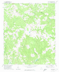 1972 Bastonville1974 Print · USGSEastern Glascock County is depicted in the early seventies, a landscape of timbered ridges and rural rail sidings. Genealogists and local historians can trace family locations near Harts, Bastonville, and several country landmarks like Magnolia Ch and Blankenship Pond.
 - 1972 Map of Thomson West, 1974 Print
 1972 Thomson West1974 Print · USGSThe outskirts of Thomson and the rural McDuffie County line appear here in the early seventies as new residential developments met long-standing farmsteads. Trace ancestral roots at Westview Cemetery or locate historic country congregations like Stony Grove Church and Paynes Chapel.2 unique versions available
 - 1972 Map of Sharon, 1974 Print
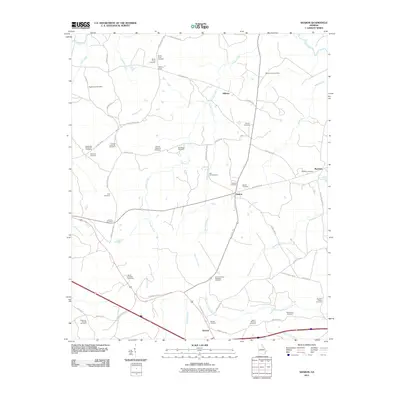
 1972 Sharon1974 Print · USGSTaliaferro County in the early seventies is characterized here by its quiet rural crossroads and winding creek networks. Genealogists can trace family roots through landmarks like Mt Olive Ch, Raytown, and the small community of Sharon.2 unique versions available
 - 1972 Map of Cadley, 1974 Print
 1972 Cadley1974 Print · USGSThe Georgia Piedmont at the start of the seventies is captured here as a landscape of rural congregations and family-named creeks. Genealogists can trace the location of South Liberty Church, Ebenezer Cem, and the Fountain Campground near Cadley.
 - 1972 Map of Jewell, 1974 Print
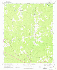
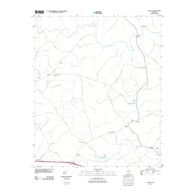
 1972 Jewell1974 Print · USGSHancock and Warren counties are shown here in the early 1970s, as rural communities remained centered around the river and local churches. Researchers can locate family landmarks like Trinity Cem and Hickory Grove or trace the early paths of Georgia 16 near Jewell.2 unique versions available
 - 1972 Map of Sparta NE, 1975 Print
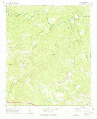
 1972 Sparta NE1975 Print · USGSNortheast of Sparta in the early seventies, this rural landscape centers on the historic settlement of Powelton and the Ogeechee River. Genealogists and local historians can trace rural landmarks like New Hope Ch, Greenwood Ch, and the Barnett Lookout Tower.2 unique versions available
 - 1972 Map of Warrenton, 1975 Print
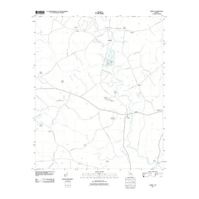
 1972 Warrenton1975 Print · USGSWarren County in the early seventies centers on the rail junction at Warrenton as the local economy balanced agriculture and transit. Genealogists can trace family roots through several rural landmarks, including Walkers Chapel, Prospect Ch Cem, and the Norwood Sch.2 unique versions available
 - 1980 Map of Clark Hill Lake, 1981 Print
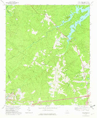
 1980 Clark Hill Lake1981 Print · USGSThe Georgia and South Carolina borderlands in the early eighties were defined by the expansive Clark Hill Lake and the winding Savannah River. Genealogists and historians can trace rail lines like the Georgia Railroad, find the De La Howe State School, and locate rural centers like Tignall and Appling.
 - 1981 Map of Thomson, 1982 Print
 1981 Thomson1982 Print · USGSEast Georgia in the early eighties shows a transition from the urban fringes of Augusta to the deep river valleys of the Savannah River and Ogeechee River. Genealogists and historians can trace rail-side communities like Boneville, Camak, and Mesena along the historic Georgia railroad line.
 - 1988 Map of Athens
 1988 Athens1988 Print · USGSThe Georgia Piedmont and South Carolina borderlands appear in the late eighties as a landscape of vast reservoirs and growing towns. Researchers can trace the legacy of the Georgia RR connecting Athens and Augusta, or locate landmarks within Oconee National Forest.
 - 2011 Map of Bastonville, 2011 Print
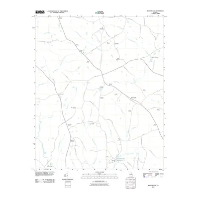 2011 Bastonville2011 Print · USGSCovers Warren County, including Reese, Bastonville, and other nearby areas
 - 2011 Map of Jewell, 2011 Print
 2011 Jewell2011 Print · USGSCovers Warren County, including Jewell, Mayfield, and other nearby areas
 - 2011 Map of Cadley, 2011 Print
 2011 Cadley2011 Print · USGSCovers Warren County, including Cadley, Thigpen, and other nearby areas
 - 2011 Map of Sparta NE, 2011 Print
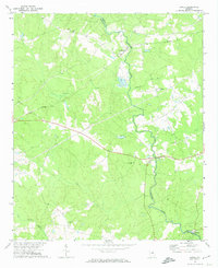
 2011 Sparta NE2011 Print · USGSCovers Warren County, including Powelton, Hancock County, and other nearby areas
 - 2011 Map of Sharon, 2011 Print
 2011 Sharon2011 Print · USGSCovers Warren County, including Sharon, Deerlick Astronomy Village, and other nearby areas
Showing maps 1-25 of 70
Top cities of Warren County
Frequently asked questions
- What are the different types of historical maps available for Warren County?
- What is the oldest map of Warren County?
- Where can I purchase historical maps of Warren County for my home or office?
- Where can I download high-res historical maps of Warren County?
- Are there historical topographic maps available for Warren County?
- Is there historical aerial imagery available for Warren County?
- Where are historical maps of Warren County sourced from?