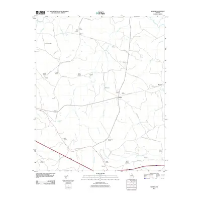
2011 Map of Sharon
USGS Topo · Published 2011About this map
Sharon and Barnett anchor this rural landscape in the eastern Georgia Piedmont, where a dense network of family and community burial grounds reflects generations of local settlement. The terrain is defined by the dendritic drainage patterns of Harden Creek, Beaverdam Creek, and Kendrick Creek, which carve through the countryside between small crossroads like Raytown and Hillman.
Find a feature on this map
63 named features on this map. Tap any name to fly to it.
Don’t see what you’re looking for? This feature index may not catch every label — zoom into the map to look around manually.
Map Details
Editions of this 2011 Sharon Map
This is the sole edition of this map. No revisions or reprints were ever made.
Other maps of this area

1906 · Crawfordville
USGS Topo · 1:125,000

1953 · Athens
USGS Topo · 1:250,000

1958 · Athens
USGS Topo · 1:250,000

1959 · Athens
USGS Topo · 1:250,000

1963 · Athens
USGS Topo · 1:250,000

1966 · Philomath
USGS Topo · 1:24,000

1966 · Crawfordville
USGS Topo · 1:24,000

1972 · Sharon
USGS Topo · 1:24,000

1972 · Sparta NW
USGS Topo · 1:24,000
1972 · Cadley
USGS Topo · 1:24,000