Old Maps of Lower Sansavilla, Georgia for Metal Detecting
Plan your next treasure hunt with 16 historic maps of Lower Sansavilla. Find old homesites, ghost towns, trails, and gathering spots that may be lost to time — perfect for identifying promising metal detecting locations.
- Locate forgotten sites: Uncover places like long-lost settlements, abandoned rail lines, or gathering spots.
- Plan better hunts: Use map overlays combined with LiDAR or satellite views to narrow in on historically rich areas.
- Made for detectorists: Thousands of hobbyists use these maps to discover relics, coins, and hidden history.
Use these historic maps to boost your research and find new opportunities beneath the surface of Lower Sansavilla.
Lower Sansavilla, GA maps
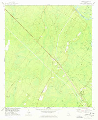
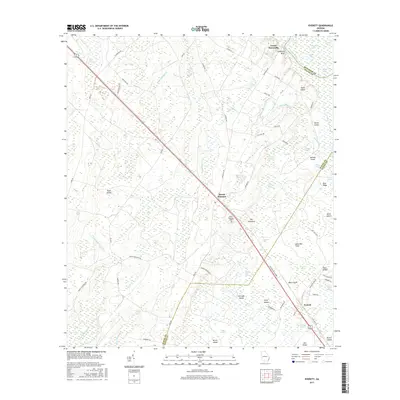
(16)- 1918 Map of Everett City
 1918 Everett City1918 Print · USGSCoastal Georgia at the end of the Great War was a world of vast river swamps and emerging rail junctions. Genealogists and historians can trace family locations through isolated landmarks like Bull Island School, the Ft Barrington Ferry, and the timber-driven siding at Thalmann.2 unique versions available
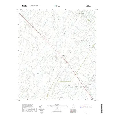
 - 1920 Map of Everett City, 1944 Print
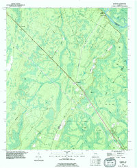
 1920 Everett City1944 Print · USGSCoastal Glynn County was a hub of railroad and river activity during the early twentieth century. Researchers can trace family-named landings and vanished rail stops like Thalmann, the Union Industrial School, and the historic Ft Barrington Ferry.
 - 1944 Map of Everett City
 1944 Everett City1944 Print · USGSCoastal Georgia during the mid-forties was a world of rail junctions and river landings tied to the Altamaha. Genealogists and historians can trace rail-side communities like Everett City, rural schoolhouses including Bull Island Sch, and the site of the Fort Barrington Ferry.
 - 1946 Map of Brunswick, 1948 Print
 1946 Brunswick1948 Print · USGSCoastal Georgia in the mid-forties reveals a landscape defined by the Camp Stewart Military Reservation and the sprawling barrier islands. Genealogists and historians can trace the rail-and-river network through inland towns like Ludowici and Jesup, or locate coastal landmarks like the St Simon Light.
 - 1948 Map of Brunswick
 1948 Brunswick1948 Print · USGSCoastal Georgia in the late 1940s is defined here by its labyrinthine barrier islands and the massive footprint of Camp Stewart. Genealogists and historians can trace the rail-tied growth of Jesup and Hinesville or locate coastal landmarks like St Simon Light.
 - 1956 Map of Brunswick, 1968 Print
 1956 Brunswick1968 Print · USGSThe Georgia coast in the mid-twentieth century is a wild expanse of barrier islands and massive river deltas. You can trace the development of the maritime economy and military presence at Brunswick, or locate historic sites like Fort Frederica National Monument and Harris Neck National Wildlife Refuge.2 unique versions available
 - 1961 Map of Brunswick
 1961 Brunswick1961 Print · USGSThe Georgia coast at the start of the 1960s was a landscape of deep tidal marshes and growing military installations. Genealogists and historians can trace rail-linked towns like Limerick Station or explore coastal landmarks from Fort Frederica National Monument to Sapelo Island.
 - 1978 Map of Everett
 1978 Everett1978 Print · USGSIn the late seventies, the junction at Everett remained a vital rail hub where the Southern and Seaboard Coast Line met near the coastal swamps. Local historians can trace old homesteads and landmarks like Sansavilla Bluff, Mt Pleasant Cem, and the Lookout Tower.
 - 1978 Map of Brunswick
 1978 Brunswick1978 Print · USGSThe Georgia coast and its barrier islands are captured in the late 1970s, as I-95 and the rail lines shaped the growth of coastal towns. Genealogists and historians can trace family locations across the islands or locate sites near Fort Stewart, Darien, and Ludowici.2 unique versions available
 - 1981 Map of Brunswick, 1982 Print
 1981 Brunswick1982 Print · USGSThe Georgia coast at the start of the eighties reveals a complex landscape of tidal estuaries, deep-water sounds, and growing island communities. Trace local history through the protected grounds of Fort Frederica National Monument and the old rail stops at Thalmann and Nahunta.3 unique versions available
 - 1993 Map of Everett, 1995 Print
 1993 Everett1995 Print · USGSThe coastal lowlands and swamps of Glynn and Wayne counties are captured here in the 1990s as the rail lines and forest roads still defined local life. Genealogists can trace the Mt Pleasant Cem and find old family sites near Akin and Everett.
 - 2011 Map of Everett, 2011 Print
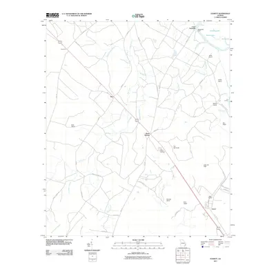 2011 Everett2011 Print · USGSCovers Lower Sansavilla, including Glynn County, Wayne County, and other nearby areas
 - 2014 Map of Everett, 2014 Print
 2014 Everett2014 Print · USGSCovers Lower Sansavilla, including Glynn County, Wayne County, and other nearby areas
 - 2017 Map of Everett, 2017 Print
 2017 Everett2017 Print · USGSCovers Lower Sansavilla, including Glynn County, Wayne County, and other nearby areas
 - 2020 Map of Everett, 2020 Print
 2020 Everett2020 Print · USGSCovers Lower Sansavilla, including Glynn County, Wayne County, and other nearby areas
 - 2024 Map of Everett, 2024 Print
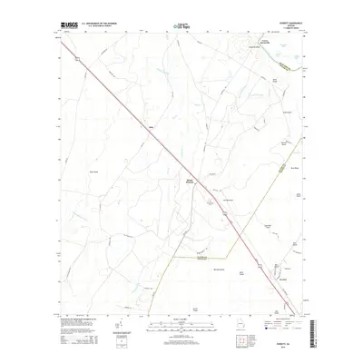
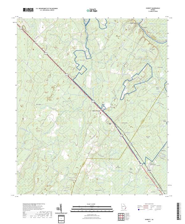 2024 Everett2024 Print · USGSCoastal Georgia's riverine corridor near the Altamaha comes to life in this survey of the Everett and Mount Pleasant vicinities. Trace local family history at Mount Pleasant Cem and explore the shifting landscape between Sansavilla Bluff and the banks of the Altamaha River.
End of results
Showing maps 1-16 of 16
Top cities near Lower Sansavilla
- Jesup historical maps
- Ludowici historical maps
- Darien historical maps
- Riceboro historical maps
- Gardi historical maps
Frequently asked questions
- What are the different types of historical maps available for Lower Sansavilla?
- What is the oldest map of Lower Sansavilla?
- Where can I purchase historical maps of Lower Sansavilla for my home or office?
- Where can I download high-res historical maps of Lower Sansavilla?
- Are there historical topographic maps available for Lower Sansavilla?
- Is there historical aerial imagery available for Lower Sansavilla?
- Where are historical maps of Lower Sansavilla sourced from?