Old Maps of Wilcox County, Georgia for Academic Research
Study the evolution of Wilcox County with 95 high-resolution historic maps. Whether you're teaching, researching, or modeling changes in land use, these maps provide essential visual documentation of urban, environmental, and geographic change.
- Analyze long-term change: Track patterns in development, transportation, and natural features.
- Ideal for environmental or urban studies: Support academic projects with primary historical map data.
- Use in the classroom or lab: Educators and researchers rely on these maps to bring historical context to life.
These maps are a powerful tool for teaching, research, and visualizing how Wilcox County has changed over the decades.
Wilcox County, GA maps
(95)- 1953 Map of Waycross, 1967 Print
 1953 Waycross1967 Print · USGSSouth Georgia's agricultural and rail heartland is captured here in the mid-1950s, showing a vast network of timber and farming towns. Researchers can trace the rail lines connecting Waycross and Tifton or locate landmarks like Jefferson Davis State Park and Lake Blackshear.2 unique versions available
 - 1957 Map of Macon
 1957 Macon1957 Print · USGSMid-century Georgia comes into focus as the river-and-rail economy shifts toward a new era of aviation and highway travel. Trace family roots and vanished landmarks across the Ocmulgee River valley from Macon to the onion fields of Vidalia.
 - 1958 Map of Macon
 1958 Macon1958 Print · USGSMiddle Georgia during the late fifties shows the post-war expansion of Warner Robins alongside the deep-rooted rail hubs of the Central of Georgia line. Researchers can trace the river-bound boundaries of numerous counties and find local landmarks like Veterans Memorial Hospital and Robins AFB.
 - 1958 Map of Waycross
 1958 Waycross1958 Print · USGSSoutheast Georgia in the late fifties remains a landscape of deep river basins and vital rail junctions. Genealogists and historians can trace family-named landmarks and rural hubs like Union Church, South Georgia College, and the sprawling Okefenokee Swamp.2 unique versions available
 - 1964 Map of Macon
 1964 Macon1964 Print · USGSCentral Georgia in the mid-sixties is defined by its major river valleys and a booming military presence. Genealogists and historians can trace the growth of Warner Robins near Robins AFB or locate smaller rural junctions like Allentown and Jeffersonville along the historic Southern railroad lines.2 unique versions available
 - 1971 Map of Pineview West, 1974 Print
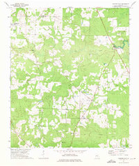
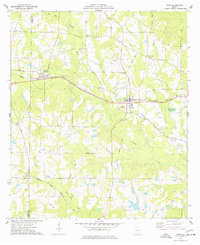
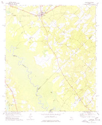
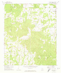 1971 Pineview West1974 Print · USGSWilcox County and the surrounding Georgia countryside are captured here in the early 1970s, showcasing a landscape of small crossroads and creek-side farms. Researchers can trace the Old Railroad Grade and locate numerous rural landmarks like Antioch Ch, Tippettville, and Pope City.
 - 1972 Map of Finleyson East, 1975 Print
 1972 Finleyson East1975 Print · USGSPulaski County and Wilcox County are captured here in the early seventies as the agricultural and timber landscape remains centered on the Ocmulgee River. Researchers can trace old family sites and rural congregations at Goose Neck, Cooks Chapel, and Union Cem.
 - 1972 Map of West Of Eastman, 1975 Print
 1972 West Of Eastman1975 Print · USGSCentral Georgia in the early seventies is mapped here as a network of rural parishes and family lands between Pulaski and Dodge counties. Trace family roots at Salem Ch, Lancaster Cem, and Zion Hill Ch along the drainages of Mosquito Creek.2 unique versions available
 - 1972 Map of Finleyson West, 1975 Print
 1972 Finleyson West1975 Print · USGSPulaski County at the start of the seventies reveals a rural landscape shaped by cotton fields, creek branches, and community-centered parishes. Researchers can trace family roots through several local landmarks like Belleview Ch, Pulaski High, and New Hope Ch.
 - 1972 Map of Abbeville North, 1975 Print
 1972 Abbeville North1975 Print · USGSWilcox and Dodge counties are captured here in the early seventies, centered on the winding corridor of the Ocmulgee River. Local researchers can trace rural church locations and family sites such as Daniels Millpond, Springfield Ch, and Mitchell Cem.
 - 1972 Map of Pineview East, 1975 Print
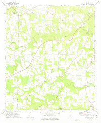
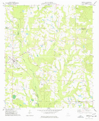
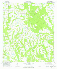
 1972 Pineview East1975 Print · USGSWilcox County in the early seventies remained a landscape of quiet rural hamlets and deep-rooted community churches. Genealogists and local historians can trace the foundations of the area at Christian Hope Cem, Pineview, and Liberty Hill Ch.
 - 1972 Map of Queensland, 1988 Print
 1972 Queensland1988 Print · USGSBen Hill County and the Ocmulgee River bottomlands are captured here in the early 1970s. Local researchers can trace family sites at Dixon Cem, locate the State Fish Hatchery, or follow the Old Railroad Grade through Queensland.
 - 1974 Map of Rebecca, 1977 Print
 1974 Rebecca1977 Print · USGSThe rural landscape of Turner County comes to life in the mid-1970s, showcasing the intersection of the Seaboard Coast Line and the Alapaha River. Genealogists can trace local roots at New Providence Ch, Paulk Cem, and the small settlement of Arp.
 - 1974 Map of Abbeville South, 1977 Print
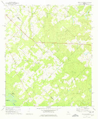
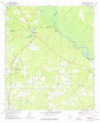
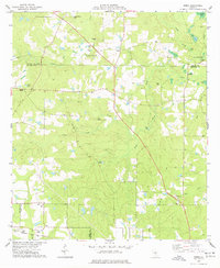
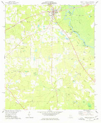 1974 Abbeville South1977 Print · USGSWilcox County in the mid-1970s centers on the riverfront town of Abbeville and the serpentine Ocmulgee River. Genealogists and local researchers can trace numerous family burial sites and rural landmarks, from Stubbs Cem to the old railroad grade near Browning.
 - 1974 Map of Pitts, 1977 Print
 1974 Pitts1977 Print · USGSWilcox and Crisp counties in the mid-seventies were defined by a network of rail-side towns and small rural congregations. Genealogists can trace family footprints across numerous sites including Snow Hill Ch, Fitzgerald Cem, and the village of Seville.
 - 1974 Map of Amboy, 1977 Print
 1974 Amboy1977 Print · USGSThe Turner County countryside in the mid-1970s reveals a landscape shaped by changing rail lines and quiet rural communities. Genealogists and historians can trace family locations near Amboy, Pate Cem, and St Lukes Ch along the Seaboard Coast Line.
 - 1977 Map of Queensland
 1977 Queensland1977 Print · USGSSettled along the Ocmulgee River in the late 1970s, this Ben Hill County landscape features a mix of river-based industry and rural community life. Researchers can trace family history at Evergreen Ch or study former transit lines along the OLD RAILROAD GRADE.
 - 1977 Map of Rochelle
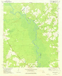
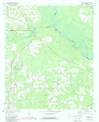
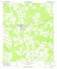 1977 Rochelle1977 Print · USGSWilcox County in the mid-1970s centers on the rail junction at Rochelle as the surrounding landscape transitions between active agriculture and creek-fed bottomlands. Trace local family history and rural development through landmarks like Excelsior Sch, Kramer, and the Old Railroad Grade.
 - 1977 Map of Rhine
 1977 Rhine1977 Print · USGSThe community of Rhine and the rural reaches of Dodge County are captured here in the late seventies as the river and rail economy shaped the landscape. Researchers can trace family history at sites like Reaves-Bates Cem or locate the remote Dodges Lake Landing on the Ocmulgee River.
 - 1977 Map of Hawkinsville
 1977 Hawkinsville1977 Print · USGSSouth Georgia’s agricultural and rail heartland is meticulously documented during the late seventies. Researchers can trace family ties and transit routes through old depots and towns like Unadilla, Pineview, and Hawkinsville along the Ocmulgee River.
 - 1977 Map of Sibbie
 1977 Sibbie1977 Print · USGSBen Hill County was still a landscape of quiet farms and timber stands in the 1970s. Genealogists and local historians can trace family-named sites like Tomberlin Cem, the community at Sibbie, and the Seaboard Coast Line railroad.
 - 1978 Map of Hawkinsville, 1979 Print
 1978 Hawkinsville1979 Print · USGSMiddle Georgia's agricultural and rail heartland is captured here in the late seventies, showing the vital connections between the Ocmulgee River and the rural plains. Genealogists and historians can trace family locations near Vienna, Hawkinsville, or along the tracks of the Southern railroad.
 - 1981 Map of Cordele, 1982 Print
 1981 Cordele1982 Print · USGSSouth Georgia’s agricultural heartland is documented here in the early eighties, showing the convergence of the Seaboard Coast Line Railroad and the Georgia Southern and Florida lines. Genealogists and researchers can trace local landmarks like Bowens Mill Pond, the University of Georgia Research Center, and the shores of Lake Blackshear.
 - 1988 Map of Waycross
 1988 Waycross1988 Print · USGSSouth Georgia's wiregrass and timber country is documented here in the late eighties, centered on the vital rail junction of Waycross. Genealogists and historians can trace the rural landscape from Okefenokee up to the Ocmulgee, finding sites like Lumber City and Jefferson Davis Memorial State Park.
 - 1988 Map of Macon, 1989 Print
 1988 Macon1989 Print · USGSCentral Georgia is captured during the late eighties, showing the expansive river systems and growing urban hubs of the regional interior. Genealogists and historians can trace the paths of the Central of Georgia Railroad and locate communities like Warner Robbins, Dublin, and Sandersville.
Showing maps 1-25 of 95
Top cities of Wilcox County
Frequently asked questions
- What are the different types of historical maps available for Wilcox County?
- What is the oldest map of Wilcox County?
- Where can I purchase historical maps of Wilcox County for my home or office?
- Where can I download high-res historical maps of Wilcox County?
- Are there historical topographic maps available for Wilcox County?
- Is there historical aerial imagery available for Wilcox County?
- Where are historical maps of Wilcox County sourced from?