Old Maps of Keanakolu, Hawaiʻi County for Genealogy
Trace your family roots with 11 historic maps of Keanakolu. These high-res maps reveal old neighborhoods, homesites, landmarks, and streets — helping you uncover where your ancestors lived and how the area evolved over time.
- Explore historic neighborhoods: Identify where your relatives may have lived in the 1800s or 1900s.
- Compare maps over time: Trace the changes in streets, buildings, and landmarks for multi-generational research.
- Perfect for genealogy & ancestry research: Used by family historians and researchers to map out lineage and migration.
These maps are an incredible resource for exploring your personal connection to Keanakolu's past.
Keanakolu, Hawaiʻi County maps
(11)- 1954 Map of Hawaii North
 1954 Hawaii North1954 Print · USGSThe Big Island in the mid-fifties shows a landscape of active volcanic history and a peak sugar-mill economy. Trace the route of the Hawaii Consolidated Railway, locate the Olaa Plantation Mill, and see the extent of the Lava flow of 1881 near Hilo.
 - 1956 Map of Keanakolu, 1957 Print
 1956 Keanakolu1957 Print · USGSThe high forested slopes of Hawaii in the mid-fifties reveal a network of remote camps and forest reserves. Researchers can trace historic mountain access via Trails to landmarks like Keanakolu, the Stone Corral, and the Puu Loa No 3 Camp.2 unique versions available
 - 1959 Map of Hawaii North
 1959 Hawaii North1959 Print · USGSThe northern half of Hawaii Island in the late fifties shows a landscape shaped by historic volcanic activity and a thriving sugar and ranching economy. Researchers can trace historic lava flows alongside local landmarks like Upolu Point Airport, Huehue Ranch, and the Pacific Sugar Mill.
 - 1961 Map of Hawaii North
 1961 Hawaii North1961 Print · USGSThe Big Island's northern reaches are shown here in the early sixties, during the peak of the sugar era and before modern resort development. Researchers can trace the Hawaii Consolidated railroad, locate the Ahu a Umi Heiau Ruins, and explore sugar industry landmarks like the Pacific Sugar Mill.2 unique versions available
 - 1975 Map of Hawaii, 1977 Print
 1975 Hawaii1977 Print · USGSThe Big Island in the mid-seventies is captured here as a landscape of volcanic giants and coastal sugar communities. Genealogists and historians can locate former plantation sites like Pepeekeo Mill or trace the routes of the Mamalahoa Highway through Kamuela.
 - 1980 Map of Hawaii County Sheet 2, 1985 Print
 1980 Hawaii County Sheet 21985 Print · USGSThe eastern coast of the Big Island is captured here in the early eighties, showcasing the intersection of active volcanic landforms and historic plantation towns. Researchers can trace family roots through settlements like Laupahoehoe and Papaikou, or explore the road networks around Kilauea Crater and General Lyman Field.
 - 1982 Map of Keanakolu
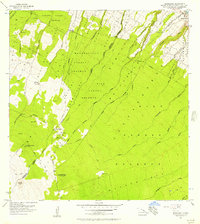
 1982 Keanakolu1982 Print · USGSHigh on the slopes of the Big Island in the early eighties, this survey captures a network of remote forest camps and traditional land divisions. Genealogists and historians can trace the boundaries of the Niupea Homesteads and locate the Doctor David Douglas Historical Monument.
 - 1993 Map of Keanakolu, 2001 Print
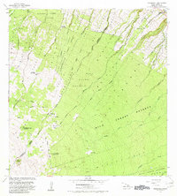
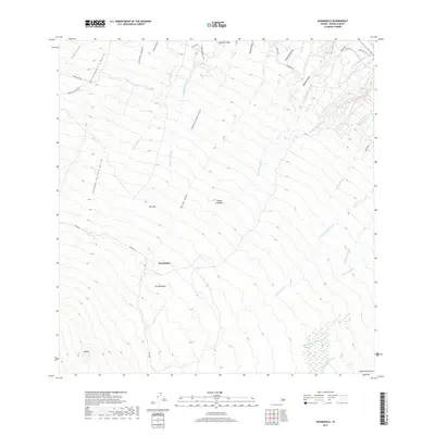
 1993 Keanakolu2001 Print · USGSHigh on the slopes of Mauna Kea in the early nineties, this area reveals a landscape of forestry camps and protected reserves. Genealogists and historians can locate Pu'uloa No 3 Camp, the Keanakolu Ranger Station, and the Cemetery near the homestead boundaries.
 - 2013 Map of Keanakolu, 2013 Print
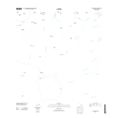 2013 Keanakolu2013 Print · USGSCovers Keanakolu, including Hawaiʻi County, United States, and other nearby areas
 - 2017 Map of Keanakolu, 2017 Print
 2017 Keanakolu2017 Print · USGSCovers Keanakolu, including Hawaiʻi County, United States, and other nearby areas
 - 2024 Map of Keanakolu, 2024 Print
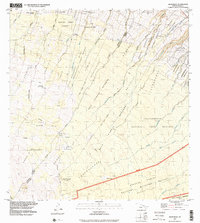
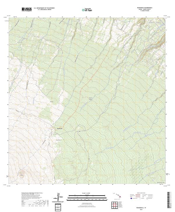 2024 Keanakolu2024 Print · USGSThe high windward slopes of Hawaii are captured here in the modern era, showing the transition from forest refuge to historic ranchlands. Researchers can trace the path of the Humuula Trl and Mana Rd past high-altitude landmarks like Pu'uloa and Keanakolu.
End of results
Showing maps 1-11 of 11
Frequently asked questions
- What are the different types of historical maps available for Keanakolu?
- What is the oldest map of Keanakolu?
- Where can I purchase historical maps of Keanakolu for my home or office?
- Where can I download high-res historical maps of Keanakolu?
- Are there historical topographic maps available for Keanakolu?
- Is there historical aerial imagery available for Keanakolu?
- Where are historical maps of Keanakolu sourced from?