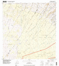
1993 Map of Keanakolu
USGS Topo · Published 2001About this map
Keanakolu and its surrounding uplands are defined by a complex network of forest reserves and early 20th-century homesteading tracts. This 1993 survey details the high-elevation transition from managed timberlands like the Hamakua Forest Reserve to the protected ecology of the Hakalau Forest National Wildlife Refuge. The landscape is etched by steep gulches, including Keanakolu Gulch and Maulua Gulch, which drain the eastern slopes of Mauna Kea.
Find a feature on this map
64 named features on this map. Tap any name to fly to it.
Don’t see what you’re looking for? This feature index may not catch every label — zoom into the map to look around manually.
Map Details
Editions of this 1993 Keanakolu Map
This is the sole edition of this map. No revisions or reprints were ever made.
Other maps of this area

1915 · Hamakua
USGS Topo · 1:62,500

1915 · Honomu
USGS Topo · 1:62,500

1954 · Hawaii North
USGS Topo · 1:250,000

1956 · Pua Akala
USGS Topo · 1:24,000

1956 · Keanakolu
USGS Topo · 1:24,000

1956 · Mauna Kea
USGS Topo · 1:24,000

1956 · Umikoa
USGS Topo · 1:24,000

1957 · Kukaiau
USGS Topo · 1:24,000

1957 · Honokaa
USGS Topo · 1:24,000

1959 · Hawaii North
USGS Topo · 1:250,000