
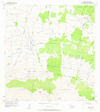
1956 Map of Umikoa
USGS Topo · Published 1957About this map
The high slopes of Hawaii's northern volcanic reaches are defined here by the extensive Hamakua Forest Reserve and Mauna Kea Forest Reserve. This mid-century landscape is dominated by the high-elevation ranching operations of Umikoa (Kukaiau Ranch) and smaller outposts like Hanaipoe and Halepiula. The terrain is deeply incised by numerous north-trending gulches, including Kukuipapa Gulch and Kalopa Gulch, which dictate the movement of water and the placement of infrastructure.
Find a feature on this map
56 named features on this map. Tap any name to fly to it.
Don’t see what you’re looking for? This feature index may not catch every label — zoom into the map to look around manually.
Map Details
Editions of this 1956 Umikoa Map
2 editions found
Other maps of this area

1915 · Hamakua
USGS Topo · 1:62,500

1916 · Waipio
USGS Topo · 1:62,500

1954 · Hawaii North
USGS Topo · 1:250,000

1956 · Pua Akala
USGS Topo · 1:24,000

1956 · Keanakolu
USGS Topo · 1:24,000

1956 · Makahalau
USGS Topo · 1:24,000
1956 · Ahumoa
USGS Topo · 1:24,000

1956 · Mauna Kea
USGS Topo · 1:24,000

1957 · Kukaiau
USGS Topo · 1:24,000

1957 · Honokaa
USGS Topo · 1:24,000