Old Maps of Punaluu, Hawaii for Hiking & Exploration
Hike through history with 20 historic maps of Punaluu. Explore old trails, ghost towns, and forgotten backroads — perfect for outdoor adventurers and local explorers.
- Rediscover forgotten places: Map out old mining camps, roads, and footpaths that no longer exist on modern maps.
- Layer with modern tools: Combine with LiDAR or satellite views to plan hikes through historical terrain.
- Made for exploration: Popular among hikers, overlanders, and local history lovers.
Use these maps to find adventure and explore the hidden past of Punaluu.
Punaluu, HI maps
(20)- 1953 Map of Hauula, 1956 Print
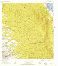 1953 Hauula1956 Print · USGSOahu's rugged interior and windward coast are captured here in the early fifties, showing the evolution of military and plantation lands. Trace the Abandoned RR near Hauula, the grounds of Leilehua High Sch, and landmarks like Sacred Falls (Kaliuwaa).
 - 1954 Map of Oahu
 1954 Oahu1954 Print · USGSMid-century Oahu is caught between its plantation roots and its growing role as a Pacific military hub. Trace the OR and L Co rail lines and explore the 1950s footprints of Pearl Harbor, Libbyville, and Waipahu.
 - 1954 Map of Kahana, 1955 Print
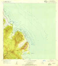 1954 Kahana1955 Print · USGSThe windward coast of Oahu is captured in the mid-fifties, showing a rural landscape before modern expansion. Historians can trace the Sugar Mill (Ruin) near Molii Pond or locate local landmarks like Mokolii Island (Chinamans Hat) and the Kahana settlement.2 unique versions available
 - 1961 Map of Oahu
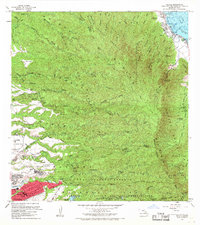
 1961 Oahu1961 Print · USGSOahu's strategic landscape is captured here during the early statehood era, showing the balance between burgeoning urban centers and massive military installations. Trace the path of the Oahu Railway and Land Co or locate historical sites like Schofield Barracks and Punchbowl Hill.
 - 1965 Map of Oahu
 1965 Oahu1965 Print · USGSOahu in the mid-sixties reveals a landscape defined by significant military installations and growing coastal communities. Researchers can trace the infrastructure of Pearl Harbor, Schofield Barracks, and landmarks like Diamond Head.2 unique versions available
 - 1966 Map of Hauula, 1968 Print
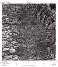
 1966 Hauula1968 Print · USGSOahu's windward coast and central plateau are captured in the mid-sixties, showing the growth of towns like Hauula and Whitmore Village. Local researchers can locate community landmarks such as Our Lady of Sorrows Sch and the Wahiawa Homesteads.
 - 1967 Map of Kahana, 1968 Print
 1967 Kahana1968 Print · USGSWindward Oahu's coastline and forest reserves are documented in detail during the 1960s, from the peaks of the Koolau Range to the reefs of the Pacific. Local history researchers can locate specific plantation-era sites like Waikane Camp and the Sugar Mill (Ruin) Chimney, or trace ancient features like Huilua Pond.
 - 1970 Map of Oahu, 1973 Print
 1970 Oahu1973 Print · USGSOahu was entering a new era of suburban and military expansion in the early seventies. Trace the growth of Mililani Town and Pearl City, or locate historic sites like Schofield Barracks and Diamond Head State Monument.2 unique versions available
 - 1977 Map of Hauula, 1984 Print
 1977 Hauula1984 Print · USGSThe windward coast and central uplands of Oahu are captured here in the late seventies, showing the landscape before recent decades of growth. Genealogists and researchers can trace the limits of Hauula and Wahiawa, or locate the Ku Tree Res and Kaluanui Stream.
 - 1978 Map of Kahana, 1984 Print
 1978 Kahana1984 Print · USGSThe windward coast of Oahu comes into sharp focus during the late 1970s, showing the early footprints of coastal development and land use. Genealogists and historians can trace the residential layout of Kahana and Kaaawa or study the shoreline at Kaoio Point.
 - 1983 Map of Hauula
 1983 Hauula1983 Print · USGSWindward Oahu meets the central highlands in the early eighties, showcasing a mix of coastal villages and military installations. Genealogists and historians can locate Hauula homes, Leilehua High Sch, and the deep interior of the Koolau Range.2 unique versions available
 - 1983 Map of Kahana
 1983 Kahana1983 Print · USGSThe windward coast of Oahu is captured here in the early eighties, showing the region's traditional fishponds and steep mountain topography. You can trace coastal settlements like Kaaawa and Punaluu, or locate landmarks such as Molii Pond and Mokolii Island (Chinamans Hat).2 unique versions available
 - 1992 Map of Hauula, 2001 Print
 1992 Hauula2001 Print · USGSOahu's windward coast and central highlands are captured here in the early nineties, showing the island's blend of military infrastructure and natural preserves. Genealogists and historians can trace the developments of Hau'ula, Whitmore Village, and the expansive Schofield Barracks.
 - 1992 Map of Kahana, 2001 Print
 1992 Kahana2001 Print · USGSThe windward Oahu coastline in the 1990s reveals a landscape of coastal ponds and narrow settlements pressed against steep valley walls. Genealogists and hikers can trace property lines through the Grant Boundary or locate landmarks like the Ka'a'awa School and Huila Pond.
 - 2013 Map of Kahana, 2013 Print
 2013 Kahana2013 Print · USGSCovers Punaluu, including Waikāne, Kaaawa, and other nearby areas
 - 2013 Map of Hauula, 2013 Print
 2013 Hauula2013 Print · USGSCovers Punaluu, including Wahiawā, Whitmore Village, and other nearby areas
 - 2017 Map of Kahana, 2017 Print
 2017 Kahana2017 Print · USGSCovers Punaluu, including Waikāne, Kaaawa, and other nearby areas
 - 2017 Map of Hauula, 2017 Print
 2017 Hauula2017 Print · USGSCovers Punaluu, including Wahiawā, Whitmore Village, and other nearby areas
 - 2024 Map of Kahana, 2024 Print
 2024 Kahana2024 Print · USGSWindward Oahu's coastal landscape and steep ridges are documented here in the early twenty-first century. Genealogists and historians can trace traditional sites like Mōli'i Pond and 'Āpua Fishpond alongside the remnants of the Kualoa Sugar Mill Beach.
 - 2024 Map of Hauula, 2024 Print
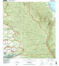
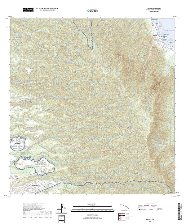 2024 Hauula2024 Print · USGSNortheastern O'ahu and the central plateau are shown in detail during the mid-2020s, from the windward coast to the Wahiawa plains. Researchers can trace land use from the Hauula Community Cem to the Opae'ula Ditch and Helemano Military Reservation.
End of results
Showing maps 1-20 of 20
Top cities near Punaluu
- Honolulu historical maps
- Waipahu historical maps
- Mililani historical maps
- Pearl City historical maps
- Kailua historical maps
- Kaneohe historical maps
See more
Frequently asked questions
- What are the different types of historical maps available for Punaluu?
- What is the oldest map of Punaluu?
- Where can I purchase historical maps of Punaluu for my home or office?
- Where can I download high-res historical maps of Punaluu?
- Are there historical topographic maps available for Punaluu?
- Is there historical aerial imagery available for Punaluu?
- Where are historical maps of Punaluu sourced from?