Old Maps of Port Allen, Hawaii for Academic Research
Study the evolution of Port Allen with 10 high-resolution historic maps. Whether you're teaching, researching, or modeling changes in land use, these maps provide essential visual documentation of urban, environmental, and geographic change.
- Analyze long-term change: Track patterns in development, transportation, and natural features.
- Ideal for environmental or urban studies: Support academic projects with primary historical map data.
- Use in the classroom or lab: Educators and researchers rely on these maps to bring historical context to life.
These maps are a powerful tool for teaching, research, and visualizing how Port Allen has changed over the decades.
Port Allen, HI maps
(10)- 1954 Map of Kauai
 1954 Kauai1954 Print · USGSKauai and Niihau are shown during a period of transition in the early fifties as plantation-era infrastructure began to change. Researchers can trace the Kilauea Sugar Plantation Railroad, the Anahola Settlement, and remote sites on Niihau like Puuwai.
 - 1963 Map of Hanapepe, 1965 Print
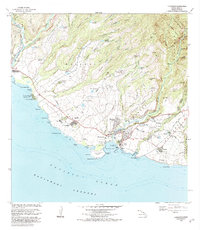
 1963 Hanapepe1965 Print · USGSThe south shore of Kauai flourished in the 1960s as a hub of sugar production and maritime activity. Researchers can trace plantation camps like Camp No 3, the industrial Sugar Mill, and coastal landmarks like Salt Pond Park.2 unique versions available
 - 1967 Map of Kauai
 1967 Kauai1967 Print · USGSThe Garden Isle and Niihau are shown here in the mid-sixties, capturing the island's transition from plantation roots to a more modern infrastructure. Genealogists can trace family connections in Moloaa Settlement or find coastal landmarks like Nonopapa and Kilauea Point Light.
 - 1970 Map of Kauai, 1974 Print
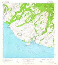
 1970 Kauai1974 Print · USGSThe islands of Kauai and Niihau are shown during the early 1970s, capturing the balance between military expansion and preserved wilderness. Researchers can trace the layout of Niihau's elusive villages like Puwai or explore Kauai's industrial landscape at Koloa Mill and Port Allen.2 unique versions available
 - 1977 Map of Hanapepe, 1981 Print
 1977 Hanapepe1981 Print · USGSSouthern Kauai is captured in the late seventies, showing the agricultural landscape and coastal orientation of the island. Genealogists and researchers can trace the developed areas of Hanapepe and the courses of the Waimea River and Makavelli River.
 - 1983 Map of Hanapepe, 1984 Print
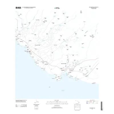
 1983 Hanapepe1984 Print · USGSSouthwestern Kauai is shown here in the early eighties as a landscape of historic forts, plantation villages, and coastal commerce. Researchers can trace the layout of Russian Fort Elizabeth State Hist Park, the Sugar Mill at Numila, and Pakala Village.2 unique versions available
 - 1996 Map of Hanapepe, 1998 Print
 1996 Hanapepe1998 Print · USGSThe southern coast of Kauai comes alive in the mid-nineties, showing a landscape of deep valleys and sugar-era infrastructure. Genealogists and historians can trace residential patterns in Hanapepe Heights or locate landmarks like the Baldwin Monument and Makaweli Landing.
 - 2013 Map of Hanapepe, 2013 Print
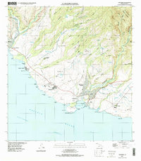
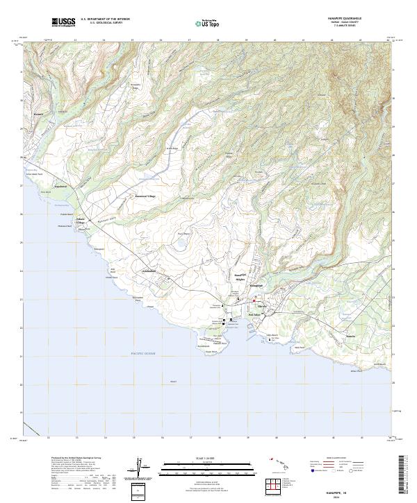
 2013 Hanapepe2013 Print · USGSCovers Port Allen, including Kaawanui Village, Kapalawai, and other nearby areas
 - 2017 Map of Hanapepe, 2017 Print
 2017 Hanapepe2017 Print · USGSCovers Port Allen, including Kaawanui Village, Kapalawai, and other nearby areas
 - 2024 Map of Hanapepe, 2024 Print
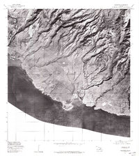
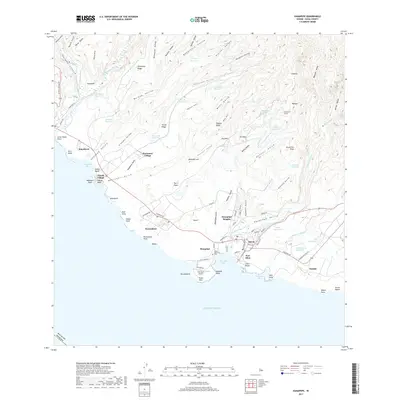
 2024 Hanapepe2024 Print · USGSThe southern coast of Kauai comes to life in this contemporary survey of the island's river valleys and plantation towns. Researchers can trace local heritage at the Kauai Veterans Cem, locate the coastal Port Allen Airport, and explore the gulches around Kaumakani.
End of results
Showing maps 1-10 of 10
Top cities near Port Allen
Frequently asked questions
- What are the different types of historical maps available for Port Allen?
- What is the oldest map of Port Allen?
- Where can I purchase historical maps of Port Allen for my home or office?
- Where can I download high-res historical maps of Port Allen?
- Are there historical topographic maps available for Port Allen?
- Is there historical aerial imagery available for Port Allen?
- Where are historical maps of Port Allen sourced from?