Old Maps of Puuwai, Hawaii for Metal Detecting
Plan your next treasure hunt with 8 historic maps of Puuwai. Find old homesites, ghost towns, trails, and gathering spots that may be lost to time — perfect for identifying promising metal detecting locations.
- Locate forgotten sites: Uncover places like long-lost settlements, abandoned rail lines, or gathering spots.
- Plan better hunts: Use map overlays combined with LiDAR or satellite views to narrow in on historically rich areas.
- Made for detectorists: Thousands of hobbyists use these maps to discover relics, coins, and hidden history.
Use these historic maps to boost your research and find new opportunities beneath the surface of Puuwai.
Puuwai, HI maps
(8)- 1954 Map of Kauai
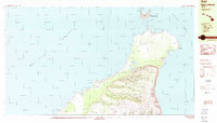
 1954 Kauai1954 Print · USGSKauai and Niihau are shown during a period of transition in the early fifties as plantation-era infrastructure began to change. Researchers can trace the Kilauea Sugar Plantation Railroad, the Anahola Settlement, and remote sites on Niihau like Puuwai.
 - 1967 Map of Kauai
 1967 Kauai1967 Print · USGSThe Garden Isle and Niihau are shown here in the mid-sixties, capturing the island's transition from plantation roots to a more modern infrastructure. Genealogists can trace family connections in Moloaa Settlement or find coastal landmarks like Nonopapa and Kilauea Point Light.
 - 1970 Map of Kauai, 1974 Print
 1970 Kauai1974 Print · USGSThe islands of Kauai and Niihau are shown during the early 1970s, capturing the balance between military expansion and preserved wilderness. Researchers can trace the layout of Niihau's elusive villages like Puwai or explore Kauai's industrial landscape at Koloa Mill and Port Allen.2 unique versions available
 - 1984 Map of Niihau North
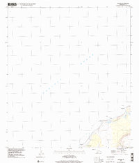
 1984 Niihau North1984 Print · USGSNiihau's secluded northern landscape and the primary settlement of Puuwai are documented here in the mid-eighties. Researchers can trace the island's ranching infrastructure through features like the Stock Pond and the peaks of Paniau and Kaeo.2 unique versions available
 - 1989 Map of Kalanei, 2001 Print
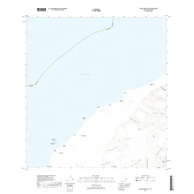
 1989 Kalanei2001 Print · USGSNiihau's western coastline and the community of Pu'uwai are shown here as they appeared in the late twentieth century. Genealogists and researchers can trace local landmarks and settlements including Kalānei, Kālehu, and the waters of Lo'e Lake.
 - 2013 Map of Niihau North OE W, 2013 Print
 2013 Niihau North OE W2013 Print · USGSCovers Puuwai, including Kauai County, United States, and other nearby areas
 - 2017 Map of Niihau North OE W, 2017 Print
 2017 Niihau North OE W2017 Print · USGSCovers Puuwai, including Kauai County, United States, and other nearby areas
 - 2024 Map of Niihau North OE W, 2024 Print
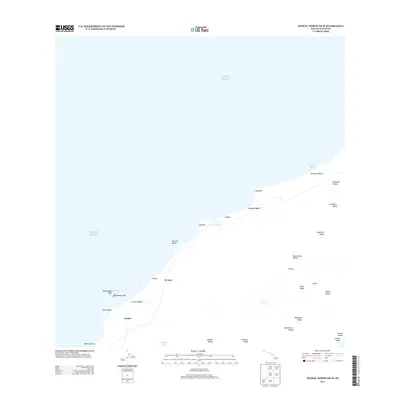
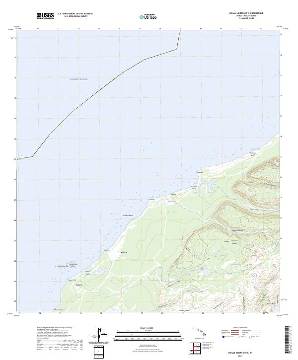 2024 Niihau North OE W2024 Print · USGSThe northern shores of Ni‘ihau are documented here in detail, showcasing the primary settlement at Pu‘uwai and the surrounding coastline. Researchers can trace the island's traditional landscape through features like Lo‘e Lake, the peaks at Ka‘eo, and the numerous valleys like Kahunāli‘i Valley.
End of results
Showing maps 1-8 of 8
Frequently asked questions
- What are the different types of historical maps available for Puuwai?
- What is the oldest map of Puuwai?
- Where can I purchase historical maps of Puuwai for my home or office?
- Where can I download high-res historical maps of Puuwai?
- Are there historical topographic maps available for Puuwai?
- Is there historical aerial imagery available for Puuwai?
- Where are historical maps of Puuwai sourced from?