2020s Maps of Kahului, Hawaii
Explore 2 historic maps of Kahului from the 2020s. These maps offer a rare glimpse into what life looked like during the 2020s — showing old roads, neighborhoods, homes, and landmarks that have changed or disappeared over time.
Whether you're researching your family's past, planning a metal detecting trip, or studying how Kahului's landscape evolved across the 2020s, these high-resolution maps are a powerful tool for exploring the history of this region.
- Focus on a specific era: All maps on this page are from the 2020s, giving you a focused view of this time period.
- See what’s changed: Compare century-old streets, trails, and buildings to today's modern landscape using overlays and satellite layers.
- Research with precision: Use these maps for genealogy, historical research, land use analysis, or educational projects.
- View, download, or print: Maps are fully viewable online in high resolution, and can be downloaded or printed for your own records.
Start exploring Kahului's history through authentic maps from the 2020s. This is your window into the past.
Kahului, HI maps
(2)- 2024 Map of Wailuku, 2024 Print
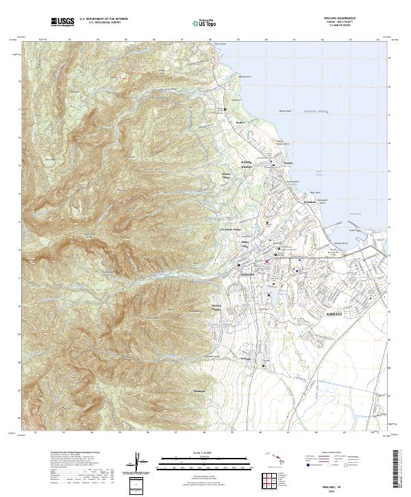 2024 Wailuku2024 Print · USGSCentral Maui comes into focus in the 2020s as the urban centers of Wailuku and Kahului expand toward the dramatic peaks of 'Īao Valley. Genealogists and historians can trace numerous local sites like the Kwong Fook Tong Chinese Cem and the Spreckels Ditch.
 - 2024 Map of Paia, 2024 Print
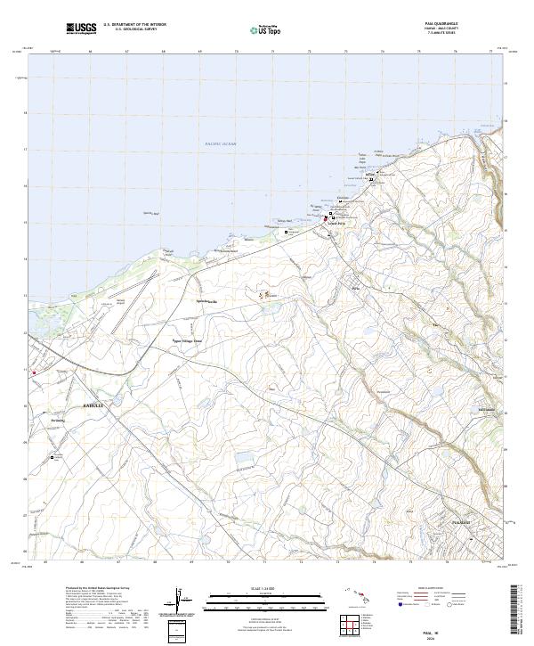 2024 Paia2024 Print · USGSMaui's northern coast comes alive in this survey of the region's sugar-era infrastructure and diverse community settlements. Trace the legacy of local families through the numerous cemeteries like Paia Chinese Cem and the complex waterway network of Lowrie Ditch.
End of results
Showing maps 1-2 of 2
Top cities near Kahului
Top neighborhoods of Kahului
Frequently asked questions
- What are the different types of historical maps available for Kahului?
- What is the oldest map of Kahului?
- Where can I purchase historical maps of Kahului for my home or office?
- Where can I download high-res historical maps of Kahului?
- Are there historical topographic maps available for Kahului?
- Is there historical aerial imagery available for Kahului?
- Where are historical maps of Kahului sourced from?