Old Maps of New Meadows, Idaho for Genealogy
Trace your family roots with 12 historic maps of New Meadows. These high-res maps reveal old neighborhoods, homesites, landmarks, and streets — helping you uncover where your ancestors lived and how the area evolved over time.
- Explore historic neighborhoods: Identify where your relatives may have lived in the 1800s or 1900s.
- Compare maps over time: Trace the changes in streets, buildings, and landmarks for multi-generational research.
- Perfect for genealogy & ancestry research: Used by family historians and researchers to map out lineage and migration.
These maps are an incredible resource for exploring your personal connection to New Meadows's past.
New Meadows, ID maps
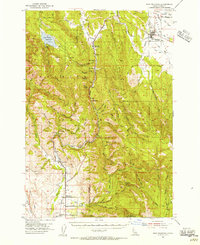
(12)- 1911 Map of Meadows
 1911 Meadows1911 Print · USGSThe high meadows and river valleys of central Idaho are seen here during the early years of the national forest system. Genealogists and historians can locate remote settlements like Lardo and Crawford, or trace rural schoolhouses including Hayes School and Rutledge School.2 unique versions available
 - 1954 Map of New Meadows, 1956 Print
 1954 New Meadows1956 Print · USGSNew Meadows and the surrounding timberlands of the Payette National Forest are captured here in the mid-1950s. Genealogists and researchers can trace the Pacific and Idaho Northern Railroad through mountain settlements like Fruitvale, Evergreen, and Starkey.2 unique versions available
 - 1955 Map of Baker, 1964 Print
 1955 Baker1964 Print · USGSThe Oregon-Idaho borderlands are captured here in the mid-fifties as the Snake River underwent massive changes from dam construction. Trace the Oregon Trail Memorial Monument near Baker, find early mines like Virtue Mine, and follow the Union Pacific Railroad through Huntington.4 unique versions available
 - 1959 Map of Baker
 1959 Baker1959 Print · USGSThe Oregon and Idaho borderlands come alive in the late fifties, showing the rugged corridor along the Snake River and the high peaks of the Wallowa Mountains. Researchers can trace the legacy of the Union Pacific railroad or locate historic mining sites like the Flagstaff Mine and Virtue Mine.2 unique versions available
 - 1980 Map of McCall, 1993 Print
 1980 McCall1993 Print · USGSThe high timber country and glacial lakes of the West Mountains are documented here in the early eighties. Genealogists and local historians can trace the Union Pacific rail line and family-linked sites like Roseberry, Starkey, and the North Hornet Mine.2 unique versions available
 - 1986 Map of New Meadows
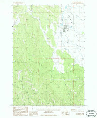 1986 New Meadows1986 Print · USGSMeadows Valley in the 1980s was a hub for timber and mountain transit within the Payette National Forest. Researchers can trace the legacy of local infrastructure through the Old RR Grade, the Railroad Trestle, and the small settlement of Rubicon.
 - 2004 Map of New Meadows, 2007 Print
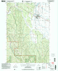 2004 New Meadows2007 Print · USGSMeadow Valley and the surrounding Idaho highlands are captured here in the early 2000s, showing the intersection of forest management and valley ranching. Researchers can trace the boundaries of the Payette National Forest and local landmarks like the Landing Strip and New Meadows townsite.
 - 2011 Map of New Meadows, 2011 Print
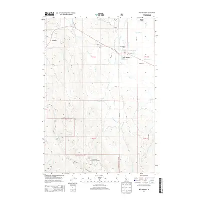
 2011 New Meadows2011 Print · USGSCovers New Meadows, including Adams County, United States, and other nearby areas
 - 2013 Map of New Meadows, 2013 Print
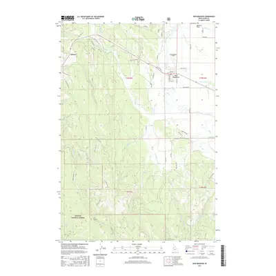
 2013 New Meadows2013 Print · USGSCovers New Meadows, including Adams County, United States, and other nearby areas
 - 2017 Map of New Meadows, 2017 Print
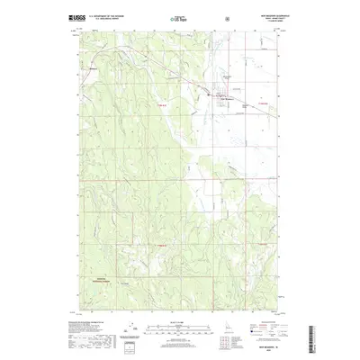
 2017 New Meadows2017 Print · USGSCovers New Meadows, including Adams County, United States, and other nearby areas
 - 2020 Map of New Meadows, 2020 Print
 2020 New Meadows2020 Print · USGSCovers New Meadows, including Adams County, United States, and other nearby areas
 - 2024 Map of New Meadows, 2024 Print
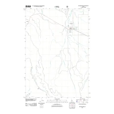
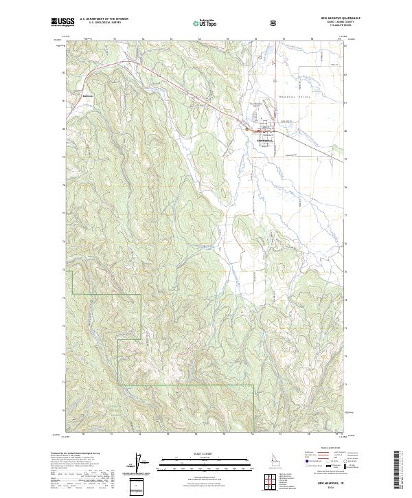 2024 New Meadows2024 Print · USGSMeadows Valley and the mountain foothills of Adams County are shown here in modern detail. Trace the layout of New Meadows, locate the New Meadows Airport, and follow the drainages of Big Creek and the Little Salmon River.
End of results
Showing maps 1-12 of 12
Top cities near New Meadows
Frequently asked questions
- What are the different types of historical maps available for New Meadows?
- What is the oldest map of New Meadows?
- Where can I purchase historical maps of New Meadows for my home or office?
- Where can I download high-res historical maps of New Meadows?
- Are there historical topographic maps available for New Meadows?
- Is there historical aerial imagery available for New Meadows?
- Where are historical maps of New Meadows sourced from?