Old Maps of Crouch, Idaho for Academic Research
Study the evolution of Crouch with 13 high-resolution historic maps. Whether you're teaching, researching, or modeling changes in land use, these maps provide essential visual documentation of urban, environmental, and geographic change.
- Analyze long-term change: Track patterns in development, transportation, and natural features.
- Ideal for environmental or urban studies: Support academic projects with primary historical map data.
- Use in the classroom or lab: Educators and researchers rely on these maps to bring historical context to life.
These maps are a powerful tool for teaching, research, and visualizing how Crouch has changed over the decades.
Crouch, ID maps
(13)- 1909 Map of Garden Valley
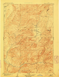 1909 Garden Valley1909 Print · USGSThe Idaho backcountry in the late nineteenth century was a frontier of river canyons and high timber. Researchers can trace the early footprints of Lowman and Banner or follow the primitive drainages of the Deadwood River and Grimes Creek.2 unique versions available
 - 1957 Map of Challis, 1964 Print
 1957 Challis1964 Print · USGSCentral Idaho in the late fifties and early sixties remains a territory of remote mining camps and high-mountain ranger stations. Trace historic mining operations like the Lucky Boy Mine or locate isolated homesteads including Robinson Bar Ranch and Allison Ranch.3 unique versions available
 - 1959 Map of Garden Valley, 1961 Print
 1959 Garden Valley1961 Print · USGSGarden Valley and the Boise National Forest are captured here in the late fifties, showcasing a landscape of river-valley ranching and mountain mining. Trace historical gold and silver prospects like the Klondike Mine or find the remote Grimes Pass School.2 unique versions available
 - 1960 Map of Challis
 1960 Challis1960 Print · USGSCentral Idaho’s high backcountry is detailed here in the early sixties, showing the remote ranching and mining life across five national forests. Genealogists and researchers can trace family holdings at the Silva Ranch or Jones Ranch and find historic sites like Redfish Lake Lodge and Clayton.
 - 1963 Map of Challis
 1963 Challis1963 Print · USGSCentral Idaho's mountain corridors and mining districts appear in detail during the early sixties, highlighting the remote settlements of Challis and Stanley. Researchers can trace the legacy of the gold and silver rushes through labels for Bonanza, the Bayhorse Mine, and the Falconberry ranch.
 - 1982 Map of Deadwood River
 1982 Deadwood River1982 Print · USGSCentral Idaho in the early eighties was a vast expanse of protected wilderness and remote river canyons. Local historians and hunters can locate early landmarks like the Mary Jane Mine, the settlement of Lowman, and isolated facilities such as the Bruce Meadows Landing Strip.
 - 1988 Map of Garden Valley, 1989 Print
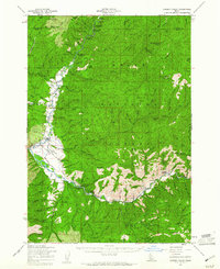
 1988 Garden Valley1989 Print · USGSGarden Valley and Crouch are centered in this late-century study of the Payette River forks. Genealogists can find the Garden Valley Pioneer Cemetery, while others can trace forest landmarks like the Garden Valley Ranger Station and Hot Springs Campground.2 unique versions available
 - 1989 Map of Challis
 1989 Challis1989 Print · USGSCentral Idaho in the late eighties remains a vast expanse of protected wilderness and high-mountain drainages. Researchers can trace remote settlements and backcountry outposts like Custer, Stibnite, and Sunbeam along the Salmon River and its many forks.2 unique versions available
 - 2011 Map of Garden Valley, 2011 Print
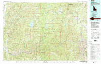
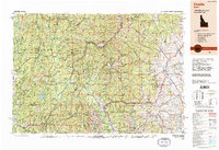
 2011 Garden Valley2011 Print · USGSCovers Crouch, including Garden Valley, Boise County, and other nearby areas
 - 2013 Map of Garden Valley, 2013 Print
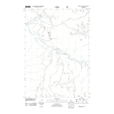
 2013 Garden Valley2013 Print · USGSCovers Crouch, including Garden Valley, Boise County, and other nearby areas
 - 2017 Map of Garden Valley, 2017 Print
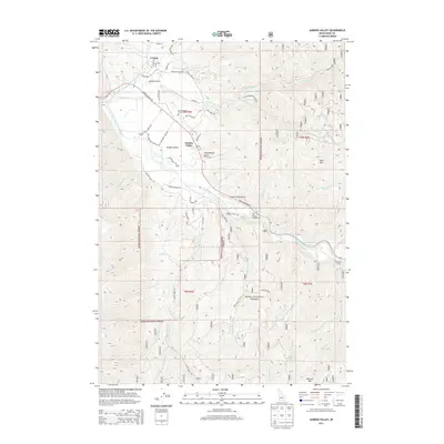
 2017 Garden Valley2017 Print · USGSCovers Crouch, including Garden Valley, Boise County, and other nearby areas
 - 2020 Map of Garden Valley, 2020 Print
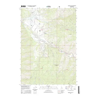
 2020 Garden Valley2020 Print · USGSCovers Crouch, including Garden Valley, Boise County, and other nearby areas
 - 2024 Map of Garden Valley, 2024 Print
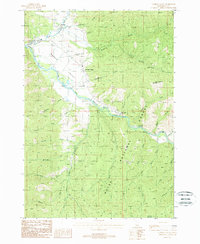
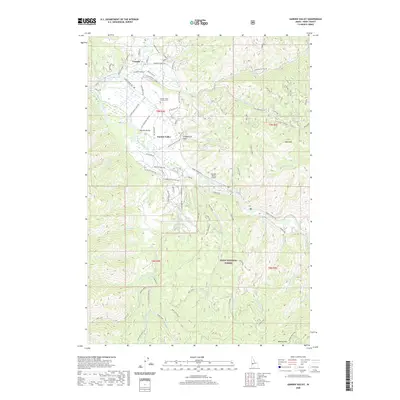
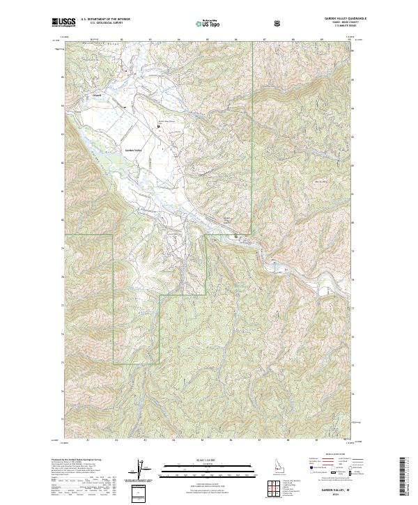 2024 Garden Valley2024 Print · USGSGarden Valley and Crouch sit at the junction of the Payette River forks in this recent survey of Boise County. Researchers can locate family landmarks like the Garden Valley Pioneer Cem or trace mountain routes through Grimes Pass and Schoolhouse Gulch.
End of results
Showing maps 1-13 of 13
Top cities near Crouch
Frequently asked questions
- What are the different types of historical maps available for Crouch?
- What is the oldest map of Crouch?
- Where can I purchase historical maps of Crouch for my home or office?
- Where can I download high-res historical maps of Crouch?
- Are there historical topographic maps available for Crouch?
- Is there historical aerial imagery available for Crouch?
- Where are historical maps of Crouch sourced from?