Old Maps of Porthill, Idaho for Hiking & Exploration
Hike through history with 12 historic maps of Porthill. Explore old trails, ghost towns, and forgotten backroads — perfect for outdoor adventurers and local explorers.
- Rediscover forgotten places: Map out old mining camps, roads, and footpaths that no longer exist on modern maps.
- Layer with modern tools: Combine with LiDAR or satellite views to plan hikes through historical terrain.
- Made for exploration: Popular among hikers, overlanders, and local history lovers.
Use these maps to find adventure and explore the hidden past of Porthill.
Porthill, ID maps
(12)- 1911 Map of Priest Lake, 1954 Print
 1911 Priest Lake1954 Print · USGSThe Idaho Panhandle during the early 1900s was a landscape of deep lakes and high-altitude mining operations connected by new rail lines. Genealogists and historians can trace pioneer settlements like Port Hill and Coolin, or locate remote industrial sites such as the Queen Mine and Mountain Chief Mine.
 - 1913 Map of Priest Lake
 1913 Priest Lake1913 Print · USGSThe Idaho Panhandle was a rugged network of rail sidings and mining camps in the years before the Great War. Genealogists and historians can trace old homesteads and depots from Sandpoint up to the Continental Mine and the remote border crossing at Addie.3 unique versions available
 - 1958 Map of Sandpoint, 1966 Print
 1958 Sandpoint1966 Print · USGSThe Idaho Panhandle and Northeast Washington are shown here in the late fifties, when timber and hydroelectric power drove the local economy. Trace family roots in rail-side towns like Cusick or Metaline Falls, and locate landmarks like the Albeni Falls Dam or Falls Ranger Station.2 unique versions available
 - 1963 Map of Sandpoint
 1963 Sandpoint1963 Print · USGSNorthern Idaho and eastern Washington are shown in the early sixties as a high-country network of timber, mining, and rail. Genealogists and historians can trace the Great Northern line through Metaline Falls, Bonners Ferry, and past the Finch Mine.
 - 1965 Map of Copeland, 1967 Print
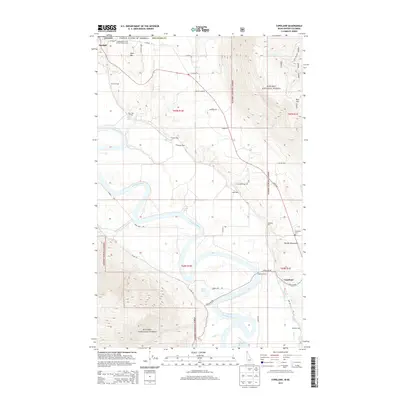
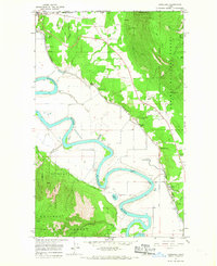 1965 Copeland1967 Print · USGSThe northern Panhandle meets the Canadian border in the mid-1960s, where the winding Kootenai River dominates the valley floor. Family historians can trace local landmarks like Copeland Cem and rail sidings such as Houcks Spur and Harpers Spur.3 unique versions available
 - 1983 Map of Bonners Ferry
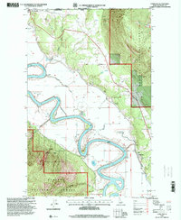
 1983 Bonners Ferry1983 Print · USGSThe Idaho Panhandle and its international border with Canada are shown here in the early 1980s as the timber and mining industries shaped the landscape. Genealogists and researchers can locate northern settlements like Porthill and Naples, alongside family-named peaks and mines such as the American Girl Mine and Parker Mtn.2 unique versions available
 - 1996 Map of Copeland, 2000 Print
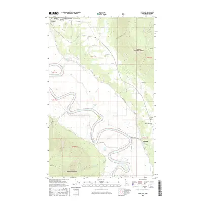
 1996 Copeland2000 Print · USGSThe international border meets the Idaho panhandle in the mid-1990s as the Kootenai River carves through the mountains. Genealogists and local historians can locate the Hundred-Foot Cemetery, the Golden Scepter Mine, and the settlement of Copeland.
 - 2011 Map of Copeland, 2011 Print
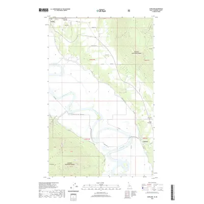
 2011 Copeland2011 Print · USGSCovers Porthill, including Area B (Goat River Valley), Regional District of Central Kootenay, and other nearby areas
 - 2013 Map of Copeland, 2013 Print
 2013 Copeland2013 Print · USGSCovers Porthill, including Area B (Goat River Valley), Regional District of Central Kootenay, and other nearby areas
 - 2017 Map of Copeland, 2017 Print
 2017 Copeland2017 Print · USGSCovers Porthill, including Area B (Goat River Valley), Regional District of Central Kootenay, and other nearby areas
 - 2020 Map of Copeland, 2020 Print
 2020 Copeland2020 Print · USGSCovers Porthill, including Area B (Goat River Valley), Regional District of Central Kootenay, and other nearby areas
 - 2024 Map of Copeland, 2024 Print
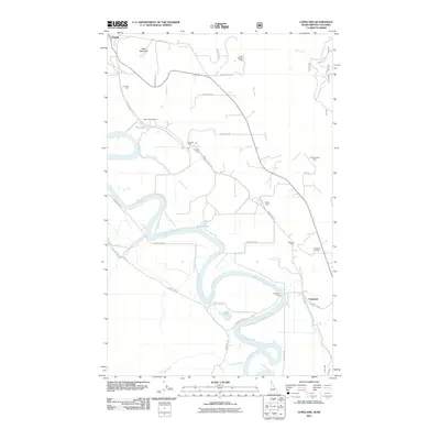
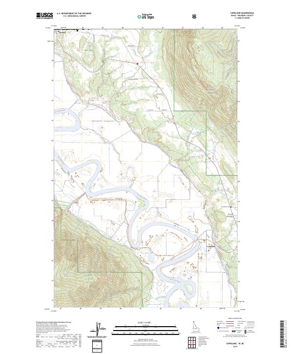 2024 Copeland2024 Print · USGSThe northern Idaho panhandle is defined by the winding Kootenai River as it passes through the Purcell Trench. Genealogists and local historians can trace the communities of Porthill and Copeland, including the hillside Copeland Cem.
End of results
Showing maps 1-12 of 12
Frequently asked questions
- What are the different types of historical maps available for Porthill?
- What is the oldest map of Porthill?
- Where can I purchase historical maps of Porthill for my home or office?
- Where can I download high-res historical maps of Porthill?
- Are there historical topographic maps available for Porthill?
- Is there historical aerial imagery available for Porthill?
- Where are historical maps of Porthill sourced from?