Old Maps of Bingo Creek Landing, Idaho for Academic Research
Study the evolution of Bingo Creek Landing with 13 high-resolution historic maps. Whether you're teaching, researching, or modeling changes in land use, these maps provide essential visual documentation of urban, environmental, and geographic change.
- Analyze long-term change: Track patterns in development, transportation, and natural features.
- Ideal for environmental or urban studies: Support academic projects with primary historical map data.
- Use in the classroom or lab: Educators and researchers rely on these maps to bring historical context to life.
These maps are a powerful tool for teaching, research, and visualizing how Bingo Creek Landing has changed over the decades.
Bingo Creek Landing, ID maps
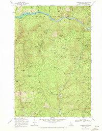
(13)- 1923 Map of Washington Creek
 1923 Washington Creek1923 Print · USGSThe Clearwater and Shoshone county line area in the early 1920s shows a frontier landscape of remote homesteads and forest reserves. Genealogists can locate named residents such as Fred Forsman and James Conner or the early buildings at Headquarters.
 - 1956 Map of Hamilton, 1970 Print
 1956 Hamilton1970 Print · USGSThe Bitterroot Valley and surrounding high country are captured here during the mid-fifties, showing the region's transition into a modern forest-and-rail hub. Genealogists and historians can trace family-named sites and early infrastructure from Fort Missoula to towns like Stevensville and Darby along the Northern Pacific line.2 unique versions available
 - 1959 Map of Hamilton
 1959 Hamilton1959 Print · USGSThe Bitterroot Valley and surrounding wilderness are captured in the late fifties, showing a landscape defined by forestry and river-based settlement. Researchers can trace the Lolo Trail or locate historical points like Fort Missoula and the Fred Burr Reservoir.
 - 1960 Map of Hamilton
 1960 Hamilton1960 Print · USGSThe Bitterroot Valley and surrounding high country are captured here during the late fifties, showing the region's transition into a modern forest and rail corridor. Researchers can trace the path of the Northern Pacific through Missoula or locate landmarks like Fort Missoula and Lake Como.
 - 1964 Map of Hamilton
 1964 Hamilton1964 Print · USGSThe Bitterroot Valley and its surrounding peaks are captured in detail during the mid-1960s, showing the early infrastructure of the Northern Rockies. Genealogists and historians can trace family roots in Hamilton and Stevensville or follow the historic Lolo Trail and Nez Perce Trail.
 - 1969 Map of Thompson Point, 1971 Print
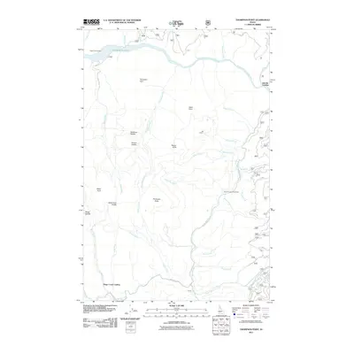
 1969 Thompson Point1971 Print · USGSThe Clearwater River canyon in the late sixties shows a landscape on the brink of change as the Dworshak Dam project began. Researchers can trace the original riverbanks and find specific points like Butte Creek Landing and Isabella Landing before they were submerged.2 unique versions available
 - 1982 Map of Headquarters, 1983 Print
 1982 Headquarters1983 Print · USGSClearwater County's timber and mining country is captured here in the early 1980s, centered on the company town of Headquarters and the historic gold-rush area of Pierce. Genealogists and researchers can trace remote settlements and work sites like Hollywood, New Boehls, and the Oxford Mine.
 - 1994 Map of Thompson Point, 1997 Print
 1994 Thompson Point1997 Print · USGSNorthern Idaho timberlands meet the shoreline of Dworshak Reservoir in the 1990s. Trace remote backcountry landings and high-altitude lookouts including Isabella Landing, Thompson Point, and Beaver Butte.
 - 2011 Map of Thompson Point, 2011 Print
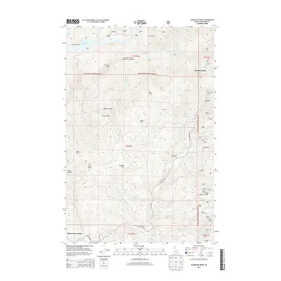
 2011 Thompson Point2011 Print · USGSCovers Bingo Creek Landing, including Isabella Landing, Clearwater County, and other nearby areas
 - 2013 Map of Thompson Point, 2013 Print
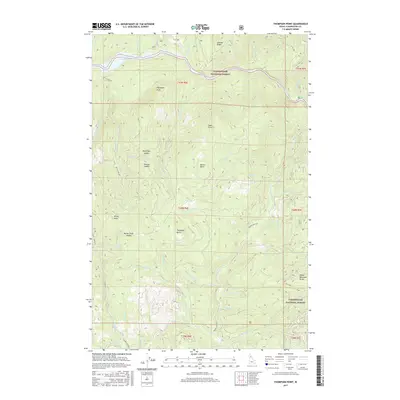
 2013 Thompson Point2013 Print · USGSCovers Bingo Creek Landing, including Isabella Landing, Clearwater County, and other nearby areas
 - 2017 Map of Thompson Point, 2017 Print
 2017 Thompson Point2017 Print · USGSCovers Bingo Creek Landing, including Isabella Landing, Clearwater County, and other nearby areas
 - 2020 Map of Thompson Point, 2020 Print
 2020 Thompson Point2020 Print · USGSCovers Bingo Creek Landing, including Isabella Landing, Clearwater County, and other nearby areas
 - 2024 Map of Thompson Point, 2024 Print
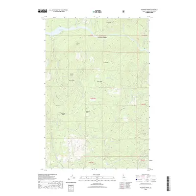
 2024 Thompson Point2024 Print · USGSClearwater County's high country is captured here as it remains today, centered on the North Fork Clearwater River and Dworshak Reservoir. Local historians and hikers can trace the ridgeline routes between Kauffman Saddle, Thompson Butte, and the Sheep Mountain Range.
End of results
Showing maps 1-13 of 13
Frequently asked questions
- What are the different types of historical maps available for Bingo Creek Landing?
- What is the oldest map of Bingo Creek Landing?
- Where can I purchase historical maps of Bingo Creek Landing for my home or office?
- Where can I download high-res historical maps of Bingo Creek Landing?
- Are there historical topographic maps available for Bingo Creek Landing?
- Is there historical aerial imagery available for Bingo Creek Landing?
- Where are historical maps of Bingo Creek Landing sourced from?