Old Maps of Clearwater County, Idaho
Explore 512 old maps of Clearwater County, spanning from 1911 to today. These high-resolution historic maps reveal how streets, neighborhoods, landmarks, and natural features evolved over time — perfect for genealogy, metal detecting, research, and local history exploration.
What you can do with these maps:
- See how Clearwater County changed over time: Compare historical maps to modern-day views to trace roads, homesites, rail lines & more.
- View detailed metadata: Each map includes creators, publishers, year, scale, and archive source.
- Overlay maps with satellite & LiDAR: Visualize the past alongside modern tools to explore terrain & human change.
- Trusted historical sources: Maps sourced from the USGS, Library of Congress, and other archives.
- Access maps your way: View online, download high-res files, or order prints for personal or research use.
Start exploring old maps of Clearwater County to uncover forgotten places, hidden landmarks, and the deep history beneath your feet.
Clearwater County, ID maps
(512)- 1911 Map of Lolo, 1954 Print
 1911 Lolo1954 Print · USGSThe Bitterroot wilderness at the dawn of the Forest Service era is documented here through its early camps and trail networks. Researchers can locate remote outposts like Moose City, the Clearwater Gold and Copper Company, and the historic Indian Post Office landmark.
 - 1913 Map of Lolo
 1913 Lolo1913 Print · USGSThe Bitterroot wilderness of the early 1900s is documented here through a web of mining camps, ranger stations, and high mountain passes. Genealogists and researchers can locate remote sites like Moose City, Williams Ranch, and the Clearwater Gold and Copper Company.2 unique versions available
 - 1923 Map of Washington Creek
 1923 Washington Creek1923 Print · USGSThe Clearwater and Shoshone county line area in the early 1920s shows a frontier landscape of remote homesteads and forest reserves. Genealogists can locate named residents such as Fred Forsman and James Conner or the early buildings at Headquarters.
 - 1924 Map of Kamiah
 1924 Kamiah1924 Print · USGSNorth-central Idaho settlements thrive along the Clearwater River and upland plateaus during the mid-twenties. Genealogists and historians can trace the paths of the Northern Pacific railroad through rail towns like Volmer, Cottonwood, and the river crossing at Kamiah.
 - 1924 Map of Weippe
 1924 Weippe1924 Print · USGSNorth-central Idaho in the early 1920s is captured here, from the prairie settlements to the deep river canyons of the Clearwater. Genealogists can trace early homesteaders like G.W. Ford or locate long-gone post offices at Tahoe and Lowell.
 - 1936 Map of Boehls Butte
 1936 Boehls Butte1936 Print · USGSThe timbered highlands of Shoshone and Clearwater counties are shown here in the mid-1930s before modern road development. Researchers can trace remote pioneer sites like Mix Cabin and identify fire-watch stations such as Bertha Hill Lookout and Boehls Butte.3 unique versions available
 - 1938 Map of Headquarters
 1938 Headquarters1938 Print · USGSClearwater County's timber and mining country is captured here in the late 1930s as logging infrastructure expanded deep into the national forest. Researchers can locate remote family landmarks like Nelson Cabin, the historic Democrat Mine, and rural schools like Springview Sch.2 unique versions available
 - 1943 Map of Boehls Butte
 1943 Boehls Butte1943 Print · USGSThe Bitterroot Mountains of Northern Idaho are documented here during the mid-1940s, showing a rugged landscape managed for timber and fire protection. Genealogists and historians can locate remote mountain dwellings like Mix Cabin and prominent fire towers including Boehls Butte Lookout.2 unique versions available
 - 1944 Map of Headquarters
 1944 Headquarters1944 Print · USGSClearwater County timber operations and forest management are in full swing here during the mid-1940s. Researchers can locate remote outposts like Casey Cabin, trace the rail spurs at Cardiff Spur, and find early mining sites at the Democrat Mines.2 unique versions available
 - 1955 Map of Pullman, 1963 Print
 1955 Pullman1963 Print · USGSThe Palouse and Clearwater regions are captured here in the mid-1950s, showing the height of the rail-and-river economy. Genealogists and historians can trace rail lines like the Camas Prairie RR, find local landmarks like Whitman County Memorial Cem, and locate early academic centers at Washington State University and the University of Idaho.3 unique versions available
 - 1956 Map of Hamilton, 1970 Print
 1956 Hamilton1970 Print · USGSThe Bitterroot Valley and surrounding high country are captured here during the mid-fifties, showing the region's transition into a modern forest-and-rail hub. Genealogists and historians can trace family-named sites and early infrastructure from Fort Missoula to towns like Stevensville and Darby along the Northern Pacific line.2 unique versions available
 - 1958 Map of Pullman
 1958 Pullman1958 Print · USGSThe Palouse and Clearwater regions are captured here in the late fifties, showing the vital river-and-rail connection between eastern Washington and northern Idaho. Local historians can trace the paths of the Camas Prairie RR and Union Pacific RR as they serve towns like Colfax, Kamiah, and Nezperce.2 unique versions available
 - 1959 Map of Hamilton
 1959 Hamilton1959 Print · USGSThe Bitterroot Valley and surrounding wilderness are captured in the late fifties, showing a landscape defined by forestry and river-based settlement. Researchers can trace the Lolo Trail or locate historical points like Fort Missoula and the Fred Burr Reservoir.
 - 1960 Map of Hamilton
 1960 Hamilton1960 Print · USGSThe Bitterroot Valley and surrounding high country are captured here during the late fifties, showing the region's transition into a modern forest and rail corridor. Researchers can trace the path of the Northern Pacific through Missoula or locate landmarks like Fort Missoula and Lake Como.
 - 1960 Map of Straight Peak, 1963 Print
 1960 Straight Peak1963 Print · USGSThe high Bitterroots along the Idaho and Montana border are shown here as they were mapped in the late fifties. You can locate remote high-country outposts like Hole-in-the-Wall Ranch, the Clear Water Crossing Ranger Station, and the Placer Mine near the Montana line.3 unique versions available
 - 1961 Map of Ahsahka, 1963 Print
 1961 Ahsahka1963 Print · USGSThe Clearwater River country of the early sixties is shown here at the confluence of its north and main forks. Genealogists and local historians can locate rural landmarks such as the Teakean-Cavendish School, Sunnyside Cemetery, and the United Brethren Camp.2 unique versions available
 - 1961 Map of Bovill, 1963 Print
 1961 Bovill1963 Print · USGSBovill and Helmer are captured during a period of active rail and mining operations in the Idaho panhandle. Researchers can trace the Milwaukee Road through the timberlands, locating the Mizpah Mine, local Claypits, and the Cem near Bovill.2 unique versions available
 - 1963 Map of Mallard Peak, 1964 Print
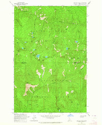 1963 Mallard Peak1964 Print · USGSThe high Idaho backcountry during the early 1960s is mapped here at the intersection of two national forests. Trace the remote ridgelines and alpine basins once monitored from Mallard Peak Lookout and Black Mtn Lookout, or locate seasonal trails like the Boundary Forest Trail.4 unique versions available
 - 1963 Map of Sheep Mtn, 1964 Print
 1963 Sheep Mtn1964 Print · USGSThe North Fork Clearwater River corridor in the early 1960s serves as a hub for Forest Service activity and remote mountain navigation. Researchers can trace the mid-century infrastructure of the Clearwater National Forest through the Canyon Ranger Station, Heliport, and the lookout at Eagle Point.3 unique versions available
 - 1963 Map of Buzzard Roost, 1964 Print
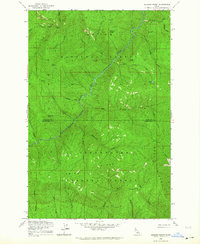 1963 Buzzard Roost1964 Print · USGSShoshone and Clearwater counties meet in this high backcountry during the early 1960s, where the river and national forests define the landscape. Researchers can locate remote landmarks like Chicadee Cabin, trace the Goat Ridge peaks, and follow Little North Fork Clearwater River.2 unique versions available
 - 1963 Map of Pole Mtn, 1964 Print
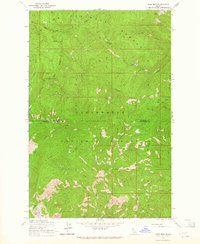 1963 Pole Mtn1964 Print · USGSThe high Idaho backcountry comes into focus during the early sixties, showing the wild intersection of Shoshone and Clearwater counties. Trace old routes along a Pack Trail or locate remote alpine waters such as Cliff Lake and Steve Lake.3 unique versions available
 - 1963 Map of The Nub, 1964 Print
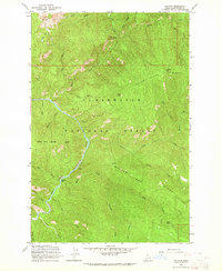 1963 The Nub1964 Print · USGSThe North Fork of the Clearwater River cuts through the Idaho backcountry during the early sixties. Researchers can locate remote landmarks like Collins Creek Cabin, the Wallow Mtn Lookout, and the riverside site of Moscow Bar.2 unique versions available
 - 1963 Map of Clarke Mtn, 1964 Print
 1963 Clarke Mtn1964 Print · USGSThe North Fork of the Clearwater River was the primary corridor through this Idaho backcountry during the early 1960s. Researchers can trace the legacy of forest management at Bungalow Ranger Sta and follow the route of the Old RR Grade or the Dead Mule Trail.2 unique versions available
 - 1963 Map of Elizabeth Lake, 1964 Print
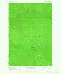 1963 Elizabeth Lake1964 Print · USGSClearwater National Forest in the early sixties remains a remote wilderness of high ridges and glacial basins. Researchers can trace the drainage of Henry Ridge and locate isolated landmarks like Cold Springs Peak, Mush Saddle, and Elizabeth Lake.2 unique versions available
 - 1963 Map of Bacon Peak, 1964 Print
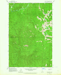 1963 Bacon Peak1964 Print · USGSShoshone and Clearwater Counties are shown here during the early sixties, documenting a high-elevation wilderness split by two National Forests. Researchers can trace the rugged drainages of the St Joe River and find landmarks like Bacon Peak and Five Lakes Butte.4 unique versions available
Showing maps 1-25 of 512
Top cities of Clearwater County
Frequently asked questions
- What are the different types of historical maps available for Clearwater County?
- What is the oldest map of Clearwater County?
- Where can I purchase historical maps of Clearwater County for my home or office?
- Where can I download high-res historical maps of Clearwater County?
- Are there historical topographic maps available for Clearwater County?
- Is there historical aerial imagery available for Clearwater County?
- Where are historical maps of Clearwater County sourced from?