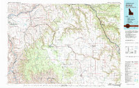
1980s Maps of Clearwater County, Idaho
Explore 17 historic maps of Clearwater County from the 1980s. These maps offer a rare glimpse into what life looked like during the 1980s — showing old roads, neighborhoods, homes, and landmarks that have changed or disappeared over time.
Whether you're researching your family's past, planning a metal detecting trip, or studying how Clearwater County's landscape evolved across the 1980s, these high-resolution maps are a powerful tool for exploring the history of this region.
- Focus on a specific era: All maps on this page are from the 1980s, giving you a focused view of this time period.
- See what’s changed: Compare century-old streets, trails, and buildings to today's modern landscape using overlays and satellite layers.
- Research with precision: Use these maps for genealogy, historical research, land use analysis, or educational projects.
- View, download, or print: Maps are fully viewable online in high resolution, and can be downloaded or printed for your own records.
Start exploring Clearwater County's history through authentic maps from the 1980s. This is your window into the past.
Clearwater County, ID maps
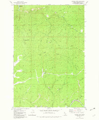
(17)- 1981 Map of Little Goat Mountains
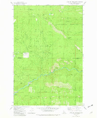 1981 Little Goat Mountains1981 Print · USGSShoshone and Clearwater counties met in these high timberlands during the early eighties, where the national forest boundaries intersect. Researchers can trace remote mountain geography through named sites like Blue Heaven Cabin, Clugs Jumpoff, and Morris Saddle.3 unique versions available
 - 1981 Map of Missoula West
 1981 Missoula West1981 Print · USGSThe Bitterroot Valley and the rugged Bitterroot Range are captured here in the early 1980s, documenting the expansion of Missoula and its outlying timber and river towns. Researchers can trace the Burlington Northern rail corridors or locate remote landmarks like Lolo Hot Springs and Lolo Pass.2 unique versions available
 - 1981 Map of Kooskia
 1981 Kooskia1981 Print · USGSNorthern Idaho in the early eighties shows a landscape of deep river canyons and high forest ridges. Researchers can locate remote mining sites like Hemlock Mine, the mountain settlement of Lowell, and the Kooskia National Fish Hatchery.
 - 1981 Map of Orofino, 1982 Print
 1981 Orofino1982 Print · USGSNorth central Idaho comes into focus in the early eighties, showing the deep river canyons and agricultural plateaus of the Nez Perce Indian Reservation. Genealogists and historians can trace the Camas Prairie rail line through rural hubs like Ferdinand, Mohler, and Reubens.
 - 1981 Map of Pinchot Butte, 1982 Print
 1981 Pinchot Butte1982 Print · USGSThe timberlands and river canyons of northern Idaho are captured here in the early eighties, showcasing the intersection of the St Joe National Forest and the Clearwater drainage. Researchers can locate remote sites like the Mary Mix Cabin (Site), trace the shores of Dworshak Reservoir, and identify landmarks like Hershey Bar.2 unique versions available
 - 1981 Map of Whiskey Butte, 1982 Print
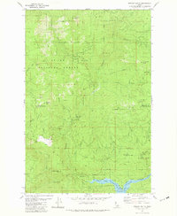
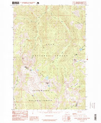
 1981 Whiskey Butte1982 Print · USGSClearwater County's timber and mining country is captured here during the 1970s, showcasing a landscape shaped by resource extraction and rugged terrain. Researchers can locate remote sites like Porters Camp, trace old Dredge Tailings along Orofino Creek, and find the Democrat Mine.2 unique versions available
 - 1981 Map of Headquarters, 1982 Print
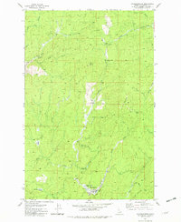 1981 Headquarters1982 Print · USGSThe timber country of Clearwater County is captured here in the early eighties, centered on the logging community of Headquarters. Researchers can trace the legacy of regional transport through the Old Railroad Grade and the Harley Creek Scout Camp.2 unique versions available
 - 1981 Map of Township Butte, 1982 Print
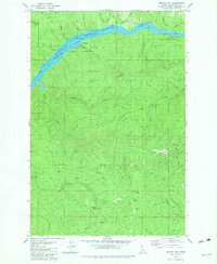
 1981 Township Butte1982 Print · USGSThe Idaho backcountry in the early 1980s is captured here as the Dworshak Reservoir fills the canyons of the Clearwater. Researchers can trace the winding Burma Road, locate the Camp X site, and find forest landmarks like the Lookout Tower and Grandad Bridge.2 unique versions available
 - 1981 Map of Bertha Hill, 1982 Print
 1981 Bertha Hill1982 Print · USGSClearwater County's backcountry is captured here in the early eighties as the reservoir system shaped the local landscape. Genealogists and historians can locate remote landmarks like Bertha Hill, the Benton Butte Lookout Tower, and the site at Camp 11.2 unique versions available
 - 1981 Map of Potlatch, 1982 Print
 1981 Potlatch1982 Print · USGSLatah County and the northern Nez Perce Reservation are shown here in the early 1980s, documenting the rail-and-river network of the Idaho panhandle. Researchers can trace historic transport lines like the Burlington Northern and find remote landmarks such as the Gold Hill Mine and Potato Hill.2 unique versions available
 - 1981 Map of Jaype, 1982 Print
 1981 Jaype1982 Print · USGSClearwater County's timber and transit corridor is captured here in the early 1980s, centered on the mill town of Jaype. Genealogists and historians can locate vanished points like Townsite Four, Hollywood, and the railway siding at Cardiff Spur.2 unique versions available
 - 1981 Map of John Lewis, 1982 Print
 1981 John Lewis1982 Print · USGSClearwater County in the early eighties shows a rugged landscape shaped by the Clearwater Reservoir and timber-related infrastructure. Trace the locations of Old Camp B, the remote Landing Strip, and high-country landmarks like Bear Butte.2 unique versions available
 - 1982 Map of Headquarters, 1983 Print
 1982 Headquarters1983 Print · USGSClearwater County's timber and mining country is captured here in the early 1980s, centered on the company town of Headquarters and the historic gold-rush area of Pierce. Genealogists and researchers can trace remote settlements and work sites like Hollywood, New Boehls, and the Oxford Mine.
 - 1984 Map of Orofino West, 1985 Print
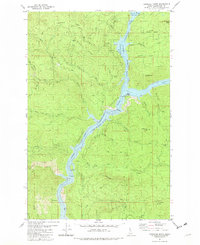
 1984 Orofino West1985 Print · USGSThe Clearwater River valley and its surrounding plateaus are captured here in the mid-1980s, documenting the interface between tribal lands and regional infrastructure. Genealogists can trace family sites at Riverside Cem or Central Ridge Cem, while historians can locate the Russell (Site) and Gilbert Ch.
 - 1985 Map of Straight Peak
 1985 Straight Peak1985 Print · USGSThe Montana-Idaho border comes alive in the mid-1980s, documenting the high-country divide within the Lolo National Forest. Trace the remote watersheds of the Bitterroot range, from the heights of Straight Peak to the waters of Trio Lakes and Heart Lake.
 - 1985 Map of Bruin Hill
 1985 Bruin Hill1985 Print · USGSThe Bitterroot Range divide comes into focus in the mid-1980s, documenting the rugged boundary between Idaho and Montana. Track remote mountain routes through Chilcoot Pass or locate high-country water bodies like Siamese Lakes and Fish Lake.
 - 1985 Map of Schley Mountain
 1985 Schley Mountain1985 Print · USGSThe Montana-Idaho border comes alive in this mid-eighties survey of the high Bitterroots, where the Lolo National Forest and Clearwater National Forest meet. Trace the ridgelines between Schley Mountain, Admiral Peak, and high alpine waters like Surveyor Lake.2 unique versions available
End of results
Showing maps 1-17 of 17
Top cities of Clearwater County
Frequently asked questions
- What are the different types of historical maps available for Clearwater County?
- What is the oldest map of Clearwater County?
- Where can I purchase historical maps of Clearwater County for my home or office?
- Where can I download high-res historical maps of Clearwater County?
- Are there historical topographic maps available for Clearwater County?
- Is there historical aerial imagery available for Clearwater County?
- Where are historical maps of Clearwater County sourced from?