Old Maps of Ashton, Idaho
Explore 10 old maps of Ashton, spanning from 1955 to today. These high-resolution historic maps reveal how streets, neighborhoods, landmarks, and natural features evolved over time — perfect for genealogy, metal detecting, research, and local history exploration.
What you can do with these maps:
- See how Ashton changed over time: Compare historical maps to modern-day views to trace roads, homesites, rail lines & more.
- View detailed metadata: Each map includes creators, publishers, year, scale, and archive source.
- Overlay maps with satellite & LiDAR: Visualize the past alongside modern tools to explore terrain & human change.
- Trusted historical sources: Maps sourced from the USGS, Library of Congress, and other archives.
- Access maps your way: View online, download high-res files, or order prints for personal or research use.
Start exploring old maps of Ashton to uncover forgotten places, hidden landmarks, and the deep history beneath your feet.
Ashton, ID maps
(10)- 1955 Map of Ashton, 1967 Print
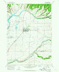
 1955 Ashton1967 Print · USGSThe Greater Yellowstone ecosystem is captured here during the mid-1950s, showing the high plateaus and remote gateway towns of Idaho and Montana. Researchers can trace the Union Pacific line to Ashton or locate small settlements like Squirrel and Grainville.4 unique versions available
 - 1958 Map of Ashton
 1958 Ashton1958 Print · USGSGreater Yellowstone and the eastern Idaho borderlands appear here in the mid-1950s as rail and road networks connected remote mountain basins. Trace the Union Pacific route through Ashton or locate early outposts like Last Chance, Squirrel, and West Yellowstone.
 - 1960 Map of Ashton
 1960 Ashton1960 Print · USGSThe Idaho-Montana-Wyoming borderlands at the dawn of the sixties show a landscape defined by the Continental Divide and early wilderness tourism. Genealogists and historians can trace rail-stop settlements like Trude Siding, old outposts like Warm River, and early lodging at Snowball Inn.
 - 1965 Map of Ashton, 1967 Print
 1965 Ashton1967 Print · USGSAshton and Marysville serve as the focal points of this Idaho agricultural landscape during the mid-sixties. Researchers can trace the complex irrigation network of the Farmers Own Canal or locate local landmarks like the Ashton Fish Hatchery and Ashton Dam.3 unique versions available
 - 1989 Map of Ashton
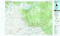 1989 Ashton1989 Print · USGSEastern Idaho at the end of the 1980s is captured here as a landscape of river-fed agriculture and high-altitude wilderness. Researchers can trace the Union Pacific line through Ashton and find old settlements like Kilgore and Idmon near the Targhee National Forest border.2 unique versions available
 - 2011 Map of Ashton, 2011 Print
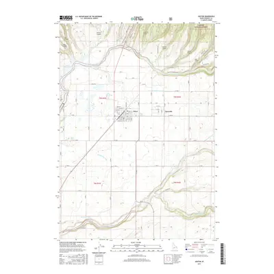
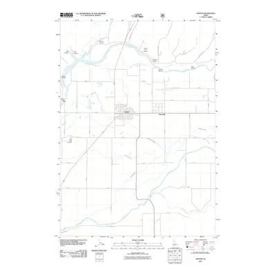 2011 Ashton2011 Print · USGSCovers Ashton, including Fremont County, United States, and other nearby areas
 - 2013 Map of Ashton, 2013 Print
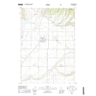
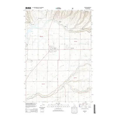 2013 Ashton2013 Print · USGSCovers Ashton, including Fremont County, United States, and other nearby areas
 - 2017 Map of Ashton, 2017 Print
 2017 Ashton2017 Print · USGSCovers Ashton, including Fremont County, United States, and other nearby areas
 - 2020 Map of Ashton, 2020 Print
 2020 Ashton2020 Print · USGSCovers Ashton, including Fremont County, United States, and other nearby areas
 - 2024 Map of Ashton, 2024 Print
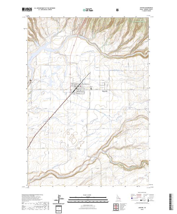 2024 Ashton2024 Print · USGSModern Fremont County agricultural life meets the wild canyons of the forest boundary in this contemporary survey of the Ashton area. Genealogists and historians can trace irrigation networks like the Marysville Canal and locate the local Cem near Pineview.
End of results
Showing maps 1-10 of 10
Top cities near Ashton
Frequently asked questions
- What are the different types of historical maps available for Ashton?
- What is the oldest map of Ashton?
- Where can I purchase historical maps of Ashton for my home or office?
- Where can I download high-res historical maps of Ashton?
- Are there historical topographic maps available for Ashton?
- Is there historical aerial imagery available for Ashton?
- Where are historical maps of Ashton sourced from?