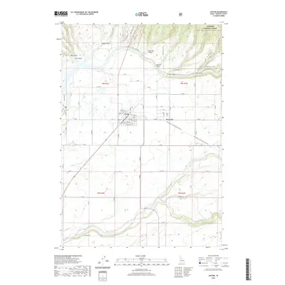
2020 Map of Ashton
USGS Topo · Published 2020About this map
Ashton serves as the central hub of this agricultural and canyon landscape, where the street grid includes family-named routes such as Idaho St and Main St. The town sits at a geographic crossroads, marked by the prominent Yellowstone / Grand Teton Rail Trail which traces the former path of the railroad through the region toward the nearby Targee National Forest. To the south, the settlement of Marysville is closely tied to an intricate network of irrigation infrastructure, including the Marysville Canal and the N Lateral Marysville Canal, which divert water to sustain the surrounding plains.
Find a feature on this map
45 named features on this map. Tap any name to fly to it.
Don’t see what you’re looking for? This feature index may not catch every label — zoom into the map to look around manually.
Map Details
Editions of this 2020 Ashton Map
This is the sole edition of this map. No revisions or reprints were ever made.
Other maps of this area

1949 · Newdale
USGS Topo · 1:24,000

1950 · Newdale
USGS Topo · 1:24,000

1955 · Ashton
USGS Topo · 1:250,000

1955 · Driggs
USGS Topo · 1:250,000

1958 · Driggs
USGS Topo · 1:250,000

1958 · Ashton
USGS Topo · 1:250,000

1960 · Ashton
USGS Topo · 1:250,000

1962 · Driggs
USGS Topo · 1:250,000

1965 · Lemon Lake
USGS Topo · 1:24,000

1965 · Ashton
USGS Topo · 1:24,000