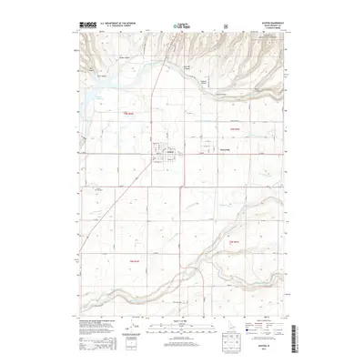
2013 Map of Ashton
USGS Topo · Published 2013About this map
Ashton serves as the focal point of this Eastern Idaho landscape, situated just west of the Marysville community near the edge of the Targhee National Forest. The area is defined by its complex irrigation network, where the Farmers Own Canal, Marysville Canal, and N Lateral Marysville Canal distribute water across the high plains. Significant topographic relief is found along the northern and southern borders, where the Henrys Fork and Fall River carve through deep canyons such as Box Canyon and Strong Canyon. The presence of the Ashton Fish Hatchery and the Ashton Reservoir underscores the importance of local water management and fishery resources. This survey illustrates the intersection of agricultural infrastructure and the natural drainage systems of the Upper Snake River Valley.
Find a feature on this map
56 named features on this map. Tap any name to fly to it.
Don’t see what you’re looking for? This feature index may not catch every label — zoom into the map to look around manually.
Map Details
Editions of this 2013 Ashton Map
This is the sole edition of this map. No revisions or reprints were ever made.
Other maps of this area

1949 · Newdale
USGS Topo · 1:24,000

1950 · Newdale
USGS Topo · 1:24,000

1955 · Ashton
USGS Topo · 1:250,000

1955 · Driggs
USGS Topo · 1:250,000

1958 · Driggs
USGS Topo · 1:250,000

1958 · Ashton
USGS Topo · 1:250,000

1960 · Ashton
USGS Topo · 1:250,000

1962 · Driggs
USGS Topo · 1:250,000

1965 · Lemon Lake
USGS Topo · 1:24,000

1965 · Ashton
USGS Topo · 1:24,000