1900s (20th Century) Maps of Bassett, Idaho
Explore 6 historic maps of Bassett from the 1900s (20th Century). These maps offer a rare glimpse into what life looked like during the 1900s — showing old roads, neighborhoods, homes, and landmarks that have changed or disappeared over time.
Whether you're researching your family's past, planning a metal detecting trip, or studying how Bassett's landscape evolved across the 1900s, these high-resolution maps are a powerful tool for exploring the history of this region.
- Focus on a specific era: All maps on this page are from the 1900s, giving you a focused view of this time period.
- See what’s changed: Compare century-old streets, trails, and buildings to today's modern landscape using overlays and satellite layers.
- Research with precision: Use these maps for genealogy, historical research, land use analysis, or educational projects.
- View, download, or print: Maps are fully viewable online in high resolution, and can be downloaded or printed for your own records.
Start exploring Bassett's history through authentic maps from the 1900s. This is your window into the past.
Bassett, ID maps
(6)- 1948 Map of Lewisville, 1959 Print
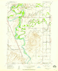 1948 Lewisville1959 Print · USGSSoutheastern Idaho's agricultural heartland is captured here in the late 1940s, showing a complex web of canals and riverfront settlements. Researchers can trace family roots through the Lewisville Cemetery, Midway High Sch, and the rail stops at Roberts and Bassett.3 unique versions available
 - 1949 Map of Lewisville
 1949 Lewisville1949 Print · USGSEastern Idaho's irrigation and rail networks are expertly detailed here in the late 1940s as the Snake River valley prospered. Genealogists and local historians can trace the foundations of Lewisville, locate the Central Cem, and find rural landmarks like Grant School.
 - 1949 Map of Roberts, 1959 Print
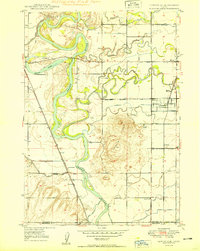
 1949 Roberts1959 Print · USGSThe Upper Snake River Plain comes alive in the late 1940s, showing a landscape defined by industrial irrigation and rail-side settlements. Genealogists and historians can trace the foundations of local communities at Lewisville Cem, Grant Sch, and Oakland Valley.
 - 1955 Map of Idaho Falls, 1963 Print
 1955 Idaho Falls1963 Print · USGSThe Snake River Plain and its surrounding volcanic peaks are captured in the late fifties, showing the region's unique mix of nuclear research and high-desert ranching. Trace the industrial footprint of the National Reactor Testing Station or find old mining sites like Empire Mine.5 unique versions available
 - 1958 Map of Idaho Falls
 1958 Idaho Falls1958 Print · USGSEastern Idaho in the late fifties showcases the rapid expansion of agricultural and scientific outposts across its volcanic plains. Researchers can locate remote sites like Atomic City, mineral interests at White Knob Mine, and the cultural grounds of St Marys Mission.2 unique versions available
 - 1980 Map of Circular Butte
 1980 Circular Butte1980 Print · USGSEastern Idaho at the start of the eighties shows a landscape of federal research and agricultural expansion. Trace the growth of nuclear history at the Idaho National Engineering Laboratory and early settlements like Monteview, Terreton, and Sage Junction.
End of results
Showing maps 1-6 of 6
Top cities near Bassett
- Idaho Falls historical maps
- Ammon historical maps
- Rigby historical maps
- Iona historical maps
- Ucon historical maps
- Menan historical maps
See more
Frequently asked questions
- What are the different types of historical maps available for Bassett?
- What is the oldest map of Bassett?
- Where can I purchase historical maps of Bassett for my home or office?
- Where can I download high-res historical maps of Bassett?
- Are there historical topographic maps available for Bassett?
- Is there historical aerial imagery available for Bassett?
- Where are historical maps of Bassett sourced from?