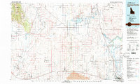
1980 Map of Circular Butte
USGS Topo · Published 1980About this map
The Idaho National Engineering Laboratory dominates the western half of this 1980 survey, illustrating the significant federal footprint in the Snake River Plain. This vast research area includes specialized sites like the US Naval Reactors Facility, the Central Facilities Area, and the Auxiliary Reactor Area. To the east, the landscape transitions toward the volcanic geology of the region, featuring prominent landmarks such as Circular Butte, Kettle Butte, and a large expanse of Lava flows. The agricultural and hydraulic development of the valley is evident through the network of the Market Lake Canal and the presence of the Snake River near the emerging urban center of Idaho Falls. Significant conservation areas, including the Camas National Wildlife Refuge and North Lake within a State Wildlife Management Area, provide a stark contrast to the nearby high-tech engineering facilities and the rugged Lemhi Range on the northwestern horizon.
Find a feature on this map
72 named features on this map. Tap any name to fly to it.
Don’t see what you’re looking for? This feature index may not catch every label — zoom into the map to look around manually.
Map Details
Editions of this 1980 Circular Butte Map
This is the sole edition of this map. No revisions or reprints were ever made.
Other maps of this area

1924 · Ammon
USGS Topo · 1:62,500

1948 · Woodville
USGS Topo · 1:24,000

1948 · Rigby
USGS Topo · 1:24,000

1948 · Lewisville
USGS Topo · 1:24,000

1948 · Idaho Falls North
USGS Topo · 1:24,000

1948 · Idaho Falls South
USGS Topo · 1:24,000

1948 · Ucon
USGS Topo · 1:24,000

1949 · Ucon
USGS Topo · 1:24,000

1949 · Idaho Falls North
USGS Topo · 1:24,000

1949 · Rigby
USGS Topo · 1:24,000