Old Maps of Bayview, Idaho for Academic Research
Study the evolution of Bayview with 13 high-resolution historic maps. Whether you're teaching, researching, or modeling changes in land use, these maps provide essential visual documentation of urban, environmental, and geographic change.
- Analyze long-term change: Track patterns in development, transportation, and natural features.
- Ideal for environmental or urban studies: Support academic projects with primary historical map data.
- Use in the classroom or lab: Educators and researchers rely on these maps to bring historical context to life.
These maps are a powerful tool for teaching, research, and visualizing how Bayview has changed over the decades.
Bayview, ID maps
(13)- 1903 Map of Rathdrum
 1903 Rathdrum1903 Print · USGSNorthern Idaho's transition from frontier outposts to a rail-and-timber economy is visible here just after the turn of the century. Researchers can trace the early layout of Rathdrum, locate Fort Sherman, and follow the Leiberg Trail through the mountains.4 unique versions available
 - 1955 Map of Spokane, 1965 Print
 1955 Spokane1965 Print · USGSInland Empire life in the fifties and sixties centers on the growth of Spokane and the heavy mining industry of northern Idaho. Trace mid-century landmarks like Fairchild Air Force Base, the Bunker Hill Mine, and early campuses such as Gonzaga University.2 unique versions available
 - 1958 Map of Spokane
 1958 Spokane1958 Print · USGSThe Inland Empire is shown at a mid-century peak of industrial and military activity, from the rail hubs of Spokane to the deep silver mines of northern Idaho. Researchers can trace the sprawling rail lines of the Union Pacific RR or locate landmarks like Fairchild Air Force Base and the Bunker Hill Smelter & Mine.
 - 1961 Map of Bayview, 1962 Print
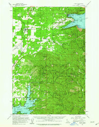
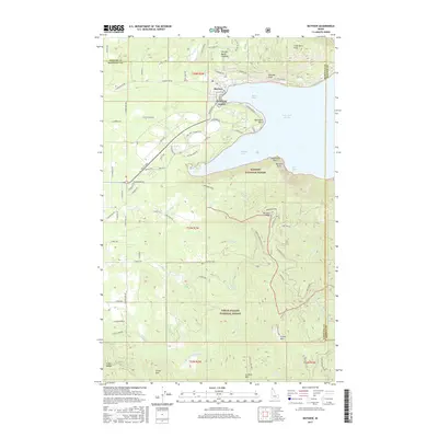
 1961 Bayview1962 Print · USGSThe northern tip of Lake Pend Oreille meets the Idaho panhandle's deep forests in the early sixties. Researchers can trace the military history of the Naval Reservation near Bayview or locate remote landmarks like The Old Maids Clearing and Bunco Corners.
 - 1961 Map of Athol, 1963 Print
 1961 Athol1963 Print · USGSNorthern Idaho in the early sixties showcases the intersection of federal forest lands and lakeside settlements. Genealogists and researchers can trace local family landmarks like Mountain View Cem, the Cedar Mtn Sch, and numerous mountain sites including the Shamrock Mine.3 unique versions available
 - 1967 Map of Bayview
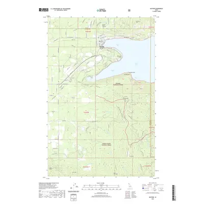
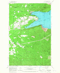 1967 Bayview1967 Print · USGSThe southern tip of Lake Pend Oreille comes alive in the 1960s as a hub for both naval research and public recreation at the edge of the Idaho panhandle. Researchers can trace the military footprint at the Naval Reservation or locate early settlements like Bunco Corners and Lewellen.3 unique versions available
 - 1987 Map of Coeur D'Alene
 1987 Coeur D'Alene1987 Print · USGSNorthern Idaho in the late eighties shows a landscape of deep-water lakes and heavy industry where the timber and mining economies meet growing valley settlements. Genealogists and historians can trace the footprints of the Sunshine Mine, the rail sidings at Corbin Junction, and the historic Old Mission State Park.3 unique versions available
 - 1996 Map of Bayview, 1999 Print
 1996 Bayview1999 Print · USGSThe Kootenai County shoreline of Lake Pend Oreille was a site of significant military research and recreation in the mid-1990s. Researchers can locate the Naval Reservation and its Naval Laboratory alongside the mountain settlements of Bunco Corners and Bayview.
 - 2011 Map of Bayview, 2011 Print
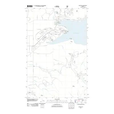 2011 Bayview2011 Print · USGSCovers Bayview, including Kootenai County, Bonner County, and other nearby areas
 - 2013 Map of Bayview, 2013 Print
 2013 Bayview2013 Print · USGSCovers Bayview, including Kootenai County, Bonner County, and other nearby areas
 - 2017 Map of Bayview, 2017 Print
 2017 Bayview2017 Print · USGSCovers Bayview, including Kootenai County, Bonner County, and other nearby areas
 - 2020 Map of Bayview, 2020 Print
 2020 Bayview2020 Print · USGSCovers Bayview, including Kootenai County, Bonner County, and other nearby areas
 - 2024 Map of Bayview, 2024 Print
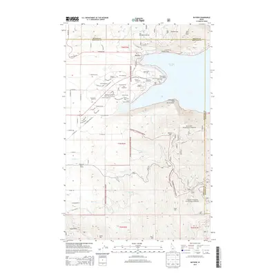
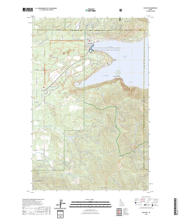 2024 Bayview2024 Print · USGSThe southern tip of Lake Pend Oreille meets the high peaks of the Idaho panhandle in this modern survey of the Bayview area. Researchers can trace the perimeter of the Naval Surface Warfare Center and locate remote landmarks like The Old Maids Clearing or Cedar Saddle.
End of results
Showing maps 1-13 of 13
Top cities near Bayview
Frequently asked questions
- What are the different types of historical maps available for Bayview?
- What is the oldest map of Bayview?
- Where can I purchase historical maps of Bayview for my home or office?
- Where can I download high-res historical maps of Bayview?
- Are there historical topographic maps available for Bayview?
- Is there historical aerial imagery available for Bayview?
- Where are historical maps of Bayview sourced from?