Old Maps of Mica, Idaho for Hiking & Exploration
Hike through history with 13 historic maps of Mica. Explore old trails, ghost towns, and forgotten backroads — perfect for outdoor adventurers and local explorers.
- Rediscover forgotten places: Map out old mining camps, roads, and footpaths that no longer exist on modern maps.
- Layer with modern tools: Combine with LiDAR or satellite views to plan hikes through historical terrain.
- Made for exploration: Popular among hikers, overlanders, and local history lovers.
Use these maps to find adventure and explore the hidden past of Mica.
Mica, ID maps
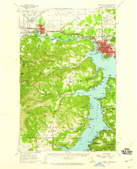
(13)- 1903 Map of Rathdrum
 1903 Rathdrum1903 Print · USGSNorthern Idaho's transition from frontier outposts to a rail-and-timber economy is visible here just after the turn of the century. Researchers can trace the early layout of Rathdrum, locate Fort Sherman, and follow the Leiberg Trail through the mountains.4 unique versions available
 - 1955 Map of Spokane, 1965 Print
 1955 Spokane1965 Print · USGSInland Empire life in the fifties and sixties centers on the growth of Spokane and the heavy mining industry of northern Idaho. Trace mid-century landmarks like Fairchild Air Force Base, the Bunker Hill Mine, and early campuses such as Gonzaga University.2 unique versions available
 - 1957 Map of Coeur D'Alene, 1959 Print
 1957 Coeur D'Alene1959 Print · USGSCoeur d'Alene and the Spokane River are captured here in the late fifties, showing a bustling landscape of timber mills and rail junctions. Researchers can trace the lines of the Great Northern railroad through Grand Junction or locate family sites near Evergreen Cemetery and Cloverleaf Grange.2 unique versions available
 - 1958 Map of Spokane
 1958 Spokane1958 Print · USGSThe Inland Empire is shown at a mid-century peak of industrial and military activity, from the rail hubs of Spokane to the deep silver mines of northern Idaho. Researchers can trace the sprawling rail lines of the Union Pacific RR or locate landmarks like Fairchild Air Force Base and the Bunker Hill Smelter & Mine.
 - 1975 Map of Coeur D'Alene SE, 1977 Print
 1975 Coeur D'Alene SE1977 Print · USGSThe Idaho panhandle's shoreline and timbered ridges are captured in high detail during the mid-seventies. Trace the 1975 development of the lakefront and local drainage patterns near Mica Bay, Coeur D'Alene Lake, and Carlin Creek.
 - 1981 Map of Mica Bay, 1982 Print
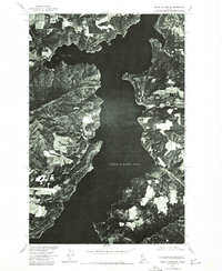
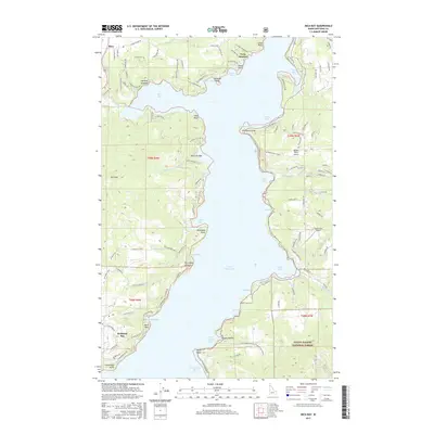
 1981 Mica Bay1982 Print · USGSThe western shores of Coeur d'Alene Lake are shown here in the early eighties, where recreation and tribal lands meet. Researchers can trace the development of Mica, locate old landing sites like Goulds Landing, and follow the Coeur d'Alene Indian Reservation Boundary.
 - 1987 Map of Coeur D'Alene
 1987 Coeur D'Alene1987 Print · USGSNorthern Idaho in the late eighties shows a landscape of deep-water lakes and heavy industry where the timber and mining economies meet growing valley settlements. Genealogists and historians can trace the footprints of the Sunshine Mine, the rail sidings at Corbin Junction, and the historic Old Mission State Park.3 unique versions available
 - 1996 Map of Mica Bay, 1999 Print
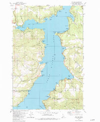
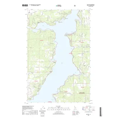
 1996 Mica Bay1999 Print · USGSCoeur d'Alene Lake and its surrounding hills show a landscape of conservation and recreation in the mid-1990s. Researchers can trace land boundaries at the Coeur d'Alene Indian Reservation or locate landmarks like Camp Easton and Goulds Landing.
 - 2011 Map of Mica Bay, 2011 Print
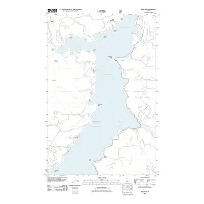 2011 Mica Bay2011 Print · USGSCovers Mica, including Twin Beaches, Len Landing, and other nearby areas
 - 2013 Map of Mica Bay, 2013 Print
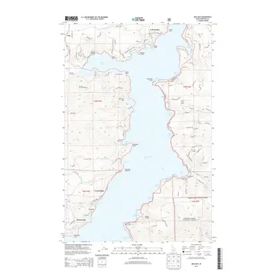 2013 Mica Bay2013 Print · USGSCovers Mica, including Twin Beaches, Len Landing, and other nearby areas
 - 2017 Map of Mica Bay, 2017 Print
 2017 Mica Bay2017 Print · USGSCovers Mica, including Twin Beaches, Len Landing, and other nearby areas
 - 2020 Map of Mica Bay, 2020 Print
 2020 Mica Bay2020 Print · USGSCovers Mica, including Twin Beaches, Len Landing, and other nearby areas
 - 2024 Map of Mica Bay, 2024 Print
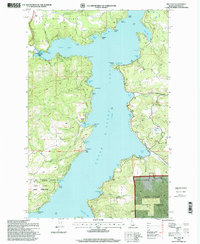
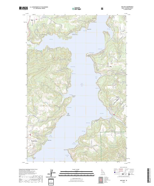 2024 Mica Bay2024 Print · USGSThe western shores of Coeur d'Alene Lake are shown in detail during the early 2020s, featuring the developed coves and mountain foothills. Trace local landings and small airstrips like Lyndale Landing, Pischl's Place Airport, and Carlin Bay Airport.
End of results
Showing maps 1-13 of 13
Top cities near Mica
- Coeur d'Alene historical maps
- Post Falls historical maps
- Hayden historical maps
- Liberty Lake historical maps
- Rathdrum historical maps
- Dalton Gardens historical maps
See more
Frequently asked questions
- What are the different types of historical maps available for Mica?
- What is the oldest map of Mica?
- Where can I purchase historical maps of Mica for my home or office?
- Where can I download high-res historical maps of Mica?
- Are there historical topographic maps available for Mica?
- Is there historical aerial imagery available for Mica?
- Where are historical maps of Mica sourced from?