1960s Maps of Lemhi County, Idaho
Explore 56 historic maps of Lemhi County from the 1960s. These maps offer a rare glimpse into what life looked like during the 1960s — showing old roads, neighborhoods, homes, and landmarks that have changed or disappeared over time.
Whether you're researching your family's past, planning a metal detecting trip, or studying how Lemhi County's landscape evolved across the 1960s, these high-resolution maps are a powerful tool for exploring the history of this region.
- Focus on a specific era: All maps on this page are from the 1960s, giving you a focused view of this time period.
- See what’s changed: Compare century-old streets, trails, and buildings to today's modern landscape using overlays and satellite layers.
- Research with precision: Use these maps for genealogy, historical research, land use analysis, or educational projects.
- View, download, or print: Maps are fully viewable online in high resolution, and can be downloaded or printed for your own records.
Start exploring Lemhi County's history through authentic maps from the 1960s. This is your window into the past.
Lemhi County, ID maps
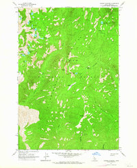
(56)- 1960 Map of Elk City
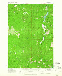
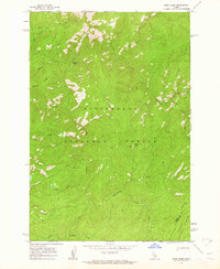
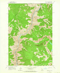
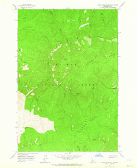
 1960 Elk City1960 Print · USGSThe Central Idaho wilderness and Bitterroot Range are captured here during the peak of mid-century industrial mining. Researchers can trace remote backcountry settlements like Burgdorf and Warren, alongside major mineral sites including the Blackbird Mine and Ima Mine.2 unique versions available
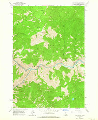
 - 1960 Map of Challis
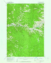
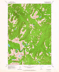
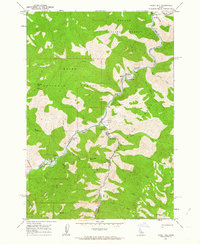
 1960 Challis1960 Print · USGSCentral Idaho’s high backcountry is detailed here in the early sixties, showing the remote ranching and mining life across five national forests. Genealogists and researchers can trace family holdings at the Silva Ranch or Jones Ranch and find historic sites like Redfish Lake Lodge and Clayton.
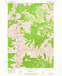
 - 1960 Map of Painted Rocks Lake, 1961 Print
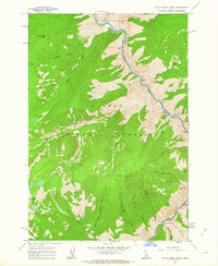
 1960 Painted Rocks Lake1961 Print · USGSThe Bitterroot mountains of western Montana are documented here in the early sixties, showing the remote canyon lands at the state border. Trace historic mountain routes like the Nez Perce Trail and locate the Copper Queen Mine or the settlement at Alta.3 unique versions available
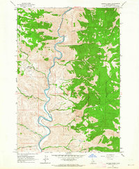
 - 1960 Map of Ulysses Mtn, 1962 Print
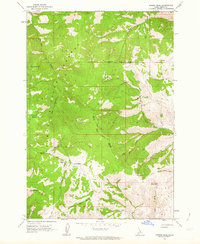
 1960 Ulysses Mtn1962 Print · USGSThe Salmon River corridor in the early sixties remained a landscape of isolated mines and Forest Service outposts. Researchers can locate the Ulysses Mine, trace old trails to Stormy Peak, and identify the settlement at Ulysses near the Indianola Ranger Station.3 unique versions available
 - 1960 Map of Shoup, 1962 Print
 1960 Shoup1962 Print · USGSThe Salmon River canyon and the Bitterroot Mountains come into focus in the early 1960s, showing a landscape defined by deep-vein mining and forest lookouts. Researchers can trace historic claims like the Kentucky Mine and Gold Hill Mine or locate the site of Reed Ranch.2 unique versions available
 - 1960 Map of Piquett Mountain, 1962 Print
 1960 Piquett Mountain1962 Print · USGSThe high Bitterroot divide during the early sixties shows a landscape of mountain lookouts and remote mining camps. Genealogists and historians can locate isolated sites like Henderson Cabin, Emmett, and the Open Pit Mine near Hughes.3 unique versions available
 - 1962 Map of Dillon
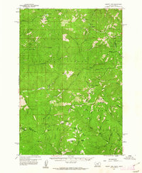
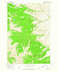
 1962 Dillon1962 Print · USGSSouthwest Montana in the early sixties is defined by its high mountain ranges and the winding rivers that carved its settlement patterns. Trace the rail routes of the Union Pacific through Dillon or locate mining activity near Butte and Argenta.
 - 1962 Map of Wood Hump, 1963 Print
 1962 Wood Hump1963 Print · USGSThe high Bitterroot range is captured here in the early sixties, showing the rugged divide between Idaho and Lemhi counties. Researchers can trace the drainage of the Selway River and locate remote landmarks like the Wood Hump Lookout and Thompson Flat.2 unique versions available
 - 1962 Map of Blue Joint, 1963 Print
 1962 Blue Joint1963 Print · USGSThe Idaho-Montana borderlands are captured here in the early sixties, where three counties and two national forests meet. Outdoor historians and researchers can trace trails to Surprise Creek Camp, the high waters of Line Lake, and the summit of Squaw Peak.2 unique versions available
 - 1962 Map of Allison Creek, 1963 Print
 1962 Allison Creek1963 Print · USGSThe Salmon River corridor in Idaho's Lemhi County is captured here in the early sixties, showing a landscape defined by its high ridges and mountain drainages. Researchers can trace early resource activity through several prospects, a Gravel Pit, and the network of jeep trails crossing McKim Creek.3 unique versions available
 - 1962 Map of Bear Creek Point, 1963 Print
 1962 Bear Creek Point1963 Print · USGSThe Idaho wilderness in the early sixties is documented here as a vast network of protected lands and river drainages. Trace the boundary between the Salmon National Forest and Boise National Forest or follow the path of Sheep Creek and the Middle Fk Salmon R.2 unique versions available
 - 1962 Map of Square Top, 1964 Print
 1962 Square Top1964 Print · USGSThe Salmon River canyon in the early 1960s was a remote landscape of national forest wilderness and fire lookouts. You can trace early forestry access and river navigation via the Skunk Camp Lookout Tower, Horse Creek Bridge, and various Rapids along the water.2 unique versions available
 - 1962 Map of Hoodoo Meadows, 1964 Print
 1962 Hoodoo Meadows1964 Print · USGSHigh in the Salmon River Mountains during the early sixties, this terrain showcases a remote Idaho wilderness defined by its alpine lakes and forest infrastructure. Trace the legacy of backcountry travel via Snowshoes Cabin, the Park Mine, and the high-altitude Airstrip at Hoodoo Meadows.2 unique versions available
 - 1962 Map of Long Tom Mtn, 1964 Print
 1962 Long Tom Mtn1964 Print · USGSThe Middle Fork Salmon River canyon in the early 1960s was a true wilderness frontier for backcountry travelers and foresters. Researchers can locate ancient Indian Petroglyphs, the Stoddard Bridge crossing, and high-altitude landmarks like Horse Heaven or Long Tom Mountain.3 unique versions available
 - 1962 Map of Puddin Mtn, 1964 Print
 1962 Puddin Mtn1964 Print · USGSThe Idaho wilderness in the early sixties is documented here as the Middle Fork Salmon River winds through the forest boundary. Researchers can trace early river crossings and remote camps like the Big Creek Bridge and Rattlesnake Or Campground.2 unique versions available
 - 1962 Map of Goldbug Ridge, 1964 Print
 1962 Goldbug Ridge1964 Print · USGSThe Salmon River canyon in the early sixties was a place of isolated ranching and high-elevation wilderness. Researchers can trace the layout of Twin Peaks Ranch and its Airstrip, or locate mining Prospects near Goldbug Ridge.2 unique versions available
 - 1962 Map of Aggipah Mtn, 1964 Print
 1962 Aggipah Mtn1964 Print · USGSCentral Idaho's wilderness remains largely untouched in the early sixties, centered on the dramatic descent of the Middle Fork Salmon River. Backcountry travelers and historians can trace routes to Stoddard Creek Lookout, the jagged Bighorn Crags, and the alpine shores of Ship Island Lake.3 unique versions available
 - 1962 Map of Mt Mc Guire, 1964 Print
 1962 Mt Mc Guire1964 Print · USGSThe Salmon River Mountains in the early sixties remain a primitive wilderness of peaks and alpine waters. Trace high-altitude trails to Mt McGuire or study the remote basins of Ship Island Lake and Roaring Creek Lakes.3 unique versions available
 - 1962 Map of Lem Peak, 1964 Print
 1962 Lem Peak1964 Print · USGSThe Lemhi Range in the early 1960s is shown here as a high-elevation wilderness defined by the Salmon National Forest. Historians can trace the Old Indian Treaty Boundary and locate remote landmarks like Vabm Lem Peak 10985 and Basin Lake.3 unique versions available
 - 1962 Map of Degan Mtn, 1964 Print
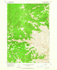 1962 Degan Mtn1964 Print · USGSThe Salmon National Forest in the early sixties was a landscape defined by resource extraction and remote mountain watchtowers. Local history researchers can trace the high-country paths to the Twin Peaks Mine, the lookout on Sheephorn Mtn, and the primitive jeep trail through Badger Basin.
 - 1962 Map of Horse Creek Butte, 1964 Print
 1962 Horse Creek Butte1964 Print · USGSLemhi County's high ridges and remote drainages are documented here in the early sixties within the Salmon National Forest. Researchers can locate isolated landmarks like Gattin Ranch and Big Indian Camp or trace the high Jeep Trail past Corn Lake.2 unique versions available
 - 1962 Map of Ramey Hill, 1964 Print
 1962 Ramey Hill1964 Print · USGSThe Idaho wilderness in the early 1960s is centered here on the confluence of the Middle Fork Salmon River and Loon Creek. Researchers can trace remote backcountry landmarks like the Tappen Ranch, Simplot Airstrip, and the Loon Creek Lookout.3 unique versions available
 - 1962 Map of Butts Creek Point, 1964 Print
 1962 Butts Creek Point1964 Print · USGSThe Salmon River canyon in the early sixties remains a wilderness of remote river bars and high-elevation lookouts. Researchers can trace early forest management and river travel at Butts Creek Point Lookout, Cunningham Bar, and Hancock Rapids.3 unique versions available
 - 1962 Map of Poison Peak, 1964 Print
 1962 Poison Peak1964 Print · USGSLemhi County, Idaho, is shown in the early sixties as a high-altitude wilderness of the Salmon National Forest. Backcountry researchers can trace the Old Indian Treaty Boundary and locate remote landmarks like Poison Peak and Bull Summit Waterhole.2 unique versions available
 - 1963 Map of Challis
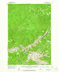
 1963 Challis1963 Print · USGSCentral Idaho's mountain corridors and mining districts appear in detail during the early sixties, highlighting the remote settlements of Challis and Stanley. Researchers can trace the legacy of the gold and silver rushes through labels for Bonanza, the Bayhorse Mine, and the Falconberry ranch.
Showing maps 1-25 of 56
Top cities of Lemhi County
Frequently asked questions
- What are the different types of historical maps available for Lemhi County?
- What is the oldest map of Lemhi County?
- Where can I purchase historical maps of Lemhi County for my home or office?
- Where can I download high-res historical maps of Lemhi County?
- Are there historical topographic maps available for Lemhi County?
- Is there historical aerial imagery available for Lemhi County?
- Where are historical maps of Lemhi County sourced from?