1980s Maps of Lemhi County, Idaho
Explore 66 historic maps of Lemhi County from the 1980s. These maps offer a rare glimpse into what life looked like during the 1980s — showing old roads, neighborhoods, homes, and landmarks that have changed or disappeared over time.
Whether you're researching your family's past, planning a metal detecting trip, or studying how Lemhi County's landscape evolved across the 1980s, these high-resolution maps are a powerful tool for exploring the history of this region.
- Focus on a specific era: All maps on this page are from the 1980s, giving you a focused view of this time period.
- See what’s changed: Compare century-old streets, trails, and buildings to today's modern landscape using overlays and satellite layers.
- Research with precision: Use these maps for genealogy, historical research, land use analysis, or educational projects.
- View, download, or print: Maps are fully viewable online in high resolution, and can be downloaded or printed for your own records.
Start exploring Lemhi County's history through authentic maps from the 1980s. This is your window into the past.
Lemhi County, ID maps
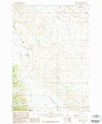
(66)- 1980 Map of Leadore, 1996 Print
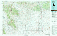
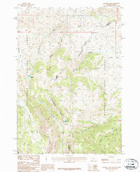
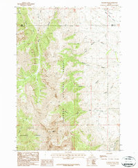
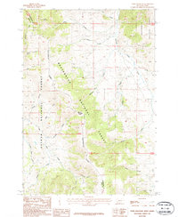
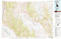 1980 Leadore1996 Print · USGSThe high mountain corridors of the Lemhi and Beaverhead ranges are captured here in the early 1980s. Local history researchers can trace the Old Railroad Grade past settlements like Leadore and Tendoy, or locate remote sites like the Copper Queen Mine and Chinatown.
 - 1981 Map of Salmon, 1982 Print
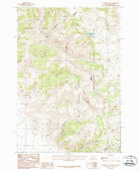
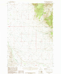
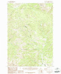
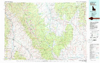 1981 Salmon1982 Print · USGSThe high mountain border between Idaho and Montana comes alive in the early 1980s as a landscape of remote mines and river junctions. Researchers can trace the heritage of the Beaverhead Mountains through sites like Elkhorn Mine, Silver King Mine, and the settlement of Wisdom.
 - 1982 Map of Challis
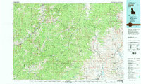 1982 Challis1982 Print · USGSIn the early 1980s, the rugged central Idaho backcountry around Challis remained a stronghold of mining and wilderness. Researchers can trace the legacy of remote industry at the Yellowjacket Mine and locate backcountry outposts like Casto and the Boyle Landing Strip.
 - 1982 Map of Bighorn Crags
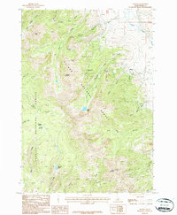
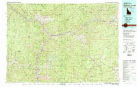 1982 Bighorn Crags1982 Print · USGSThe Salmon River Mountains in the early 1980s showcase a landscape where mining industry met vast new wilderness protections. Metal detectorists and local historians can trace the sites of the Blackbird Mine, the settlement of Cobalt, and the high-altitude Bighorn Crags.
 - 1983 Map of Dubois
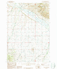
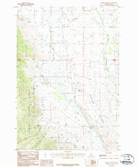
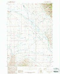
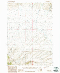
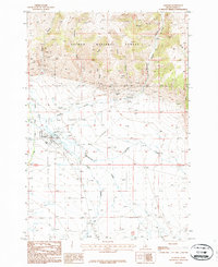
 1983 Dubois1983 Print · USGSEastern Idaho's high-country ranching and research landscape is captured here in the early 1980s. Local researchers can trace the Union Pacific line through Dubois, locate the sprawling U S Sheep Experiment Station, or find the former location of Winsper (Site).
 - 1987 Map of Gilmore
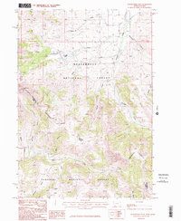
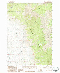
 1987 Gilmore1987 Print · USGSMining history and mountain terrain intersect near the settlement of Gilmore in the 1980s. Genealogists and historians can trace an Old Railroad Grade and numerous historical workings such as the Portland Mine and Mountain Boy Mine.
 - 1987 Map of West of Leadore
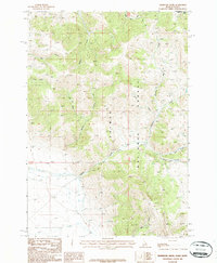
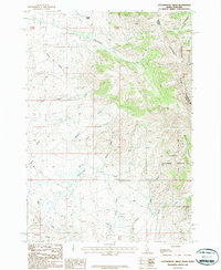
 1987 West of Leadore1987 Print · USGSLemhi County ranching and mining lands are captured here in the late 1980s as they border federal forest territory. Genealogists and researchers can trace family-named water rights and mining claims near Mineral Hill, the Lemhi River, and the Fish Hatchery.
 - 1987 Map of Eighteenmile Peak
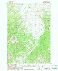
 1987 Eighteenmile Peak1987 Print · USGSThe Continental Divide serves as the backbone of this Montana-Idaho borderland in the late twentieth century. Researchers can trace early mineral exploration through various Prospects and family-named landmarks like Henderson Gulch and Coons Canyon.2 unique versions available
 - 1987 Map of Deadman Lake
 1987 Deadman Lake1987 Print · USGSThe high mountain crest between Montana and Idaho is captured here in the late 1980s, centered on the Continental Divide. Researchers can trace the hydrological separation at Bannock Pass and locate remote water bodies like Deadman Lake and Divide Creek Lake.
 - 1987 Map of Morrison Lake
 1987 Morrison Lake1987 Print · USGSThe high Idaho-Montana borderlands along the Continental Divide were documented in the late eighties, showing a landscape of remote mineral exploration. Researchers can trace the locations of an Open Pit Mine and various Prospects near Morrison Lake.
 - 1987 Map of Purcell Spring
 1987 Purcell Spring1987 Print · USGSLemhi County in the late eighties reveals a landscape of high-altitude water management and mineral exploration. Researchers can trace the Old Railroad Grade, locate a remote Cem, and find scattered Prospects near Purcell Spring.
 - 1987 Map of Mulkey Bar
 1987 Mulkey Bar1987 Print · USGSButte County ranching and water management are frozen in time during the late eighties at the intersection of three counties. Trace the irrigation history of Mulkey Bar and Deer Flats through features like Black Ditch and the Dry Creek Canal.
 - 1987 Map of Gilmore Summit
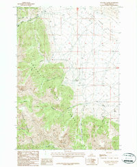
 1987 Gilmore Summit1987 Print · USGSThe high Lemhi County passes are captured here in the 1980s, where the continental divide separates major river drainages. Genealogists and historians can trace an Old Railroad Grade and explore several named water sources like Slaughterhouse Spring and Allhands Spring.
 - 1987 Map of Nicholia
 1987 Nicholia1987 Print · USGSThe northern Birch Creek Valley in the early 1980s was a remote landscape of mining history and mountain springs. Genealogists and historians can trace the topography of Nicholia and explore the rugged drainages of Smelter Gulch and Viola Gulch.
 - 1987 Map of Powderhorn Gulch
 1987 Powderhorn Gulch1987 Print · USGSLemhi County's high-mountain wilderness is captured here in the late twentieth century as the remote drainages of the Salmon National Forest meet the valley floor. Researchers can trace the legacy of resource extraction through prospects along Tenmile Creek or follow the path of Eighteenmile Creek below Center Ridge.
 - 1987 Map of Reservoir Creek
 1987 Reservoir Creek1987 Print · USGSThe high Lemhi County backcountry and the Idaho-Montana border are mapped here in the late eighties. Researchers can trace historical mining activity through various Prospects and follow water sources like Reservoir Creek and Hawley Creek.
 - 1987 Map of Diamond Peak
 1987 Diamond Peak1987 Print · USGSThe high Lemhi Range and the Lemhi-Butte county line are documented here during the late twentieth century. Researchers can trace remote routes into the backcountry, locating high-altitude prospects and name features like Diamond Peak and Bighorn Canyon.
 - 1987 Map of Bell Mountain
 1987 Bell Mountain1987 Print · USGSThe high country of the Lemhi and Butte county border is documented here in the late eighties, centered on the heights of Bell Mountain. Researchers can locate the settlement of Clyde and trace water resources through Birch Basin and Willow Springs.
 - 1987 Map of Coal Kiln Canyon
 1987 Coal Kiln Canyon1987 Print · USGSThe high desert of Lemhi County meets the mountain forest during the late eighties, showing a landscape defined by ranching and mining history. Trace the site of Hahn or locate industrial remnants like the Kiln and several prospects tucked into Coal Kiln Canyon.
 - 1987 Map of Leadore
 1987 Leadore1987 Print · USGSThe high Lemhi Valley comes alive in the late twentieth century as a landscape of mountain mining and rail history. Trace the remnants of the silver-mining era at Leadville Site or follow the path of the Old Railroad Grade past Leadore.
 - 1987 Map of Tepee Mountain
 1987 Tepee Mountain1987 Print · USGSThe high ridges of the Montana-Idaho border are captured here in the 1980s as the Continental Divide cuts through the forest. Researchers can trace mineral exploration at a Prospect or Shaft and follow named drainages like Medicine Lodge Creek and Horsethief Creek.
 - 1987 Map of Iron Creek Point
 1987 Iron Creek Point1987 Print · USGSThe high Lemhi Range and Salmon River Mountains meet in the late eighties along the Lemhi and Custer county line. Geologists and hikers can trace mining history through the Prospect Adit or navigate the drainages of Big Timber Creek and Sawmill Creek.
 - 1987 Map of Cottonwood Creek
 1987 Cottonwood Creek1987 Print · USGSThe high Idaho-Montana borderlands are captured here in the 1980s as the state line follows the Continental Divide. Researchers can trace remote water sources and terrain features like Walters Spring, Cottonwood Creek, and the Beaverhead Mountains.
 - 1987 Map of Italian Canyon
 1987 Italian Canyon1987 Print · USGSThe high Idaho desert meets the forest boundary in the late eighties, documenting a landscape of canyons and mining claims. Genealogists and researchers can locate the Barzee Cem and trace numerous Prospect sites near Smelter Gulch.
 - 1987 Map of Sheephorn Peak
 1987 Sheephorn Peak1987 Print · USGSLemhi County's high-country peaks and headwaters are captured in the 1980s as they appeared in the Salmon National Forest. Researchers can trace old resource markers like a mountain Adit or locate landmarks such as Sheephorn Peak and Nez Perce Lake.
Showing maps 1-25 of 66
Top cities of Lemhi County
Frequently asked questions
- What are the different types of historical maps available for Lemhi County?
- What is the oldest map of Lemhi County?
- Where can I purchase historical maps of Lemhi County for my home or office?
- Where can I download high-res historical maps of Lemhi County?
- Are there historical topographic maps available for Lemhi County?
- Is there historical aerial imagery available for Lemhi County?
- Where are historical maps of Lemhi County sourced from?