1900s (20th Century) Maps of Lewiston, Idaho
Explore 12 historic maps of Lewiston from the 1900s (20th Century). These maps offer a rare glimpse into what life looked like during the 1900s — showing old roads, neighborhoods, homes, and landmarks that have changed or disappeared over time.
Whether you're researching your family's past, planning a metal detecting trip, or studying how Lewiston's landscape evolved across the 1900s, these high-resolution maps are a powerful tool for exploring the history of this region.
- Focus on a specific era: All maps on this page are from the 1900s, giving you a focused view of this time period.
- See what’s changed: Compare century-old streets, trails, and buildings to today's modern landscape using overlays and satellite layers.
- Research with precision: Use these maps for genealogy, historical research, land use analysis, or educational projects.
- View, download, or print: Maps are fully viewable online in high resolution, and can be downloaded or printed for your own records.
Start exploring Lewiston's history through authentic maps from the 1900s. This is your window into the past.
Lewiston, ID maps
(12)- 1945 Map of Clarkston, 1965 Print
 1945 Clarkston1965 Print · USGSThe Snake and Clearwater rivers meet in the mid-1940s, showing the early industrial growth of the border towns. Genealogists can trace family landmarks like Huggins Ranch and Stout Ranch or locate burials at Vineland Cem and Asotin Cem.
 - 1948 Map of Clarkston
 1948 Clarkston1948 Print · USGSSoutheast Washington and the Idaho border come alive in this post-war survey of the Snake and Clearwater river junction. Genealogists and local historians can trace family roots through sites like Vineland Cem, Huggins Ranch, and the early township of Asotin.
 - 1955 Map of Pullman, 1963 Print
 1955 Pullman1963 Print · USGSThe Palouse and Clearwater regions are captured here in the mid-1950s, showing the height of the rail-and-river economy. Genealogists and historians can trace rail lines like the Camas Prairie RR, find local landmarks like Whitman County Memorial Cem, and locate early academic centers at Washington State University and the University of Idaho.3 unique versions available
 - 1958 Map of Pullman
 1958 Pullman1958 Print · USGSThe Palouse and Clearwater regions are captured here in the late fifties, showing the vital river-and-rail connection between eastern Washington and northern Idaho. Local historians can trace the paths of the Camas Prairie RR and Union Pacific RR as they serve towns like Colfax, Kamiah, and Nezperce.2 unique versions available
 - 1958 Map of Lewiston Orchards North, 1960 Print
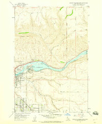 1958 Lewiston Orchards North1960 Print · USGSNez Perce County undergoes significant postwar development along the river and plateau during the late fifties. Genealogists and local historians can trace the growth of Lewiston Orchards and locate landmarks like Garfield Sch and the Clearwater River Memorial Bridge.2 unique versions available
 - 1958 Map of Lewiston Orchards South, 1960 Print
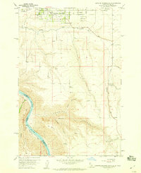 1958 Lewiston Orchards South1960 Print · USGSNez Perce County, Idaho, comes alive in this late 1950s survey of the suburban and canyon lands south of Lewiston. Researchers can locate the Upper Tammany Cemetery, the old Tammany School, and the remote river settlement at Graham.4 unique versions available
 - 1958 Map of Lewiston Orchards, 1960 Print
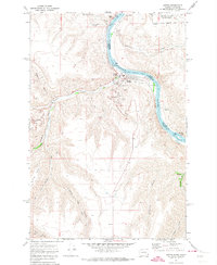
 1958 Lewiston Orchards1960 Print · USGSNez Perce County in the late fifties shows the development of the Clearwater and Snake River basins as irrigation and rail networks expanded. Genealogists can locate family names at Webb Cemetery, the Tammany School, and the North Idaho Indian Agency.
 - 1971 Map of Asotin, 1974 Print
 1971 Asotin1974 Print · USGSThe Snake River valley at the Washington-Idaho border shows the town of Asotin at a pivotal point of growth in the early seventies. Genealogists and local historians can trace family-named terrain like George Meyer Ridge and Maguire Gulch alongside the old settlements of Jerry and Clemens.2 unique versions available
 - 1971 Map of Clarkston, 1974 Print
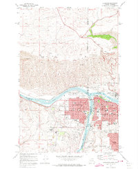 1971 Clarkston1974 Print · USGSThe growing border communities of Clarkston and Lewiston are captured in the early 1970s at the meeting of the Snake and Clearwater Rivers. Genealogists can locate family landmarks like Vineland Cemetery, Stout Ranch, and the North Idaho Childrens Home.2 unique versions available
 - 1975 Map of Clarkston, 1977 Print
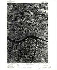 1975 Clarkston1977 Print · USGSThe border towns of Washington and Idaho come into sharp focus in the mid-seventies, showing the urban footprint of Clarkston and Lewiston. Trace the residential grids of Lewiston Orchards and the confluence of the Snake River and Clearwater River.
 - 1981 Map of Clarkston
 1981 Clarkston1981 Print · USGSNorthwestern river life and mountain terrain meet in the early eighties as the Snake River carves through the landscape. Researchers can trace rail history along the Camas Prairie Railroad and locate smaller settlements like Peola and Anatone.2 unique versions available
 - 1981 Map of Orofino, 1982 Print
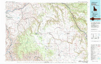 1981 Orofino1982 Print · USGSNorth central Idaho comes into focus in the early eighties, showing the deep river canyons and agricultural plateaus of the Nez Perce Indian Reservation. Genealogists and historians can trace the Camas Prairie rail line through rural hubs like Ferdinand, Mohler, and Reubens.
End of results
Showing maps 1-12 of 12
Top cities near Lewiston
- Clarkston historical maps
- Lapwai historical maps
- Asotin historical maps
- Genesee historical maps
- Colton historical maps
- Uniontown historical maps
Top neighborhoods of Lewiston
Frequently asked questions
- What are the different types of historical maps available for Lewiston?
- What is the oldest map of Lewiston?
- Where can I purchase historical maps of Lewiston for my home or office?
- Where can I download high-res historical maps of Lewiston?
- Are there historical topographic maps available for Lewiston?
- Is there historical aerial imagery available for Lewiston?
- Where are historical maps of Lewiston sourced from?