Old Maps of Nez Perce County, Idaho
Explore 233 old maps of Nez Perce County, spanning from 1910 to today. These high-resolution historic maps reveal how streets, neighborhoods, landmarks, and natural features evolved over time — perfect for genealogy, metal detecting, research, and local history exploration.
What you can do with these maps:
- See how Nez Perce County changed over time: Compare historical maps to modern-day views to trace roads, homesites, rail lines & more.
- View detailed metadata: Each map includes creators, publishers, year, scale, and archive source.
- Overlay maps with satellite & LiDAR: Visualize the past alongside modern tools to explore terrain & human change.
- Trusted historical sources: Maps sourced from the USGS, Library of Congress, and other archives.
- Access maps your way: View online, download high-res files, or order prints for personal or research use.
Start exploring old maps of Nez Perce County to uncover forgotten places, hidden landmarks, and the deep history beneath your feet.
Nez Perce County, ID maps
(233)- 1910 Map of Pullman
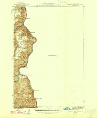
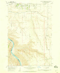
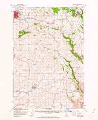
 1910 Pullman1910 Print · USGSThe Palouse hills and Snake River breaks are shown here in the early twentieth century, during a period of rapid railway expansion and academic growth. Genealogists and historians can trace the early layouts of Pullman and Colfax, as well as rural post offices like Guy Albion PO and the campus of the State College of Washington.5 unique versions available
 - 1924 Map of Kamiah
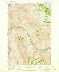
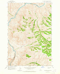
 1924 Kamiah1924 Print · USGSNorth-central Idaho settlements thrive along the Clearwater River and upland plateaus during the mid-twenties. Genealogists and historians can trace the paths of the Northern Pacific railroad through rail towns like Volmer, Cottonwood, and the river crossing at Kamiah.
 - 1945 Map of Clarkston, 1965 Print
 1945 Clarkston1965 Print · USGSThe Snake and Clearwater rivers meet in the mid-1940s, showing the early industrial growth of the border towns. Genealogists can trace family landmarks like Huggins Ranch and Stout Ranch or locate burials at Vineland Cem and Asotin Cem.
 - 1946 Map of Limekiln Rapids
 1946 Limekiln Rapids1946 Print · USGSThe Snake River canyon at the junction of Washington, Oregon, and Idaho is captured here just after the war. Local historians can trace the river economy through Rogersburg and sites like Captain John Ferry or Brahams Landing.
 - 1948 Map of Clarkston
 1948 Clarkston1948 Print · USGSSoutheast Washington and the Idaho border come alive in this post-war survey of the Snake and Clearwater river junction. Genealogists and local historians can trace family roots through sites like Vineland Cem, Huggins Ranch, and the early township of Asotin.
 - 1955 Map of Pullman, 1963 Print
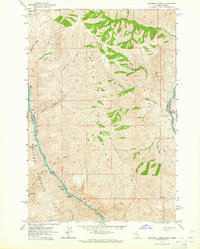
 1955 Pullman1963 Print · USGSThe Palouse and Clearwater regions are captured here in the mid-1950s, showing the height of the rail-and-river economy. Genealogists and historians can trace rail lines like the Camas Prairie RR, find local landmarks like Whitman County Memorial Cem, and locate early academic centers at Washington State University and the University of Idaho.3 unique versions available
 - 1955 Map of Grangeville, 1964 Print
 1955 Grangeville1964 Print · USGSThe high country of the Idaho-Oregon border comes alive in the mid-1950s, showing the deep river canyons and mountain peaks. Trace the Union Pacific RR through the valleys or locate settlements like Grangeville, Joseph, and the shoreline of Wallowa Lake.4 unique versions available
 - 1958 Map of Pullman
 1958 Pullman1958 Print · USGSThe Palouse and Clearwater regions are captured here in the late fifties, showing the vital river-and-rail connection between eastern Washington and northern Idaho. Local historians can trace the paths of the Camas Prairie RR and Union Pacific RR as they serve towns like Colfax, Kamiah, and Nezperce.2 unique versions available
 - 1958 Map of Lapwai, 1959 Print
 1958 Lapwai1959 Print · USGSNez Perce land and river life are captured here in the late fifties, centered on the confluence of the Clearwater River. Genealogists and researchers can locate the North Idaho Indian Agency and Spalding Memorial State Park.3 unique versions available
 - 1958 Map of Sweetwater, 1960 Print
 1958 Sweetwater1960 Print · USGSNez Perce County's ranching and reservation lands are captured here in the late fifties, showcasing the intricate water systems of the Lapwai Valley. Researchers can locate the Sweetwater Cemetery, the William Craig Historical Mon, and the small settlement at Webb.2 unique versions available
 - 1958 Map of Lewiston Orchards North, 1960 Print
 1958 Lewiston Orchards North1960 Print · USGSNez Perce County undergoes significant postwar development along the river and plateau during the late fifties. Genealogists and local historians can trace the growth of Lewiston Orchards and locate landmarks like Garfield Sch and the Clearwater River Memorial Bridge.2 unique versions available
 - 1958 Map of Lewiston Orchards South, 1960 Print
 1958 Lewiston Orchards South1960 Print · USGSNez Perce County, Idaho, comes alive in this late 1950s survey of the suburban and canyon lands south of Lewiston. Researchers can locate the Upper Tammany Cemetery, the old Tammany School, and the remote river settlement at Graham.4 unique versions available
 - 1958 Map of Lewiston Orchards, 1960 Print
 1958 Lewiston Orchards1960 Print · USGSNez Perce County in the late fifties shows the development of the Clearwater and Snake River basins as irrigation and rail networks expanded. Genealogists can locate family names at Webb Cemetery, the Tammany School, and the North Idaho Indian Agency.
 - 1958 Map of Culdesac, 1960 Print
 1958 Culdesac1960 Print · USGSThe Nez Perce and Lewis county borderlands in the late fifties show a landscape of steep canyons and high grain prairies. Trace the winding Camas Prairie RR through the tunnels of Culdesac Hill or locate the historic Slickpoo St Joseph Mission.2 unique versions available
 - 1959 Map of Grangeville
 1959 Grangeville1959 Print · USGSThe high alpine peaks and deep river canyons of the Idaho-Oregon borderlands are captured in the late fifties. Researchers can trace the Union Pacific RR through the valleys to settlements like Enterprise, Union, and Grangeville.2 unique versions available
 - 1961 Map of Kendrick, 1963 Print
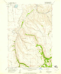
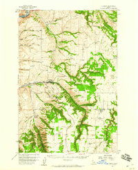
 1961 Kendrick1963 Print · USGSThe Potlatch and Clearwater river valleys were bustling rail and timber corridors in the early sixties. Genealogists can trace family roots through numerous upland burial sites like Little Bear Ridge Cem and American Ridge Cem, or locate the schools and homesteads near Kendrick and Juliaetta.2 unique versions available
 - 1961 Map of Ahsahka, 1963 Print
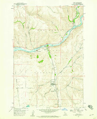
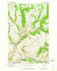
 1961 Ahsahka1963 Print · USGSThe Clearwater River country of the early sixties is shown here at the confluence of its north and main forks. Genealogists and local historians can locate rural landmarks such as the Teakean-Cavendish School, Sunnyside Cemetery, and the United Brethren Camp.2 unique versions available
 - 1961 Map of Moscow, 1963 Print
 1961 Moscow1963 Print · USGSThe Latah County wheat country and rail corridors are frozen in time here during the early sixties. Genealogists and local historians can trace the Northern Pacific line through Genesee, locate the Aspendale Community Hall, and find remote burials at Fix Ridge Cem.2 unique versions available
 - 1963 Map of Cactus Mtn, 1964 Print
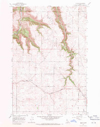
 1963 Cactus Mtn1964 Print · USGSThe Snake and Salmon rivers meet along the Idaho-Oregon border in the early sixties, a landscape of high summits and deep river canyons. Researchers can trace remote outposts like Spencer Ranch, the historic river crossing at Dug Bar, and the long Wallowa Summit Ridge.2 unique versions available
 - 1963 Map of Deadhorse Ridge, 1965 Print
 1963 Deadhorse Ridge1965 Print · USGSThe confluence of the Salmon and Snake Rivers is captured here in the early sixties, a time when mining and ranching still defined this remote borderland. Researchers can locate specific industrial sites like the Mountain Chief Mine and Mine Ruins at Eureka Bar, or trace early homesteads at Cherry Creek Ranch and Dobbin Cabin.3 unique versions available
 - 1963 Map of Jim Creek Butte, 1965 Print
 1963 Jim Creek Butte1965 Print · USGSThe Snake River canyon and the Wallowa high country meet in this mid-century survey of the Oregon-Idaho border. Researchers can trace the rugged network of trails and jeep tracks leading to remote landmarks like Jim Creek Butte, an isolated mine, and Cochran Islands.2 unique versions available
 - 1963 Map of Rattlesnake Ridge, 1965 Print
 1963 Rattlesnake Ridge1965 Print · USGSThe remote Salmon River canyon and the high spine of Idaho's back-country are detailed here in the early 1960s. Researchers can locate isolated landmarks like Flynn Creek Ranch and the Camp Thomas (Site) along a network of primitive trails.2 unique versions available
 - 1963 Map of Wapshilla Creek, 1965 Print
 1963 Wapshilla Creek1965 Print · USGSThe high canyons of the Craig Mountains meet the Snake and Salmon Rivers in the early sixties. Genealogists and historians can trace riverbank sites like Geneva Bar, the Wallowa National Forest boundary, and remote water sources like Coyote Spr.2 unique versions available
 - 1964 Map of Uniontown, 1965 Print
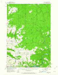
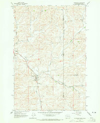 1964 Uniontown1965 Print · USGSThe Washington-Idaho border comes alive in the mid-1960s, showing the agricultural heart of the Palouse. Genealogists can trace family roots at Uniontown and Colton, or locate landmarks like the St Boniface Sch and Thorn Creek Ranch.
 - 1967 Map of Mohler, 1971 Print
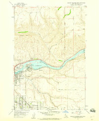
 1967 Mohler1971 Print · USGSThe high plateau of Lewis County is captured here in the late sixties, where the small community of Mohler meets the breaks of Big Canyon Creek. Researchers can locate Russell Cem, trace the Boise Meridian, and find old Gravel Pits along Holes Creek.
Showing maps 1-25 of 233
Top cities of Nez Perce County
Frequently asked questions
- What are the different types of historical maps available for Nez Perce County?
- What is the oldest map of Nez Perce County?
- Where can I purchase historical maps of Nez Perce County for my home or office?
- Where can I download high-res historical maps of Nez Perce County?
- Are there historical topographic maps available for Nez Perce County?
- Is there historical aerial imagery available for Nez Perce County?
- Where are historical maps of Nez Perce County sourced from?