1990s Maps of Nez Perce County, Idaho
Explore 13 historic maps of Nez Perce County from the 1990s. These maps offer a rare glimpse into what life looked like during the 1990s — showing old roads, neighborhoods, homes, and landmarks that have changed or disappeared over time.
Whether you're researching your family's past, planning a metal detecting trip, or studying how Nez Perce County's landscape evolved across the 1990s, these high-resolution maps are a powerful tool for exploring the history of this region.
- Focus on a specific era: All maps on this page are from the 1990s, giving you a focused view of this time period.
- See what’s changed: Compare century-old streets, trails, and buildings to today's modern landscape using overlays and satellite layers.
- Research with precision: Use these maps for genealogy, historical research, land use analysis, or educational projects.
- View, download, or print: Maps are fully viewable online in high resolution, and can be downloaded or printed for your own records.
Start exploring Nez Perce County's history through authentic maps from the 1990s. This is your window into the past.
Nez Perce County, ID maps
(13)- 1990 Map of Juliaetta
 1990 Juliaetta1990 Print · USGSThe canyon of the Potlatch River and the high plateaus of Latah County are captured here just as the late twentieth century began. Genealogists and local historians can trace the boundaries of the Nez Perce Indian Reservation or locate family sites like American Ridge Cem and Juliaetta Cem.
 - 1990 Map of Green Knob
 1990 Green Knob1990 Print · USGSNorthwestern Idaho in the 1990s remained a landscape of high ridges and deep river canyons along the tribal border. Researchers can find family burial sites at Overacker Cem and Fix Ridge Cem or trace the Nez Perce Indian Reservation Boundary.
 - 1990 Map of Genesee
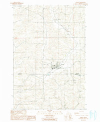 1990 Genesee1990 Print · USGSGenesee and the surrounding Latah County highlands are documented here during the late twentieth century. Genealogists can locate several local burial sites like Genesee Valley Cem and St Marys Cem while tracing the path of Cow Creek.
 - 1990 Map of Ahsahka, 1991 Print
 1990 Ahsahka1991 Print · USGSClearwater County at the start of the nineties shows a landscape defined by water management and public recreation. Researchers can trace the infrastructure of the Dworshak Dam and historic sites like the Lewis-Clark Canoe Camp State Park and Ahsahka.
 - 1990 Map of Lenore, 1991 Print
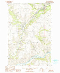
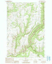
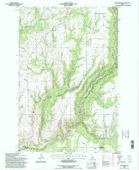
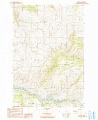 1990 Lenore1991 Print · USGSNez Perce County is shown during the late twentieth century as the river-and-ridge landscape supported both riverside industry and upland farming. Researchers can trace the Nez Perce Indian Reservation Boundary and locate community sites like Lenore Cem, Wifola, and Leland.
 - 1990 Map of Texas Ridge, 1991 Print
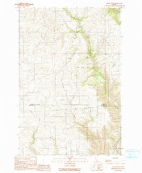
 1990 Texas Ridge1991 Print · USGSThe high plateaus of Latah County are captured here in the early nineties, showing a landscape defined by deep canyons and agricultural ridges. Researchers can locate remote rural landmarks like Elwood Cem, the Wild Rose Ch, and the Big Bear Ridge Community Hall.
 - 1990 Map of Little Bear Ridge, 1991 Print
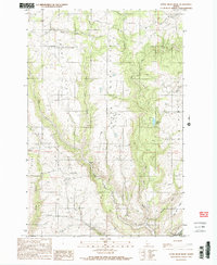 1990 Little Bear Ridge1991 Print · USGSLatah County at the start of the 1990s shows a landscape of upland ridges and deep creek valleys centered around Bovard. Researchers can trace rural lineages through local landmarks like Little Bear Ridge Cem, Spencer Cem, and Atwater Lake.2 unique versions available
 - 1990 Map of Park, 1991 Print
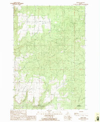 1990 Park1991 Print · USGSIn the Idaho Panhandle during the late twentieth century, the high plateau around Park remained a landscape of timbered ridges and deep gulches. Researchers can trace land patterns along the Boise Meridian and locate landmarks like Gold Hill and the Landing Strip.
 - 1990 Map of Southwick, 1991 Print
 1990 Southwick1991 Print · USGSNorth-central Idaho’s high-plateau farming and timber country is shown here in the late twentieth century, before modern development further altered the rural landscape. Researchers can locate family-named landmarks and essential local sites such as Southwick, the Teakean Cavendish Sch, and Potlatch Ridge.
 - 1994 Map of Park, 1997 Print
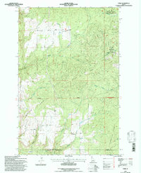 1994 Park1997 Print · USGSThe Latah County timberlands are captured here in the mid-nineties during a period of active forest management. Genealogists and researchers can trace the rugged terrain surrounding Park and Crescent while locating landmarks like Gold Hill, the Landing Strip, and Norwegian Ridge.2 unique versions available
 - 1994 Map of Orofino West, 1997 Print
 1994 Orofino West1997 Print · USGSIn the mid-1990s, the confluence of the Clearwater and its North Fork remained the vital heart of this Idaho river valley. Researchers can trace the path of the Camas Prairie Railroad and locate local landmarks like Gilbert Ch and Central Ridge Cem.
 - 1994 Map of Ahsahka, 1997 Print
 1994 Ahsahka1997 Print · USGSThe Clearwater and North Fork rivers meet in the 1990s as the massive Dworshak Reservoir reshapes the Idaho landscape. Trace the history of the Nez Perce region through sites like Lewis Clark Canoe Camp State Park and the Ahsahka settlement.
 - 1994 Map of Texas Ridge, 1998 Print
 1994 Texas Ridge1998 Print · USGSThe high plateau of Latah County in the mid-1990s showcases a landscape of upland farming and deep river canyons. Genealogists and local historians can trace the foundations of ridge-top life through Bethany Ch, Elwood Cem, and the Potlatch River crossing.
End of results
Showing maps 1-13 of 13
Top cities of Nez Perce County
Frequently asked questions
- What are the different types of historical maps available for Nez Perce County?
- What is the oldest map of Nez Perce County?
- Where can I purchase historical maps of Nez Perce County for my home or office?
- Where can I download high-res historical maps of Nez Perce County?
- Are there historical topographic maps available for Nez Perce County?
- Is there historical aerial imagery available for Nez Perce County?
- Where are historical maps of Nez Perce County sourced from?