Old Maps of Murphy Hot Springs, Idaho for Genealogy
Trace your family roots with 5 historic maps of Murphy Hot Springs. These high-res maps reveal old neighborhoods, homesites, landmarks, and streets — helping you uncover where your ancestors lived and how the area evolved over time.
- Explore historic neighborhoods: Identify where your relatives may have lived in the 1800s or 1900s.
- Compare maps over time: Trace the changes in streets, buildings, and landmarks for multi-generational research.
- Perfect for genealogy & ancestry research: Used by family historians and researchers to map out lineage and migration.
These maps are an incredible resource for exploring your personal connection to Murphy Hot Springs's past.
Murphy Hot Springs, ID maps
(5)- 1955 Map of Twin Falls, 1963 Print
 1955 Twin Falls1963 Print · USGSThe Magic Valley flourished in the mid-1950s as a sophisticated network of irrigation and rail lines connected high-desert outposts. Researchers can trace the engineering of the Milner-Gooding Canal, the remote Murphy Hot Springs, and the Union Pacific rail network.3 unique versions available
 - 1958 Map of Twin Falls
 1958 Twin Falls1958 Print · USGSThe Magic Valley and Snake River Plain are captured here in the late fifties, showcasing a region defined by transformative irrigation projects and desert military ranges. Researchers can trace the Union Pacific rail lines and locate small outlying settlements like Wickahoney, Rogerson, and Hollister.2 unique versions available
 - 1979 Map of Murphy Hot Springs, 1980 Print
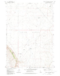 1979 Murphy Hot Springs1980 Print · USGSHigh desert ranching and remote outposts define this corner of Owyhee County in the late seventies. Researchers can trace the rugged geography of the East Fork Jarbidge River and find isolated landmarks like Murphy Hot Springs, the Jim Bob Reservoir, and Pence Butte.
 - 1989 Map of Sheep Creek
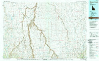 1989 Sheep Creek1989 Print · USGSOwyhee County and the Idaho-Nevada borderlands are mapped here in the late eighties, showing a landscape defined by ranching and deep river chasms. Researchers can trace remote landmarks like Grasmere, the Bruneau Canyon, and the Duck Valley Indian Reservation.
 - 2023 Map of Murphy Hot Springs, 2023 Print
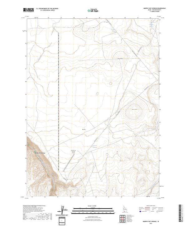 2023 Murphy Hot Springs2023 Print · USGSOwyhee County's high-desert canyons and plateaus come into focus in this contemporary study of the Idaho backcountry. Researchers can locate the isolated Murphy Hot Springs settlement and trace the winding course of the East Fork Jarbidge River or find the remote Murphy Hot Springs Airport.
End of results
Showing maps 1-5 of 5
Top cities near Murphy Hot Springs
Frequently asked questions
- What are the different types of historical maps available for Murphy Hot Springs?
- What is the oldest map of Murphy Hot Springs?
- Where can I purchase historical maps of Murphy Hot Springs for my home or office?
- Where can I download high-res historical maps of Murphy Hot Springs?
- Are there historical topographic maps available for Murphy Hot Springs?
- Is there historical aerial imagery available for Murphy Hot Springs?
- Where are historical maps of Murphy Hot Springs sourced from?