Old Maps of Hillside Manor, Quincy
Explore 20 old maps of Hillside Manor, spanning from 1925 to today. These high-resolution historic maps reveal how streets, neighborhoods, landmarks, and natural features evolved over time — perfect for genealogy, metal detecting, research, and local history exploration.
What you can do with these maps:
- See how Hillside Manor changed over time: Compare historical maps to modern-day views to trace roads, homesites, rail lines & more.
- View detailed metadata: Each map includes creators, publishers, year, scale, and archive source.
- Overlay maps with satellite & LiDAR: Visualize the past alongside modern tools to explore terrain & human change.
- Trusted historical sources: Maps sourced from the USGS, Library of Congress, and other archives.
- Access maps your way: View online, download high-res files, or order prints for personal or research use.
Start exploring old maps of Hillside Manor to uncover forgotten places, hidden landmarks, and the deep history beneath your feet.
Hillside Manor, Quincy maps
(20)- 1925 Map of Quincy
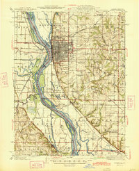
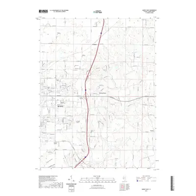
 1925 Quincy1925 Print · USGSQuincy and its Mississippi River hinterlands are captured in the mid-1920s, showing a landscape defined by river navigation and rail transport. Genealogists can locate dozens of country schools and churches, from St Ludgerus School to Zion Church and the Soldiers Home.2 unique versions available
 - 1944 Map of Quincy, 1954 Print
 1944 Quincy1954 Print · USGSQuincy and the Mississippi River valley are captured in the 1940s, showing a landscape defined by rail lines and rural parish schools. Researchers can trace the riverfront at Marion City, the grounds of the Soldiers Home, and historic sites like Zion Church.5 unique versions available
 - 1945 Map of Quincy
 1945 Quincy1945 Print · USGSQuincy and its Mississippi River crossings are captured here in the mid-1940s during a period of transition for its riverfront and rail lines. Genealogists can trace family roots at local landmarks like the Soldiers Home, Melrose Chapel, and numerous rural schoolhouses such as Hickory Grove School.2 unique versions available
 - 1948 Map of Quincy
 1948 Quincy1948 Print · USGSThe Mississippi and Illinois River valleys are captured at a post-war crossroads as rail and river travel met the expanding highway system. Genealogists can trace family settlements from Quincy to Hannibal and smaller towns like Vandalia and Jerseyville.2 unique versions available
 - 1956 Map of Quincy, 1967 Print
 1956 Quincy1967 Print · USGSThe river and rail corridors of the Illinois-Missouri border are documented here during the mid-1950s. Researchers can trace historic river landings and regional transit hubs from Quincy and Hannibal to smaller settlements like Meredosia and Roodhouse.3 unique versions available
 - 1971 Map of Quincy East, 1973 Print
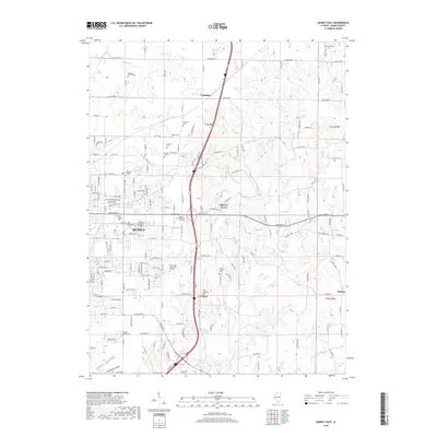
 1971 Quincy East1973 Print · USGSEastern Quincy and the surrounding Adams County townships are captured here in the early seventies as the city grid pushed toward the rural prairie. Genealogists can locate several family burial grounds including Powell Cem and Eeds Cem, alongside landmarks like Melrose Chapel and Hickory Grove.2 unique versions available
 - 1971 Map of Quincy West, 1973 Print
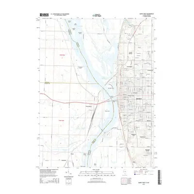
 1971 Quincy West1973 Print · USGSThe riverfront city of Quincy is shown in the early seventies, at the height of its mid-century industrial and civic development. Researchers can trace local institutions and family names at Woodland Cem, Quincy College, and the Illinois Soldiers and Sailors Home.
 - 1986 Map of Quincy
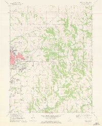
 1986 Quincy1986 Print · USGSThe tri-state border region along the Mississippi River comes into focus during the mid-1980s. Researchers can trace the legacy of river towns and rail hubs like Quincy and Monroe City or locate landmarks such as Mount Olive Cem.2 unique versions available
 - 1995 Map of Quincy East, 1998 Print
 1995 Quincy East1998 Print · USGSThe eastern edges of Quincy and the rural outskirts of Adams County are shown here during a period of late-century expansion. Genealogists can trace family names across a high density of burial grounds like National Cem, Powell Cem, and the historic Melrose Chapel.
 - 1996 Map of Quincy West, 1997 Print
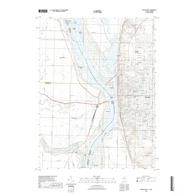
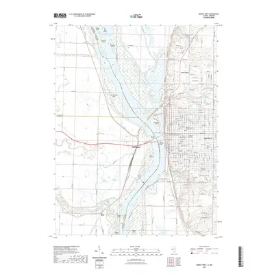
 1996 Quincy West1997 Print · USGSThe riverfront at Quincy and the Illinois-Missouri border are captured here in the mid-1990s as the city expands along the eastern bluffs. Researchers can trace the river's complex island system, industrial mines, and local landmarks like St Boniface Cem and the Quincy Mem Bridge.
 - 2012 Map of Quincy West, 2012 Print
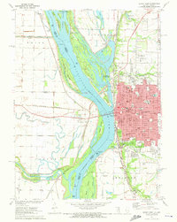
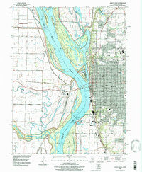
 2012 Quincy West2012 Print · USGSCovers Hillside Manor, including Quincy, North Quincy, and other nearby areas
 - 2012 Map of Quincy East, 2012 Print
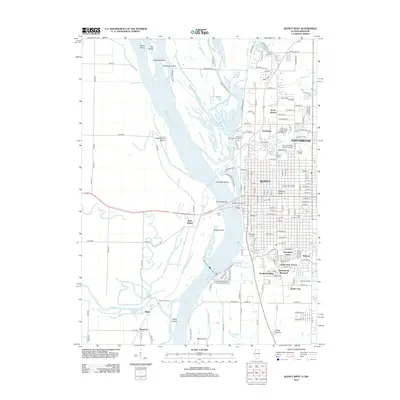
 2012 Quincy East2012 Print · USGSCovers Hillside Manor, including Quincy, Country Meadows, and other nearby areas
 - 2015 Map of Quincy East, 2015 Print
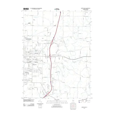
 2015 Quincy East2015 Print · USGSCovers Hillside Manor, including Quincy, Country Meadows, and other nearby areas
 - 2015 Map of Quincy West, 2015 Print
 2015 Quincy West2015 Print · USGSCovers Hillside Manor, including Quincy, North Quincy, and other nearby areas
 - 2018 Map of Quincy East, 2018 Print
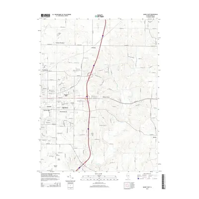
 2018 Quincy East2018 Print · USGSCovers Hillside Manor, including Quincy, Country Meadows, and other nearby areas
 - 2018 Map of Quincy West, 2018 Print
 2018 Quincy West2018 Print · USGSCovers Hillside Manor, including Quincy, North Quincy, and other nearby areas
 - 2021 Map of Quincy West, 2021 Print
 2021 Quincy West2021 Print · USGSCovers Hillside Manor, including Quincy, North Quincy, and other nearby areas
 - 2021 Map of Quincy East, 2021 Print
 2021 Quincy East2021 Print · USGSCovers Hillside Manor, including Quincy, Country Meadows, and other nearby areas
 - 2024 Map of Quincy East, 2024 Print
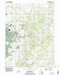
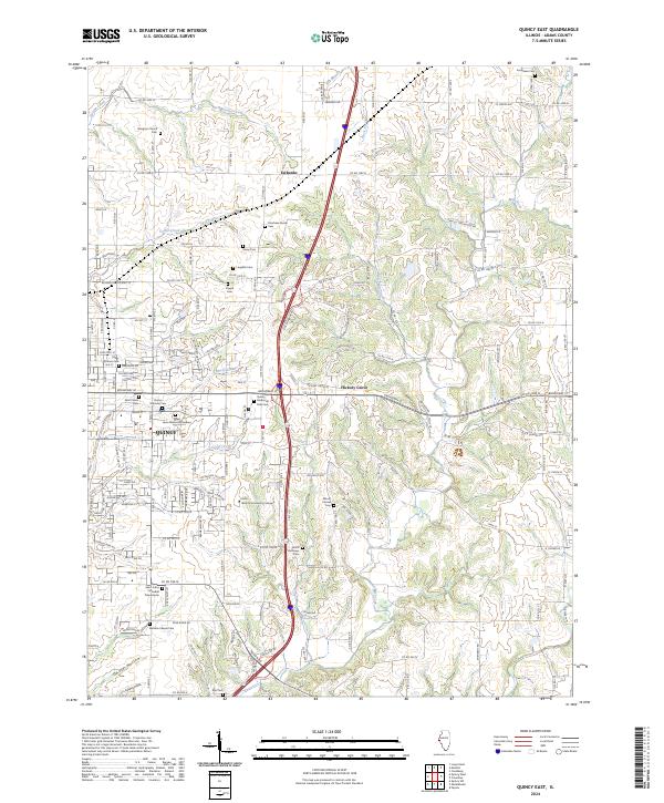 2024 Quincy East2024 Print · USGSQuincy and its eastern Adams County suburbs are documented here in the early twenty-first century, showing a mix of growing residential districts and established rural hamlets. Family historians can trace numerous sites including the Quincy National Cem, Voorhees Family Cem, and Ellington Church.
 - 2024 Map of Quincy West, 2024 Print
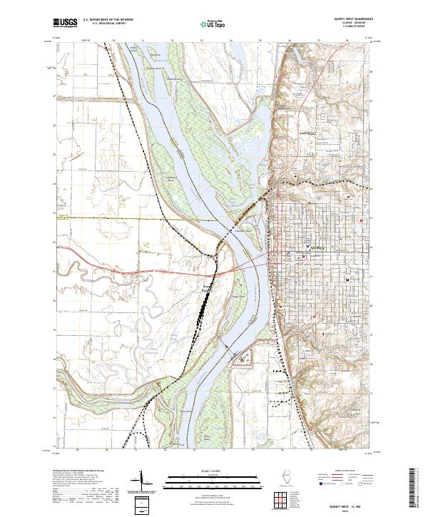 2024 Quincy West2024 Print · USGSQuincy and the Mississippi River bluffs are documented here during the mid-2020s, showing the intersection of urban growth and river conservation. Researchers can locate civic landmarks like the Adams County Courthouse or trace historic burial grounds such as Woodland Cem and Sunset Veterans Cem.
End of results
Showing maps 1-20 of 20
Frequently asked questions
- What are the different types of historical maps available for Hillside Manor?
- What is the oldest map of Hillside Manor?
- Where can I purchase historical maps of Hillside Manor for my home or office?
- Where can I download high-res historical maps of Hillside Manor?
- Are there historical topographic maps available for Hillside Manor?
- Is there historical aerial imagery available for Hillside Manor?
- Where are historical maps of Hillside Manor sourced from?