1960s Maps of Alexander County, Illinois
Explore 12 historic maps of Alexander County from the 1960s. These maps offer a rare glimpse into what life looked like during the 1960s — showing old roads, neighborhoods, homes, and landmarks that have changed or disappeared over time.
Whether you're researching your family's past, planning a metal detecting trip, or studying how Alexander County's landscape evolved across the 1960s, these high-resolution maps are a powerful tool for exploring the history of this region.
- Focus on a specific era: All maps on this page are from the 1960s, giving you a focused view of this time period.
- See what’s changed: Compare century-old streets, trails, and buildings to today's modern landscape using overlays and satellite layers.
- Research with precision: Use these maps for genealogy, historical research, land use analysis, or educational projects.
- View, download, or print: Maps are fully viewable online in high resolution, and can be downloaded or printed for your own records.
Start exploring Alexander County's history through authentic maps from the 1960s. This is your window into the past.
Alexander County, IL maps
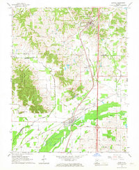
(12)- 1961 Map of Paducah
 1961 Paducah1961 Print · USGSThe Lower Ohio Valley at mid-century is a landscape defined by its great rivers and newly formed reservoirs. Researchers can trace the riverfronts of Paducah and Metropolis, or locate smaller settlements like Old Shawneetown and Cave in Rock along the banks.2 unique versions available
 - 1964 Map of Paducah
 1964 Paducah1964 Print · USGSThe river-and-rail corridor of Southern Illinois and Western Kentucky is captured here during the height of the mid-century industrial era. Genealogists and researchers can trace local landmarks across several counties, from the rail yards of Paducah to the waters of Crab Orchard Lake and Kentucky Reservoir.2 unique versions available
 - 1966 Map of Dongola, 1967 Print
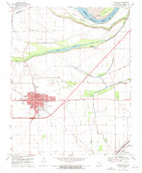
 1966 Dongola1967 Print · USGSSouthern Illinois rail corridors and timberlands meet in the mid-1960s as two major lines converge near the Cache River. Genealogists can trace family landmarks like Butter Ridge Cem, Mt Pisgah Ch, and the rural community of Wetaug.3 unique versions available
 - 1966 Map of Thebes, 1968 Print
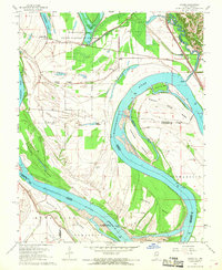
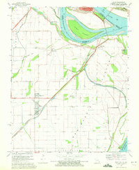
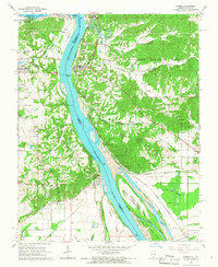 1966 Thebes1968 Print · USGSThe Mississippi River forms a busy industrial and transit corridor between Missouri and Illinois in the late sixties. Genealogists can trace family names at Hobbs Cem and Grays Point Cem while rail fans follow the Missouri Pacific Railroad through Thebes.2 unique versions available
 - 1967 Map of Cairo, 1968 Print
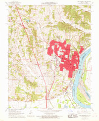
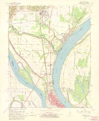 1967 Cairo1968 Print · USGSCairo and the river confluence are captured in the late sixties, showing a major rail-and-river hub at its peak. Genealogists can trace family landmarks like Lincoln Sch, Thistlewood Cemetery, and the Mound City National Cem.3 unique versions available
 - 1967 Map of Thebes SW, 1968 Print
 1967 Thebes SW1968 Print · USGSThe Missouri-Illinois borderlands are captured here in the late sixties, showcasing the intricate river geography of the Mississippi River. Researchers can trace old riverfront landings and rural community sites like Price Landing, Unity Ch, and Pollard Cem.2 unique versions available
 - 1967 Map of Pulaski, 1968 Print
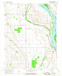
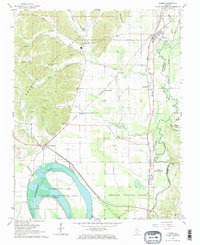
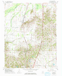 1967 Pulaski1968 Print · USGSSouthern Illinois in the late 1960s was defined by the Illinois Central rail line and the bottomlands of the Cache River. Family historians can trace rural landmarks from Old Shiloh Cem and Pryortown to True Light Ch.2 unique versions available
 - 1967 Map of Cache, 1968 Print
 1967 Cache1968 Print · USGSThe Illinois-Missouri borderlands along the Mississippi River are captured here in the late sixties, showing a landscape shaped by river engineering and rail. Genealogists and historians can trace family-named sites like Bumgard Cem or locate the old Indian Mound near Willard.2 unique versions available
 - 1967 Map of Cape Girardeau, 1968 Print
 1967 Cape Girardeau1968 Print · USGSCape Girardeau is shown here as a thriving river city and educational hub during the late sixties. Researchers can trace institutional footprints like Southeast Missouri State College or find family history at Old Hanover Cem and St Marys Cem.2 unique versions available
 - 1967 Map of Tamms, 1968 Print
 1967 Tamms1968 Print · USGSSouthern Illinois in the late sixties shows a landscape of river-bottom commerce and rail junctions near the Cache River. Genealogists and historians can trace family-named sites like Miller Cem, the Honey School, and the community of Unity.2 unique versions available
 - 1969 Map of Charleston, 1971 Print
 1969 Charleston1971 Print · USGSMississippi River bottomlands in the late sixties reveal a landscape defined by levee systems and rail-dependent towns. Genealogists can trace family names at the Texas Bend Cem or Lee Cem, and locate former neighborhood anchors like St Henrys Sch.2 unique versions available
 - 1969 Map of Wyatt, 1972 Print
 1969 Wyatt1972 Print · USGSThe strategic river confluence at the Missouri-Illinois-Kentucky border is captured here during the late sixties. Researchers can trace the path of the St Louis Southwestern railroad and locate local landmarks like Washington Sch and Bird Cem.2 unique versions available
End of results
Showing maps 1-12 of 12
Top cities of Alexander County
- Cairo historical maps
- Tamms historical maps
- Thebes historical maps
- McClure historical maps
- East Cape Girardeau historical maps
Frequently asked questions
- What are the different types of historical maps available for Alexander County?
- What is the oldest map of Alexander County?
- Where can I purchase historical maps of Alexander County for my home or office?
- Where can I download high-res historical maps of Alexander County?
- Are there historical topographic maps available for Alexander County?
- Is there historical aerial imagery available for Alexander County?
- Where are historical maps of Alexander County sourced from?