
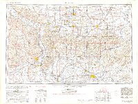
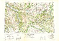
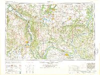
1961 Map of Paducah
USGS Topo · Published 1961About this map
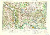
The confluence of the Ohio River, Mississippi River, Tennessee River, and Cumberland River anchors this regional study of the tri-state area. Compiled from earlier surveys, the map illustrates the landscape just as the massive impoundments of Kentucky Lake and Lake Barkley were reshaping the hydrology and topography of western Kentucky. Large-scale conservation and management areas are prominent, including the Crab Orchard National Wildlife Refuge and extensive tracts of the Shawnee National Forest across southern Illinois.
Find a feature on this map
212 named features on this map. Tap any name to fly to it.
Don’t see what you’re looking for? This feature index may not catch every label — zoom into the map to look around manually.
Map Details
Editions of this 1961 Paducah Map
2 editions found
Historical Maps of Cape Girardeau Through Time
12 maps found

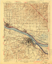
1926 Paducah
McCracken County, KY
1929 Paducah
McCracken County, KY
1936 Paducah
McCracken County, KY
1940 Paducah
McCracken County, KY
1949 Paducah
McCracken County, KY

1950 Paducah
McCracken County, KY
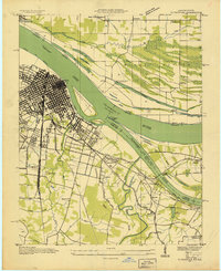
1954 Paducah
McCracken County, KY
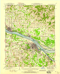
1961 Paducah
McCracken County, KY
1964 Paducah
McCracken County, KY

1984 Paducah
McCracken County, KY

1986 Paducah
McCracken County, KY

1987 Paducah
McCracken County, KY