Old Maps of Stickney Township, Illinois
Explore 60 old maps of Stickney Township, spanning from 1889 to today. These high-resolution historic maps reveal how streets, neighborhoods, landmarks, and natural features evolved over time — perfect for genealogy, metal detecting, research, and local history exploration.
What you can do with these maps:
- See how Stickney Township changed over time: Compare historical maps to modern-day views to trace roads, homesites, rail lines & more.
- View detailed metadata: Each map includes creators, publishers, year, scale, and archive source.
- Overlay maps with satellite & LiDAR: Visualize the past alongside modern tools to explore terrain & human change.
- Trusted historical sources: Maps sourced from the USGS, Library of Congress, and other archives.
- Access maps your way: View online, download high-res files, or order prints for personal or research use.
Start exploring old maps of Stickney Township to uncover forgotten places, hidden landmarks, and the deep history beneath your feet.
Stickney Township, IL maps
(60)- 1889 Map of Chicago
 1889 Chicago1889 Print · USGSChicago in the late Victorian era was a sprawling rail and maritime titan on the shores of Lake Michigan. Genealogists and historians can trace the early urban grid and massive rail yards of the Belt Railroad and Chicago and Northwestern R.R.
 - 1890 Map of Des Plaines
 1890 Des Plaines1890 Print · USGSThe Des Plaines valley and southern Cook County are shown here in the late nineteenth century as a hub of canal and rail transit. Genealogists can trace family roots in early settlements like Lemont, Orland, and Mokena or locate vanished stops like Johnston Station.
 - 1891 Map of Chicago
 1891 Chicago1891 Print · USGSChicago was a booming rail and water hub in the late nineteenth century, just before the turn of the century. Trace the intricate network of the Illinois and Michigan Canal and major lines like the Wisconsin Central R.R. and Belt Railroad.
 - 1891 Map of Riverside
 1891 Riverside1891 Print · USGSWest of Chicago in the early nineties, these developing suburbs formed a dense network of rail-side settlements and waterworks. Genealogists can trace early homesteads and vanished landmarks like the County Farm and Mammoth Springs alongside the banks of the Des Plaines River.
 - 1892 Map of Calumet
 1892 Calumet1892 Print · USGSThe industrial corridor south of Chicago is captured in the late nineteenth century as rail lines and rivers shaped new towns. Genealogists can trace family roots through early settlements like Pullman, Blue Island, and the South Lawn Harvey P.O. at a time of rapid growth.
 - 1893 Map of Calumet
 1893 Calumet1893 Print · USGSSouthern Cook County and the Indiana borderlands are captured here during a period of massive rail and industrial growth. Trace the footprints of historic company towns and transit hubs like Pullman, Blue Island, and Hammond before the landscape was fully urbanized.
 - 1893 Map of Riverside
 1893 Riverside1893 Print · USGSWest of Chicago in the 1890s, the landscape was a growing network of rail-centered villages and industrial canals. Genealogists and local historians can trace early property and town layouts in Riverside, Maywood, and the Dunning County Farm alongside the Desplaines River.
 - 1894 Map of Des Plaines
 1894 Des Plaines1894 Print · USGSCook and Will counties in the 1890s are defined by the convergence of major rail lines and early waterway transit. Genealogists and historians can trace the foundations of Lemont, Mokena, and New Lenox along lines like the Wabash R. R. and the Illinois and Michigan Canal.
 - 1900 Map of Chicago
 1900 Chicago1900 Print · USGSChicago at the turn of the century shows a city of massive infrastructure, from its emerging park system to its complex rail hubs. Researchers can trace the development of early neighborhoods like Mayfair and South Lynn or locate grounds like Rose Hill Cemetery and the historic Illinois and Michigan Canal.
 - 1900 Map of Des Plaines
 1900 Des Plaines1900 Print · USGSCook and Will counties at the turn of the century reveal a landscape of massive canal engineering and burgeoning railroad junctions. Researchers can trace ancestral farmsteads and old station stops from Sag Bridge Sta. to the early streets of Tinley Park and Mokena.
 - 1900 Map of Riverside
 1900 Riverside1900 Print · USGSThe western Chicago suburbs and the Desplaines River valley are captured here during a period of massive industrial and rail expansion. Genealogists can locate early settlements like Fullersburg and Lace, or trace family plots in Waldheim Cemetery.
 - 1900 Map of Calumet
 1900 Calumet1900 Print · USGSSouthern Cook County and the Indiana borderlands are captured here at the peak of the rail era, showing a landscape of burgeoning industrial towns and complex rail junctions. Researchers can trace the layout of the historic company town of Pullman, the growth of Hammond, and the early footprints of Blue Island and Harvey.
 - 1901 Map of Calumet
 1901 Calumet1901 Print · USGSSouthern Chicago and the Calumet region are captured at the peak of their industrial expansion at the turn of the century. Genealogists and historians can trace the growth of rail-side towns like Pullman, Blue Island, and Hegewisch and locate landmarks like the Glenwood Industrial School.5 unique versions available
 - 1901 Map of Des Plaines
 1901 Des Plaines1901 Print · USGSCook and Will County communities thrive along a dense network of nineteenth-century canals and rail lines. Genealogists and local historians can trace early property patterns and rail stops in Willow Springs, Tinley Park, and Gooding's Grove.5 unique versions available
 - 1901 Map of Riverside
 1901 Riverside1901 Print · USGSGreater Chicago and the Desplaines River valley are captured here at a moment of rapid rail expansion and civic engineering. Genealogists and historians can trace early settlements and burial sites like Waldheim Cemetery, the Chicago Union Transfer Railroad Yards, and Jefferson Park.4 unique versions available
 - 1901 Map of Chicago
 1901 Chicago1901 Print · USGSChicago was a booming industrial and rail hub in the late nineteenth century, defined by its lakefront and canal systems. Genealogists and urban historians can trace early neighborhood boundaries and rail corridors through Elsdon, Chicago Lawn, and Rose Hill Cemetery.5 unique versions available
 - 1928 Map of Palos Park
 1928 Palos Park1928 Print · USGSSouthwest of Chicago in the late twenties, this landscape is a complex network of industrial canals and developing suburbs. Genealogists can locate several large burial grounds like Holy Sepulchre Cemetery while tracing local history through old landmarks such as McClaughry School and Spring Forest.4 unique versions available
 - 1928 Map of Berwyn
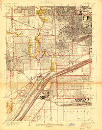 1928 Berwyn1928 Print · USGSThe suburban expansion west of Chicago is in full swing in the late twenties as industrial and rail networks reshape the land. Trace family history at Waldheim Cemetery or explore early aviation at the Maywood U S Mail Airport.3 unique versions available
 - 1929 Map of Blue Island
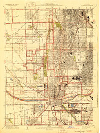 1929 Blue Island1929 Print · USGSSouth Chicago and its suburbs are captured in the late twenties during a period of rapid industrial and rail expansion. Genealogists can trace family plots across Mt Hope and Oak Hill, or locate local landmarks like Bremen School and Blue Island.3 unique versions available
 - 1929 Map of Englewood
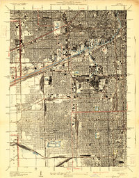 1929 Englewood1929 Print · USGSThe South Side of Chicago in the mid-twenties shows a landscape transformed by heavy industry and rail transport. Genealogy and local history researchers can trace the dense grid around the Union Stock Yards, Englewood, and the sprawling Corwith Yards.3 unique versions available
 - 1953 Map of Palos Park, 1955 Print
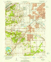 1953 Palos Park1955 Print · USGSMid-century Cook County shows a landscape of expansive forest preserves and industrial waterways just as residential growth began to accelerate. Genealogists and local historians can trace family plots at Holy Sepulchre Cemetery or locate the long-since changed Harlem Airport and Bachelor Grove Cem.
 - 1953 Map of Blue Island, 1956 Print
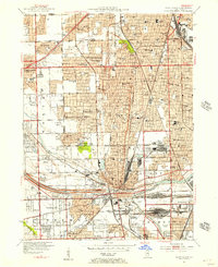 1953 Blue Island1956 Print · USGSBlue Island and the southern Chicago suburbs are shown here in a period of significant postwar growth and heavy rail industrialization. Genealogists and local historians can trace the vast cemetery lands of Mt Greenwood Cemetery or find defunct landmarks like Howell Airport and the Rock Island RR lines.
 - 1953 Map of Englewood, 1956 Print
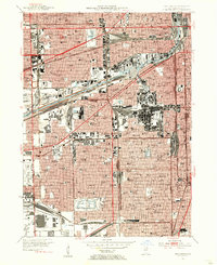 1953 Englewood1956 Print · USGSMid-century Southwest Chicago reveals a landscape defined by heavy industry and deep-rooted neighborhoods during the post-war era. Researchers can trace the massive rail infrastructure of the Indiana Harbor Belt and find local landmarks like Marquette Park and the US Quartermaster Depot.
 - 1953 Map of Berwyn, 1956 Print
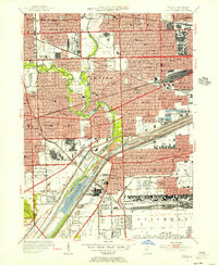 1953 Berwyn1956 Print · USGSWestern Cook County thrives as a mid-century industrial and transport hub, where dense residential blocks meet massive rail yards and canals. Genealogists can locate family sites across the Jewish Cemeteries or trace neighborhood landmarks like Morton Junior College and Stinson Airport.
 - 1953 Map of Chicago, 1964 Print
 1953 Chicago1964 Print · USGSThe southern Lake Michigan shoreline was rapidly modernizing in the mid-fifties, balancing heavy industry with its famous academic centers. Researchers can trace the footprints of Notre Dame University or locate vanished sites like the Kingsbury Ordnance Plant and Meigs Field.5 unique versions available
Showing maps 1-25 of 60
Top cities near Stickney Township
- Chicago historical maps
- Joliet historical maps
- Cicero historical maps
- Skokie historical maps
- Des Plaines historical maps
- Oak Lawn historical maps
See more
Top neighborhoods of Stickney Township
- Central Stickney historical maps
- Burbank historical maps
- Stickney historical maps
- Forest View historical maps
- Glenn historical maps
Frequently asked questions
- What are the different types of historical maps available for Stickney Township?
- What is the oldest map of Stickney Township?
- Where can I purchase historical maps of Stickney Township for my home or office?
- Where can I download high-res historical maps of Stickney Township?
- Are there historical topographic maps available for Stickney Township?
- Is there historical aerial imagery available for Stickney Township?
- Where are historical maps of Stickney Township sourced from?