Old Maps of Edwards County, Illinois for Genealogy
Trace your family roots with 72 historic maps of Edwards County. These high-res maps reveal old neighborhoods, homesites, landmarks, and streets — helping you uncover where your ancestors lived and how the area evolved over time.
- Explore historic neighborhoods: Identify where your relatives may have lived in the 1800s or 1900s.
- Compare maps over time: Trace the changes in streets, buildings, and landmarks for multi-generational research.
- Perfect for genealogy & ancestry research: Used by family historians and researchers to map out lineage and migration.
These maps are an incredible resource for exploring your personal connection to Edwards County's past.
Edwards County, IL maps
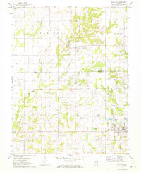
(72)- 1903 Map of Patoka
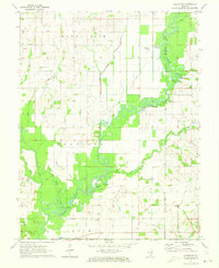
 1903 Patoka1903 Print · USGSThe lower Wabash Valley at the start of the twentieth century was a vital crossroads of river trade and rail expansion. Genealogists can trace family roots through settlements like New Harmony and Parker's Settlement or locate the County Farm and Grand Rapids.2 unique versions available
 - 1904 Map of Mount Carmel
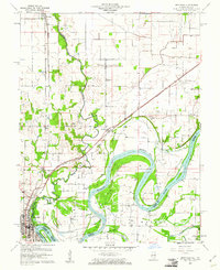
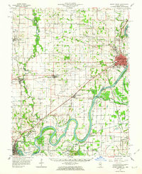
 1904 Mount Carmel1904 Print · USGSMount Carmel and the Wabash River valley are captured here at the height of the steam era. Genealogists and historians can trace defunct rail stops and riverside settlements like Schrodts Sta., Jimtown, and Rochester.3 unique versions available
 - 1911 Map of Sumner, 1954 Print
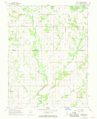
 1911 Sumner1954 Print · USGSSoutheast Illinois at the dawn of the twentieth century was a landscape of bustling rail towns and ubiquitous country schools. Genealogists can locate family-named landmarks and long-lost rural centers like Berryville, the Oil Tanks of Bridgeport, and Frogeye School.
 - 1913 Map of Sumner
 1913 Sumner1913 Print · USGSThe rural landscape of Lawrence and Richland counties is captured here just before the First World War, centered on the BALTIMORE AND OHIO SOUTHWESTERN rail line. Genealogists can locate numerous rural schools like Frogeye School and Buckhorn School or trace the early Oil Tanks near Bridgeport.2 unique versions available
 - 1943 Map of Albion, 1969 Print
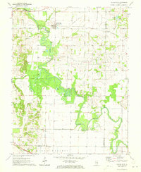
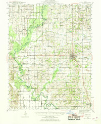 1943 Albion1969 Print · USGSEdwards County and its neighbors are captured here in the 1940s, showing a landscape defined by the winding Little Wabash River and the Southern rail line. Genealogists can locate numerous rural landmarks like Wanbor Cem, Samsville, and the Curtisville Sch.
 - 1946 Map of Albion
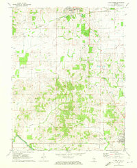
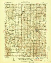 1946 Albion1946 Print · USGSEdwards and Wayne Counties are shown in the mid-1940s as a thriving network of rural school districts and small rail towns. Genealogists can trace family homesteads near Albion and Bone Gap or locate vanished landmarks like Blacks Store and Beech Bluff Sch.
 - 1949 Map of Olney
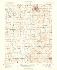 1949 Olney1949 Print · USGSSoutheastern Illinois in the late 1940s is a landscape of thriving rail hubs and scattered oil wells. Genealogists can locate family names and rural landmarks like Sodom Sch, Shields Cem, and the Baltimore and Ohio RR corridor.2 unique versions available
 - 1956 Map of Vincennes, 1967 Print
 1956 Vincennes1967 Print · USGSSouthern Indiana and the Illinois borderlands are captured here in the mid-fifties, showing the region's dense network of river towns and rail lines. Researchers can trace historic river crossings along the Wabash River or locate landmarks like Wyandotte Cave and Lincoln State Park.4 unique versions available
 - 1957 Map of Vincennes
 1957 Vincennes1957 Print · USGSSouthwest Indiana and the Illinois borderlands come alive in the late 1950s, a period of heavy rail traffic and expanding state forests. Genealogists and historians can trace the riverfronts and rail lines of Vincennes, New Harmony, and the vast Crane Naval Ammunition Depot.
 - 1958 Map of Vincennes
 1958 Vincennes1958 Print · USGSSouthern Indiana and the Illinois borderlands are captured during a mid-century period of heavy rail traffic and military activity. Researchers can trace the sprawling bounds of the Crane Naval Ammunition Depot or locate historic settlements like New Harmony and French Lick.2 unique versions available
 - 1958 Map of Belleville, 1973 Print
 1958 Belleville1973 Print · USGSSouthern Illinois during the mid-twentieth century reveals a landscape of industrial growth and massive new reservoirs. Genealogists and historians can trace the paths of the Illinois Central RR through towns like Centralia or locate landmarks such as Emerald Mound and the Looking Glass Prairie.3 unique versions available
 - 1959 Map of Bone Gap, 1961 Print
 1959 Bone Gap1961 Print · USGSThe Edwards and Wabash county line is defined by the winding course of Bonpas Creek during the late fifties. Genealogists and local historians can trace the Indian Treaty Boundary and locate numerous rural landmarks like St Sebastians Ch and Tanquary Cem.2 unique versions available
 - 1959 Map of Grayville, 1961 Print
 1959 Grayville1961 Print · USGSThe Wabash River borderlands of Illinois and Indiana come alive in this mid-century survey of the river's winding bends. Genealogists can trace family names and sites like Fortney Cem, Friedens Ch, and the town of Grayville.3 unique versions available
 - 1959 Map of Mount Carmel, 1963 Print
 1959 Mount Carmel1963 Print · USGSMount Carmel and the Wabash River valley are shown here in the late fifties, during a period of active drainage and industrial growth. Genealogists can trace family landmarks like Keens Cem and Nisbet Chapel or explore the Old Indian Treaty Boundary and the paths of the Illinois Central railroad.2 unique versions available
 - 1962 Map of Belleville
 1962 Belleville1962 Print · USGSSouthern Illinois in the late fifties reveals a landscape of industrial growth and ancient landmarks before the full expansion of the interstate system. Genealogists can trace family names and rural post offices near Centralia, Salem, and the historic Monks Mound.
 - 1968 Map of Berryville, 1969 Print
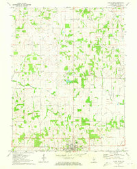
 1968 Berryville1969 Print · USGSSoutheast Illinois at the end of the sixties reveals a rural landscape where county lines meet along the Old Indian Treaty Boundary. Genealogists can locate several family landmarks and burial sites like Welser Cem, Pinhook Cem, and Pleasant Grove Ch.
 - 1971 Map of Golden Gate, 1973 Print
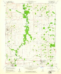
 1971 Golden Gate1973 Print · USGSSoutheastern Illinois in the early 1970s is characterized by the winding oxbows of the Little Wabash River and active riverfront industry. Genealogists can trace several family burial sites including Wilson Cem and Stewart Cem, while historians can locate the Old Iron Bridge and Southern Railway corridor.
 - 1971 Map of Albion NW, 1973 Print
 1971 Albion NW1973 Print · USGSSoutheastern Illinois farm life and the oil industry intersect along the Little Wabash River in the early 1970s. Researchers can locate family landmarks like Locust Grove Cem and McKendree Chapel, or trace the development of the Maple Grove Oil Field.
 - 1971 Map of Albion South, 1973 Print
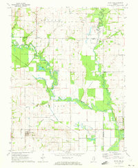
 1971 Albion South1973 Print · USGSEdwards County in the early seventies shows a landscape where historic river crossings meet a growing energy sector. Genealogists and historians can trace numerous rural burial grounds like Birk Prairie Cem and old river landmarks such as Dixon Shoals near the Little Wabash River.2 unique versions available
 - 1971 Map of Albion North, 1973 Print
 1971 Albion North1973 Print · USGSSouthern Illinois in the early seventies shows a landscape where agriculture meets the energy industry near Albion. Genealogists and local historians can trace rural roots through Medler Cem, Ebenezer Ch, and the extensive Bone Gap Oil Field.
 - 1971 Map of Mount Erie, 1973 Print
 1971 Mount Erie1973 Print · USGSWayne County settlement centers on the high ground near Mount Erie in the early 1970s, while the Little Wabash River meanders through the bottomlands. Researchers can trace rural lineages through numerous local sites like Wynoose Cem, Forest Ridge Ch, and the crossroads at Bennington.2 unique versions available
 - 1971 Map of West Salem, 1973 Print
 1971 West Salem1973 Print · USGSSoutheastern Illinois reveals its rural character and energy history in the early seventies as the Edwards and Richland County line meets. Genealogists and historians can trace numerous family burial sites and country churches, including Bethel Cemetery, Marion Church, and the Moravian Cemetery.
 - 1982 Map of Mount Vernon
 1982 Mount Vernon1982 Print · USGSSouthern Illinois and Southwestern Indiana meet here during a period of significant regional water management and transit growth. Researchers can trace the development of Rend Lake and locate vanished rail stops along the Southern RR near Bluford and Golden Gate.
 - 1986 Map of Olney
 1986 Olney1986 Print · USGSSouth-central Illinois in the mid-eighties shows a landscape of small agricultural towns linked by historic rail lines and prairie preserves. Trace family roots and vanished rail stops near Kinmundy, the Prairie Chicken Sanctuary, and Salem.2 unique versions available
 - 1986 Map of Vincennes
 1986 Vincennes1986 Print · USGSThe Wabash River valley in the mid-1980s shows a landscape defined by deep-rooted river towns and heavy industry. Researchers can trace the legacy of regional rail lines like the Conrail system or locate landmarks such as Vincennes University and St Francisville Church.2 unique versions available
Showing maps 1-25 of 72
Top cities of Edwards County
Frequently asked questions
- What are the different types of historical maps available for Edwards County?
- What is the oldest map of Edwards County?
- Where can I purchase historical maps of Edwards County for my home or office?
- Where can I download high-res historical maps of Edwards County?
- Are there historical topographic maps available for Edwards County?
- Is there historical aerial imagery available for Edwards County?
- Where are historical maps of Edwards County sourced from?