1980s Maps of Gilman, Illinois
Explore 6 historic maps of Gilman from the 1980s. These maps offer a rare glimpse into what life looked like during the 1980s — showing old roads, neighborhoods, homes, and landmarks that have changed or disappeared over time.
Whether you're researching your family's past, planning a metal detecting trip, or studying how Gilman's landscape evolved across the 1980s, these high-resolution maps are a powerful tool for exploring the history of this region.
- Focus on a specific era: All maps on this page are from the 1980s, giving you a focused view of this time period.
- See what’s changed: Compare century-old streets, trails, and buildings to today's modern landscape using overlays and satellite layers.
- Research with precision: Use these maps for genealogy, historical research, land use analysis, or educational projects.
- View, download, or print: Maps are fully viewable online in high resolution, and can be downloaded or printed for your own records.
Start exploring Gilman's history through authentic maps from the 1980s. This is your window into the past.
Gilman, IL maps
(6)- 1984 Map of Watseka, 1985 Print
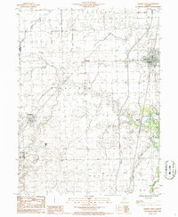
 1984 Watseka1985 Print · USGSThe Illinois-Indiana borderlands thrived on a dense rail and river network during the mid-eighties. Genealogists and local historians can trace the foundations of rural life through landmarks like St Josephs College, the Iroquois Hospital, and towns like Milford and Beaverville.
 - 1985 Map of Fairbury
 1985 Fairbury1985 Print · USGSCentral Illinois in the mid-1980s reveals a landscape shaped by the Illinois Central Gulf rail network and the Vermilion River basin. Trace the roots of local communities from Fairbury to Pontiac, and locate landmarks like the State Correctional Center and High Chapel.2 unique versions available
 - 1986 Map of La Hogue
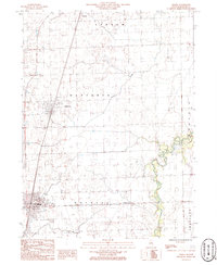
 1986 La Hogue1986 Print · USGSIroquois County at the mid-eighties reveals a landscape shaped by the rail lines and townships of the Illinois prairie. Genealogists and local historians can trace the rural tracts between La Hogue and the Gilman corporate boundary, or locate private airfields like the Wilken Landing Strip.
 - 1986 Map of Gilman
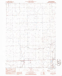
 1986 Gilman1986 Print · USGSIroquois County's prairie landscape is defined by its rail junctions and townships in the 1980s. Trace the historical tracks of the Illinois Central Gulf and locate specific sites like the Landing Strip and the small settlement of Leonard.
 - 1986 Map of Onarga West
 1986 Onarga West1986 Print · USGSIroquois County farmland is captured here in the mid-1980s, showcasing the rural township grids and rail corridors of east-central Illinois. Genealogists and local historians can trace the paths of the Illinois Central Gulf through Delrey or locate rural landmarks like the Cem near Ridgeville.
 - 1986 Map of Onarga East
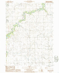 1986 Onarga East1986 Print · USGSIroquois County farmland in the mid-1980s reveals a quiet landscape of rural townships and winding waterways. Researchers can trace the layout of early communities like Gilman and Onarga, or find family history landmarks such as Idaville Corner and the local Cem.
End of results
Showing maps 1-6 of 6
Top cities near Gilman
- Onarga historical maps
- Clifton historical maps
- Chebanse historical maps
- Cissna Park historical maps
- Piper City historical maps
- Ashkum historical maps
See more
Frequently asked questions
- What are the different types of historical maps available for Gilman?
- What is the oldest map of Gilman?
- Where can I purchase historical maps of Gilman for my home or office?
- Where can I download high-res historical maps of Gilman?
- Are there historical topographic maps available for Gilman?
- Is there historical aerial imagery available for Gilman?
- Where are historical maps of Gilman sourced from?