Old Maps of Simpson, Illinois for Hiking & Exploration
Hike through history with 27 historic maps of Simpson. Explore old trails, ghost towns, and forgotten backroads — perfect for outdoor adventurers and local explorers.
- Rediscover forgotten places: Map out old mining camps, roads, and footpaths that no longer exist on modern maps.
- Layer with modern tools: Combine with LiDAR or satellite views to plan hikes through historical terrain.
- Made for exploration: Popular among hikers, overlanders, and local history lovers.
Use these maps to find adventure and explore the hidden past of Simpson.
Simpson, IL maps
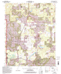
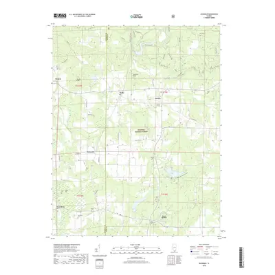
(27)- 1917 Map of Brownfield
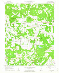
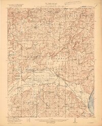 1917 Brownfield1917 Print · USGSSouthern Illinois in the years before the Great War is captured here through its dense network of rural schoolhouses and rail sidings. Researchers can locate family landmarks like Lackey Bridge, Allard College School, and Dixon Springs Sta (Renshaw P.O.).4 unique versions available
 - 1918 Map of Vienna, 1943 Print
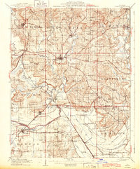 1918 Vienna1943 Print · USGSJohnson and Massac Counties appear here during the height of the steam rail era, centered on the crossroads of VIENNA. Local historians can trace old rural schoolhouses like Taylor School, family sites at Oliver Cemetery, and early settlements such as Ganntown and Samoth.
 - 1919 Map of Vienna
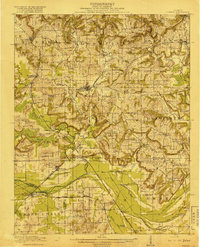 1919 Vienna1919 Print · USGSSouthern Illinois during the late teens reveals a landscape defined by extensive drainage engineering and a high density of rural schools. Genealogists can trace family roots at Oliver Cemetery or locate early rural schoolhouses like Peach School and Whiteside School.
 - 1942 Map of Vienna, 1958 Print
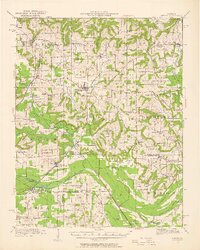 1942 Vienna1958 Print · USGSSouthern Illinois hill country and the Cache River lowlands are shown here during the early 1940s, highlighting a landscape of rail-connected towns and rural school districts. Researchers can trace family roots through numerous sites like Oliver Cemetery, Tall Tree School, and the Crossroads Store.2 unique versions available
 - 1949 Map of Paducah
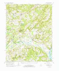
 1949 Paducah1949 Print · USGSThe confluence of the Ohio, Mississippi, Tennessee, and Cumberland rivers at the close of the 1940s reveals a region bound by water and rail. Researchers can trace historic river landings, timberlands in the Shawnee National Forest, and the coal-mining infrastructure around West Frankfort and Herrin.2 unique versions available
 - 1950 Map of Paducah
 1950 Paducah1950 Print · USGSThe confluence of the great midwestern rivers defines this mid-century landscape at the intersection of Illinois, Kentucky, and Missouri. Genealogists and historians can trace the rail-and-river economy through the hubs of Paducah, Cairo, and Metropolis or locate family roots near the Wildcat Hills.
 - 1954 Map of Paducah
 1954 Paducah1954 Print · USGSSouthern Illinois and Western Kentucky intersect at the great river confluences during this mid-century era of rail and river industry. Genealogists and historians can trace family roots and commerce through river towns like Cairo, Metropolis, and Golconda, or along the tracks of the Illinois Central Railroad.2 unique versions available
 - 1961 Map of Paducah
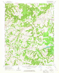
 1961 Paducah1961 Print · USGSThe Lower Ohio Valley at mid-century is a landscape defined by its great rivers and newly formed reservoirs. Researchers can trace the riverfronts of Paducah and Metropolis, or locate smaller settlements like Old Shawneetown and Cave in Rock along the banks.2 unique versions available
 - 1962 Map of Glendale, 1963 Print
 1962 Glendale1963 Print · USGSSouthern Illinois forest country in the early sixties was a landscape of remote ridges and rail-side settlements. Genealogists can trace family roots through sites like Rock Springs Ch or the McShanahan Cem while rail fans follow the Illinois Central line.
 - 1962 Map of Brownfield, 1965 Print
 1962 Brownfield1965 Print · USGSSouthern Illinois at the peak of the mid-century era shows a landscape where the deep woods of the Shawnee National Forest meet the Ohio River. Genealogists and historians can trace rail-side towns like Reevesville and discover dozens of family burial grounds, including Barger Cem and Nelson Cem.
 - 1964 Map of Paducah
 1964 Paducah1964 Print · USGSThe river-and-rail corridor of Southern Illinois and Western Kentucky is captured here during the height of the mid-century industrial era. Genealogists and researchers can trace local landmarks across several counties, from the rail yards of Paducah to the waters of Crab Orchard Lake and Kentucky Reservoir.2 unique versions available
 - 1966 Map of Bloomfield, 1967 Print
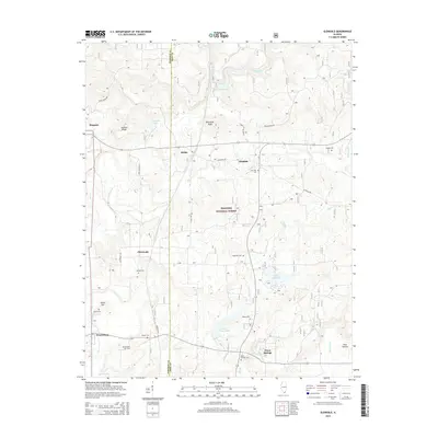
 1966 Bloomfield1967 Print · USGSSouthern Illinois during the mid-sixties reveals a landscape of forestry and rural infrastructure at the edge of the Shawnee National Forest. Researchers can trace old family lineages at Odd Fellows Cem and Whiteside Cem, or locate the Illinois State Prison (Vienna Branch) and local landmarks like Grantsburg Sch.3 unique versions available
 - 1984 Map of Paducah, 1986 Print
 1984 Paducah1986 Print · USGSThe river-driven economy of western Kentucky and southern Illinois is captured here in the mid-eighties, showing the massive impact of the Kentucky Lake and Lake Barkley reservoirs. Genealogists and historians can trace rail lines like the Illinois Central Gulf RR and explore sites from Fort Massac State Park to the Kentucky State Penitentiary.
 - 1986 Map of Paducah, 1987 Print
 1986 Paducah1987 Print · USGSThe tri-river confluence of the Ohio, Tennessee, and Cumberland rivers is captured here in the mid-1980s during a period of established river power and industry. Researchers can trace local heritage through landmarks like Friendship Church, the Smithland Locks and Dam, and the Illinois Central Gulf RR.
 - 1987 Map of Paducah, 1988 Print
 1987 Paducah1988 Print · USGSThe Lower Ohio Valley and the Illinois Ozarks come alive in this late twentieth-century regional survey. Genealogists and local historians can trace river-town roots and state park landmarks from Metropolis to Cape Girardeau and Trail of Tears State Park.
 - 1996 Map of Bloomfield, 1998 Print
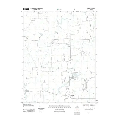
 1996 Bloomfield1998 Print · USGSSouthern Illinois in the late twentieth century is shown as a blend of forest preserve and institutional agriculture. Trace family sites like Ledbetter Cem, Bethlehem Ch, and the settlements of Bloomfield and Grantsburg.
 - 1996 Map of Glendale, 1998 Print
 1996 Glendale1998 Print · USGSSouthern Illinois in the 1990s reveals a landscape of protected forests and deep history. Genealogists and historians can trace family roots at Harper Cem or explore the prehistoric significance of the Millstone Bluff National Register Site.
 - 2012 Map of Glendale, 2012 Print
 2012 Glendale2012 Print · USGSCovers Simpson, including Dixon Springs, Robbs, and other nearby areas
 - 2012 Map of Bloomfield, 2012 Print
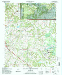
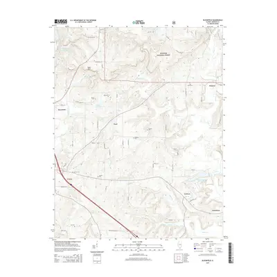
 2012 Bloomfield2012 Print · USGSCovers Simpson, including Vienna, Wartrace, and other nearby areas
 - 2015 Map of Glendale, 2015 Print
 2015 Glendale2015 Print · USGSCovers Simpson, including Dixon Springs, Robbs, and other nearby areas
 - 2015 Map of Bloomfield, 2015 Print
 2015 Bloomfield2015 Print · USGSCovers Simpson, including Vienna, Wartrace, and other nearby areas
 - 2018 Map of Bloomfield, 2018 Print
 2018 Bloomfield2018 Print · USGSCovers Simpson, including Vienna, Wartrace, and other nearby areas
 - 2018 Map of Glendale, 2018 Print
 2018 Glendale2018 Print · USGSCovers Simpson, including Dixon Springs, Robbs, and other nearby areas
 - 2021 Map of Bloomfield, 2021 Print
 2021 Bloomfield2021 Print · USGSCovers Simpson, including Vienna, Wartrace, and other nearby areas
 - 2021 Map of Glendale, 2021 Print
 2021 Glendale2021 Print · USGSCovers Simpson, including Dixon Springs, Robbs, and other nearby areas
Showing maps 1-25 of 27
Top cities near Simpson
- Marion historical maps
- Carrier Mills historical maps
- Vienna historical maps
- Goreville historical maps
- Creal Springs historical maps
- Karnak historical maps
See more
Frequently asked questions
- What are the different types of historical maps available for Simpson?
- What is the oldest map of Simpson?
- Where can I purchase historical maps of Simpson for my home or office?
- Where can I download high-res historical maps of Simpson?
- Are there historical topographic maps available for Simpson?
- Is there historical aerial imagery available for Simpson?
- Where are historical maps of Simpson sourced from?